List of lighthouses in England
This is a list of lighthouses in England. It includes lighthouses which are no longer in use as a light but are still standing. It also includes some of the harbour and pier-head lights around the country.[1][2][3][4][5][6][7][8]
Bamburgh
Farne
Longstone
Coquet
St Mary's
Souter
Whitby
Flamborough
Withernsea
Spurn
Cromer
Happisburgh
Lowestoft
Southwold
Orfordness
N. Foreland
S. Foreland
Dungeness
Royal S.
Beachy Head
Nab
St Catherine's
Needles
Hurst
Anvil Pt
Portland
Berry Hd
Start Pt
Eddystone
Hartland Pt
Bull Pt
Lynmouth
Lundy
Hilbre Island
New Brighton
Walney
St Bees
Coastal lighthouses in England (except Cornwall)


(Lights deactivated or demolished before 1970 are omitted.)
(Lights deactivated or demolished before 1970 are omitted.)
St Anthony's
Lizard
Tater Du
Wolf Rock
Longships
Trevose Head
Pendeen
Godrevy
Peninnis
B
Round I
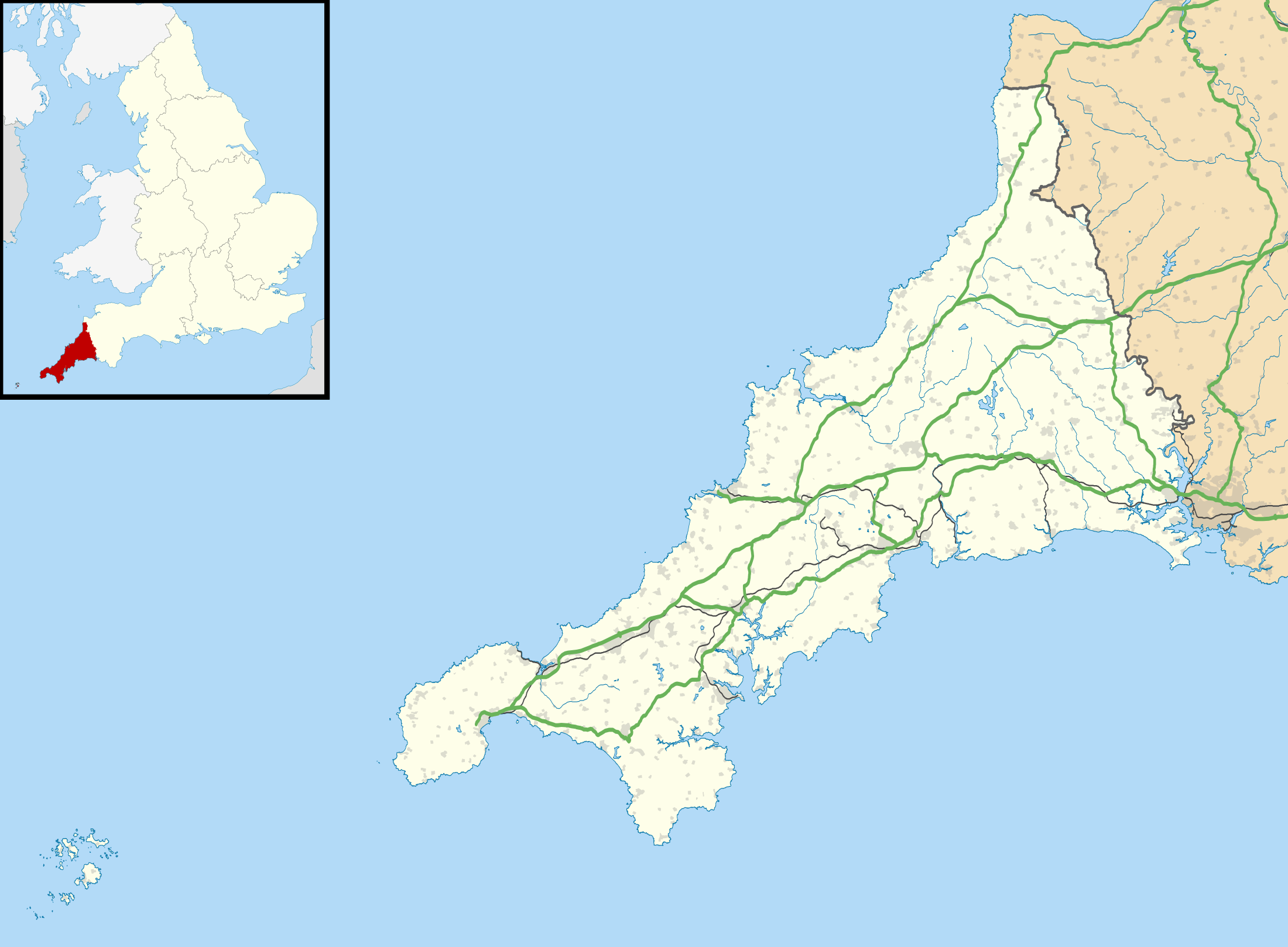
Coastal lighthouses in Cornwall
B = Bishop Rock
B = Bishop Rock
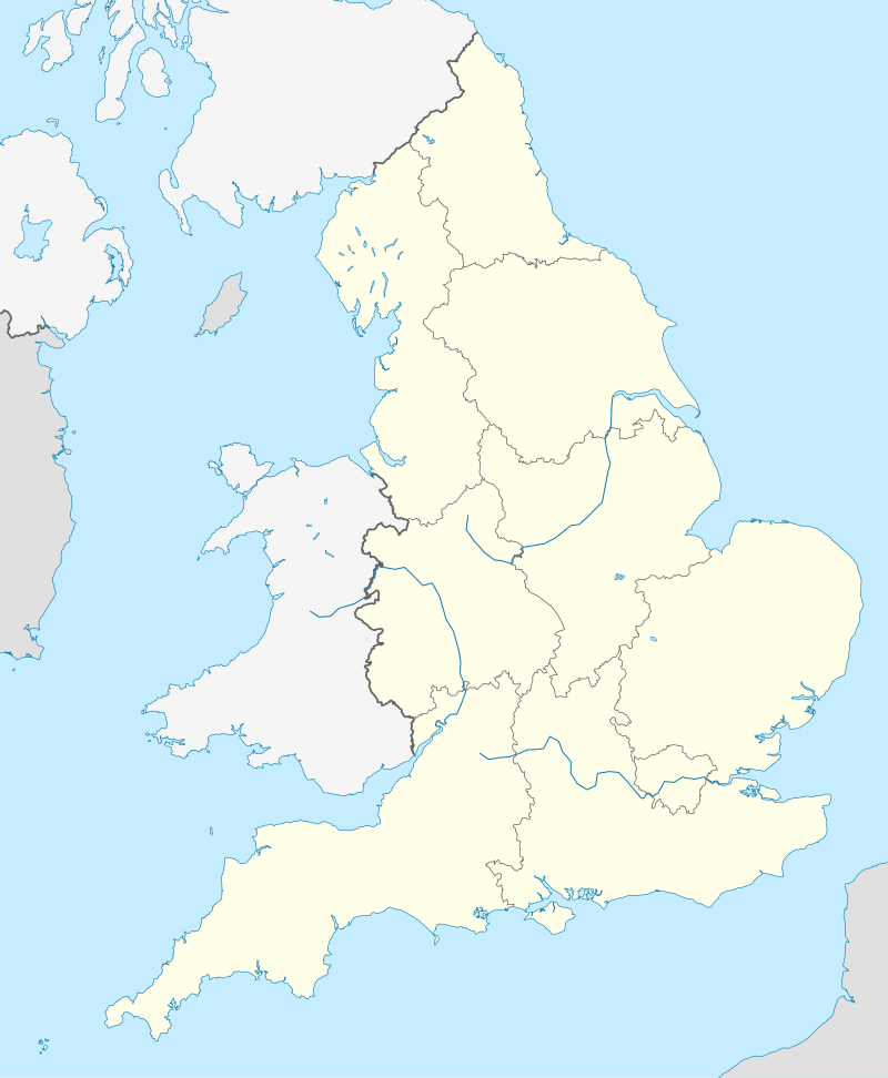
Details of several lighthouses and lightvessels in current use in England, together with Wales, the Channel Islands and Gibraltar can be found on the website of Trinity House.[9] Locations of major lighthouses are shown on the adjacent map.
Lighthouses
| Lighthouse | Image | Location coordinates |
County | Year built | Tower height | Focal height | Range | Notes |
|---|---|---|---|---|---|---|---|---|
| Anvil Point | 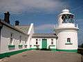 | Anvil Point 50.5919°N 1.9600°W | Dorset | 1881 | 12 m (39 ft) | 45 m (148 ft) | 9 nmi (17 km) | Trinity House |
| Bamburgh | 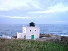 | Bamburgh 55.6166°N 1.7242°W | Northumberland | 1910 | 9 m (30 ft) | 12 m (39 ft) | 12 nmi (22 km) | Trinity House |
| Beachy Head | 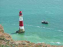 | Beachy Head 50.7337°N 0.2414°E | East Sussex | 1902 | 43 m (141 ft) | 31 m (102 ft) | 8 nmi (15 km) | Trinity House |
| Belle Tout | 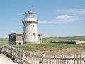 | Beachy Head 50.7382°N 0.2145°E | East Sussex | 1834 | 14 m (46 ft) | 87 m (285 ft) | Inactive | ex-Trinity House Decommissioned in 1902 – replaced by Beachy Head |
| Berkeley Pill Front | 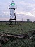 | Severn Estuary 51.6998°N 2.4901°W | Gloucestershire | 1937 | 8 m (26 ft) | 5 m (16 ft) | Unknown | Gloucester Harbour Trustees |
| Berkeley Pill Rear |  | Severn Estuary 51.6982°N 2.4904°W | Gloucestershire | 1937 | 12 m (39 ft) | 11 m (36 ft) | Unknown | Gloucester Harbour Trustees |
| Berry Head |  | Berry Head 50.3994°N 3.4834°W | Devon | 1906 | 5 m (16 ft) | 58 m (190 ft) | 19 nmi (35 km) | Trinity House |
| Berwick | 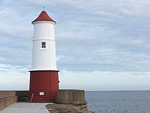 | Berwick-upon-Tweed 55.7648°N 1.9842°W | Northumberland | 1826 | 13 m (43 ft) | 15 m (49 ft) | 6 nmi (11 km) | Port of Berwick |
| Bidston | 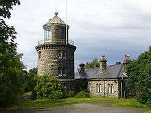 | Bidston Hill 53.3970°N 3.0750°W | Merseyside | 1873 | 21 m (69 ft) | Unknown | Inactive | ex-Mersey Docks and Harbour Board Inactive since 1913 |
| Bishop Rock | 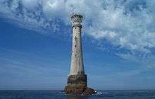 | Bishop Rock 49.8729°N 6.4458°W | Isles of Scilly | 1851 | 49 m (161 ft) | 44 m (144 ft) | 24 nmi (44 km) | Trinity House |
| Black Nore | 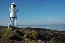 | Portishead 51.4847°N 2.7997°W | Somerset | 1894 | 11 m (36 ft) | Unknown | Inactive | ex-Trinity House Inactive since 2011 |
| Blyth High | 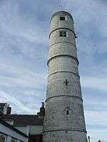 | Blyth 55.1256°N 1.4994°W | Northumberland | 1788 | 19 m (62 ft) | Unknown | Inactive | Inactive since 1985 |
| Bow Creek | 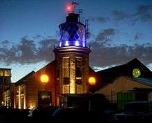 | Trinity Buoy Wharf 51.5077°N 0.0083°E | Greater London | 1863 | Unknown | Unknown | Inactive | Formerly used for lighting trials for Trinity House. |
| Brownsman Island | 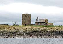 | Farne Islands 55.6341°N 1.6255°W | Northumberland | 1811 | 12 m (39 ft) | Unknown | Inactive | ex-Trinity House Replaced by Longstone in 1826 |
| Bull Point |  | Mortehoe 51.1992°N 4.2011°W | Devon | 1879 | 11 m (36 ft) | 54 m (177 ft) | 24 nmi (44 km) | Trinity House |
| Burnham-on-Sea High | 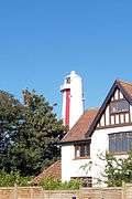 | Burnham-on-Sea 51.2483°N 3.0058°W | Somerset | 1832 | 30 m (98 ft) | Unknown | Inactive | ex-Trinity House Inactive since 1993 |
| Burnham-on-Sea Low | 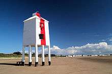 | Burnham-on-Sea 51.2483°N 3.0058°W | Somerset | 1832 | 11 m (36 ft) | 7 m (23 ft) | 12 nmi (22 km) | Sedgemoor District Council ex-Trinity House (inactive 1969–1993) |
| Burnham-on-Sea Round Tower |  | Burnham-on-Sea 51.2397°N 2.9983°W | Somerset | 1801 | Unknown | Unknown | Inactive | ex-Trinity House Replaced by High & Low lights in 1832 |
| Chapel Rock | 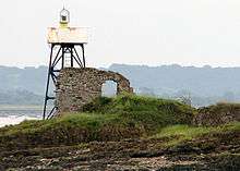 | Severn Estuary 51.6071°N 2.6534°W | Gloucestershire | 1907 | 8 m (26 ft) | 6 m (20 ft) | 8 nmi (15 km) | Gloucester Harbour Trustees |
| Coquet Island |  | Coquet Island 55.3339°N 1.5397°W | Northumberland | 1841 | 22 m (72 ft) | 25 m (82 ft) | 19 nmi (35 km) | Trinity House |
| Cromer | 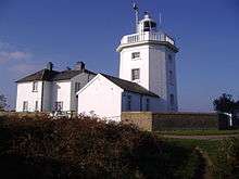 | Cromer 52.9247°N 1.3165°E | Norfolk | 1833 | 18 m (59 ft) | 84 m (276 ft) | 21 nmi (39 km) | Trinity House |
| Crow Point | 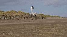 | Braunton Burrows 51.0661°N 4.1897°W | Devon | 1954 | 5 m (16 ft) | 8 m (26 ft) | 6 nmi (11 km) | Minor structure categorized as a lighthouse by Trinity House |
| Dovercourt High | 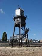 | Dovercourt 51.9304°N 1.2753°E | Essex | 1863 | 14 m (46 ft) | Unknown | Inactive | ex-Trinity House Inactive since 1917 |
| Dovercourt Low | 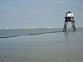 | Dovercourt 51.9301°N 1.2781°E | Essex | 1863 | 8 m (26 ft) | Unknown | Inactive | ex-Trinity House Inactive since 1917 |
| Dubris Pharos | 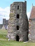 | Dover Castle 51.1284°N 1.3230°E | Kent | 100 | 19 m (62 ft) | Unknown | Inactive | Also known as the Dover Pharos or Roman Pharos. Dating varies from AD 50 to 150. |
| Dungeness | 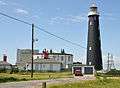 | Dungeness 50.9138°N 0.9697°E | Kent | 1904 | 44 m (144 ft) | Unknown | Inactive | ex-Trinity House Replaced by new lighthouse (below) in 1961 |
| Dungeness | 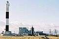 | Dungeness 50.9133°N 0.9761°E | Kent | 1961 | 43 m (141 ft) | 40 m (131 ft) | 21 nmi (39 km) | Trinity House |
| Eddystone | 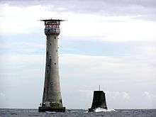 | Eddystone Rocks 50.1800°N 4.2650°W | Devon | 1882 | 49 m (161 ft) | 41 m (135 ft) | 17 nmi (31 km) | Trinity House |
| Egypt Point | 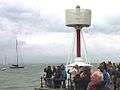 | Egypt Point | Isle of Wight | 1897 | 7.5 m (25 ft) | Unknown | Inactive | ex-Trinity House Inactive since 1982 |
| Ellesmere Port | 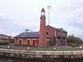 | Ellesmere Port 53.29034°N 2.89395°W | Cheshire | 1880 | 11 m (36 ft) | Unknown | Inactive | |
| Farne | 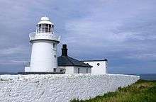 | Farne Islands 55.6153°N 1.6558°W | Northumberland | 1811 | 13 m (43 ft) | 27 m (89 ft) | 10 nmi (19 km) | Trinity House |
| Fish Quay High |  | North Shields 55.0086°N 1.4378°W | Tyne and Wear | 1807 | 18 m (59 ft) | 42 m (138 ft) | Inactive | ex-Newcastle-upon-Tyne Trinity House Inactive since c.1990 |
| Fish Quay Low | 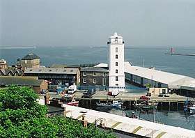 | North Shields 55.0091°N 1.4344°W | Tyne and Wear | 1807 | 26 m (85 ft) | 25 m (82 ft) | Inactive | ex-Newcastle-upon-Tyne Trinity House Inactive since c.1990 |
| Fish Quay Old High |  | North Shields 55.0094°N 1.4368°W | Tyne and Wear | 1727 | Unknown | Unknown | Inactive | ex-Newcastle-upon-Tyne Trinity House Inactive since 1810 |
| Fish Quay Old Low | 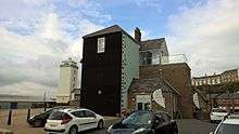 | North Shields 55.0098°N 1.4334°W | Tyne and Wear | 1727 | Unknown | Unknown | Inactive | ex-Newcastle-upon-Tyne Trinity House Inactive since 1810 |
| Flamborough Head | 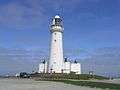 | Flamborough Head 54.1164°N 0.0828°W | East Riding of Yorkshire | 1806 | 27 m (89 ft) | 65 m (213 ft) | 24 nmi (44 km) | Trinity House |
| Fleetwood Pharos Lighthouse | 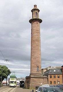 | Fleetwood 53.9265°N 3.0075°W | Lancashire | 1840 | 27 m (89 ft) | 28 m (92 ft) | 9 nmi (17 km) | Port of Fleetwood |
| Fleetwood Lower Lighthouse | 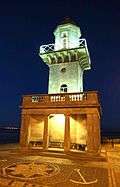 | Fleetwood 53.9286°N 3.0091°W | Lancashire | 1840 | 13 m (43 ft) | 14 m (46 ft) | 9 nmi (17 km) | Port of Fleetwood |
| Folkestone Pier | .jpg) | Folkestone 51.07601°N 1.19478°E | Kent | 1860 | 13 m (43 ft) | 14 m (46 ft) | 22 nmi (41 km) | Folkestone Harbour Co. |
| Godrevy | 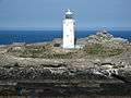 | St Ives 50.2425°N 5.4003°W | Cornwall | 1859 | 26 m (85 ft) | 37 m (121 ft) | 8 nmi (15 km) | Trinity House Still listed by Trinity House, but light now mounted separately |
| Gorleston (Range Rear) | 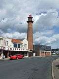 | Gorleston 52.5721°N 1.7323°E | Norfolk | 1878 | 21 m (69 ft) | 20 m (66 ft) | Inactive | Great Yarmouth Port Authority Inactive since 2007 |
| Gorleston South Pier | 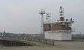 | Gorleston 52.5721°N 1.7380°E | Norfolk | 1955 | 8 m (26 ft) | 11 m (36 ft) | 11 nmi (20 km) | Great Yarmouth Port Authority |
| Guile Point | 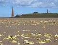 | Lindisfarne 55.6667°N 1.8000°W | Northumberland | 1859 | 21 m (69 ft) | 9 m (30 ft) | 4 nmi (7 km) | Trinity House ex-Newcastle-upon-Tyne Trinity House Minor structure categorized as a lighthouse by Trinity House |
| Gunfleet |  | Frinton-on-Sea 51.7792°N 1.3575°E | Essex | 1850 | 23 m (75 ft) | Unknown | Inactive | ex-Trinity House Inactive since 1921 |
| Hale Head | 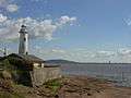 | Hale 53.3225°N 2.7943°W | Cheshire | 1906 | 18 m (59 ft) | Unknown | Inactive | Inactive since 1958 |
| Happisburgh | 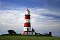 | Happisburgh 52.8195°N 1.5387°E | Norfolk | 1791 | 26 m (85 ft) | 41 m (135 ft) | 14 nmi (26 km) | Happisburgh Lighthouse Trust (ex-Trinity House) |
| Hartland Point | .jpg) | Hartland Point 51.0175°N 4.5178°W | Devon | 1874 | 18 m (59 ft) | 37 m (121 ft) | 8 nmi (15 km) | Trinity House Still listed by Trinity House, but light now mounted separately |
| Hartlepool Heugh | 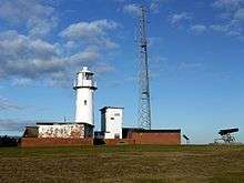 | Hartlepool 54.6969°N 1.1753°W | Durham | 1927 | 16 m (52 ft) | 19 m (62 ft) | 19 nmi (35 km) | PD Ports |
| Harwich High | 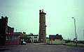 | Harwich 51.9444°N 1.2885°E | Essex | 1818 | 21 m (69 ft) | Unknown | Inactive | ex-Trinity House Replaced by Dovercourt in 1863 |
| Harwich Low | 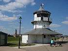 | Harwich 51.9434°N 1.2909°E | Essex | 1818 | 9 m (30 ft) | Unknown | Inactive | ex-Trinity House Replaced by Dovercourt in 1863 |
| Herd Groyne | 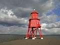 | South Shields 55.0079°N 1.4241°W | Tyne and Wear | 1882 | 15 m (49 ft) | 15 m (49 ft) | 19 nmi (35 km) | Port of Tyne ex-Newcastle-upon-Tyne Trinity House |
| Heugh Hill | 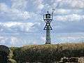 | Lindisfarne 55.6667°N 1.8000°W | Northumberland | Unknown | 8 m (26 ft) | 24 m (79 ft) | 5 nmi (9 km) | Trinity House ex-Newcastle-upon-Tyne Trinity House Minor structure categorized as a lighthouse by Trinity House |
| Hilbre Island | 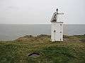 | Hilbre Island 53.3833°N 3.2286°W | Merseyside | 1927 | 3 m (10 ft) | 14 m (46 ft) | 5 nmi (9 km) | Trinity House ex-Mersey Docks and Harbour Board Minor structure categorized as a lighthouse by Trinity House |
| Hodbarrow | 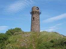 | Millom 54.1940°N 3.2583°W | Cumbria | 1866 | 18 m (59 ft) | Unknown | Inactive | ex-Hodbarrow Mining Company Replaced by Hodbarrow Haverigg in 1905 |
| Hodbarrow Haverigg |  | Haverigg 54.1904°N 3.2675°W | Cumbria | 1905 | 9 m (30 ft) | 12 m (39 ft) | Inactive | ex-Hodbarrow Mining Company Inactive since 1946 |
| Hoylake Upper | 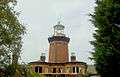 | Hoylake 53.3947°N 3.1806°W | Merseyside | 1865 | 17 m (56 ft) | Unknown | Inactive | ex-Mersey Docks and Harbour Board Inactive since 1886 |
| Hunstanton | 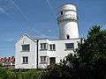 | Hunstanton 52.9496°N 0.4936°E | Norfolk | 1840 | 19 m (62 ft) | Unknown | Inactive | ex-Trinity House Inactive since 1922 |
| Hurst Point | 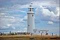 | Hurst Castle 50.7081°N 1.5503°W | Hampshire | 1867 | 26 m (85 ft) | 23 m (75 ft) | 13 nmi (24 km) | Trinity House |
| Ilfracombe | 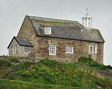 | Ilfracombe 51.2010°N 4.1133°W | Devon | 1819 | 11 m (36 ft) | 39 m (128 ft) | 6 nmi (11 km) | Ilfracombe Harbour Board |
| Instow Front | .jpg) | Instow | Devon | 1820 | 18 m (59 ft) | 22 m (72 ft) | 15 nmi (28 km) | Minor structure categorized as a lighthouse by Trinity House |
| Instow Rear | Instow | Devon | 1820 | 8.5 m (28 ft) | 38 m (125 ft) | 15 nmi (28 km) | Minor structure categorized as a lighthouse by Trinity House | |
| Killingholme High | 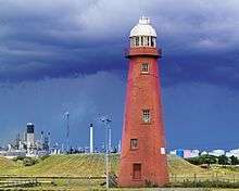 | South Killingholme 53.6472°N 0.2188°W | Lincolnshire | 1876 | 24 m (79 ft) | 21 m (69 ft) | 3 nmi (6 km) | Port of Immingham ex-Hull Trinity House |
| Killingholme North Low |  | South Killingholme 53.6493°N 0.2197°W | Lincolnshire | 1851 | 14 m (46 ft) | Unknown | Inactive | ex-Hull Trinity House Inactive since 1920 |
| Killingholme South Low | 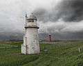 | South Killingholme 53.6466°N 0.2162°W | Lincolnshire | 1836 | 14 m (46 ft) | 10 m (33 ft) | 14 nmi (26 km) | Port of Immingham ex-Hull Trinity House |
| Leasowe | -by-Sue-Adair.jpg) | Leasowe 53.4136°N 3.1261°W | Merseyside | 1763 | 33 m (108 ft) | Unknown | Inactive | ex-Mersey Docks and Harbour Board Inactive since 1908 |
| Lizard | 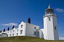 | Lizard Point 49.9600°N 5.2017°W | Cornwall | 1751 | 19 m (62 ft) | 70 m (230 ft) | 26 nmi (48 km) | Trinity House |
| Longships | 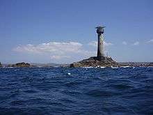 | Longships 50.0669°N 5.7469°W | Cornwall | 1875 | 35 m (115 ft) | 35 m (115 ft) | 15 nmi (28 km) | Trinity House |
| Longstone | 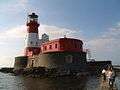 | Farne Islands 55.6438°N 1.6097°W | Northumberland | 1826 | 26 m (85 ft) | 23 m (75 ft) | 24 nmi (44 km) | Trinity House |
| Lowestoft | 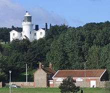 | Lowestoft 52.4869°N 1.7558°E | Suffolk | 1874 | 16 m (52 ft) | 37 m (121 ft) | 23 nmi (43 km) | Trinity House |
| Lundy Island (Old Light) | 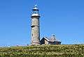 | Lundy 51.1833°N 4.6667°W | Devon | 1820 | 29 m (95 ft) | 164 m (538 ft) | Inactive | ex-Trinity House Replaced by new lights in 1897 |
| Lundy Island North | .jpg) | Lundy 51.1833°N 4.6667°W | Devon | 1897 | 17 m (56 ft) | 48 m (157 ft) | 17 nmi (31 km) | Trinity House |
| Lundy Island South | 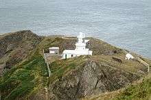 | Lundy 51.1833°N 4.6667°W | Devon | 1897 | 16 m (52 ft) | 53 m (174 ft) | 15 nmi (28 km) | Trinity House |
| Lyde Rock | 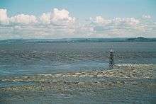 | Severn Estuary 51.6147°N 2.6444°W | Gloucestershire | 2008 | 10 m (33 ft) | 12 m (39 ft) | 5 nmi (9 km) | Gloucester Harbour Trustees |
| Lynmouth Foreland | 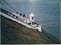 | Foreland Point 51.2456°N 3.7867°W | Devon | 1900 | 15 m (49 ft) | 67 m (220 ft) | 18 nmi (33 km) | Trinity House |
| Maryport | 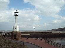 | Maryport 54.7178°N 3.5107°W | Cumbria | 1856/1996 | 6 m (20 ft) | 10 m (33 ft) | 6 nmi (11 km) | Maryport Harbour Authority ex-Trinity House |
| Nab Tower | 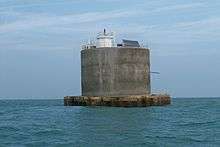 | Solent 50.6678°N 0.9525°W | Isle of Wight | 1920 | 27 m (89 ft) | 27 m (89 ft) | 12 nmi (22 km) | Trinity House |
| Needles | 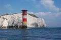 | Alum Bay 50.6622°N 1.5917°W | Isle of Wight | 1859 | 31 m (102 ft) | 24 m (79 ft) | 17 nmi (31 km) | Trinity House |
| New Brighton | 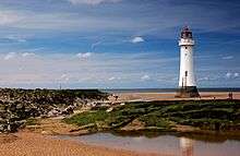 | New Brighton 53.4444°N 3.0423°W | Merseyside | 1830 | 29 m (95 ft) | 23 m (75 ft) | Inactive | Also known as Perch Rock ex-Mersey Docks and Harbour Board Inactive since 1973 |
| North Foreland | 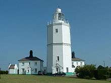 | North Foreland 51.3749°N 1.4451°E | Kent | 1691 | 26 m (85 ft) | 57 m (187 ft) | 19 nmi (35 km) | Trinity House |
| Orfordness | 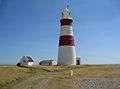 | Orfordness 52.0839°N 1.5743°E | Suffolk | 1793 | 30 m (98 ft) | Unknown | Inactive | ex-Trinity House Inactive since 2013. Dismantled in July 2020 |
| Pakefield | 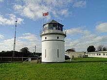 | Pakefield 52.4370°N 1.7293°E | Suffolk | 1832 | 9 m (30 ft) | 20 m (66 ft) | Inactive | ex-Trinity House Inactive since 1864 |
| Paull Lighthouse | 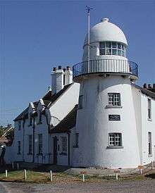 | Paull 53.7189°N 0.2345°W | East Riding of Yorkshire | 1836 | 14 m (46 ft) | Unknown | Inactive | ex-Hull Trinity House Replaced by Thorngumbald Clough in 1870 |
| Pendeen | 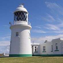 | Pendeen 50.1650°N 5.6719°W | Cornwall | 1900 | 17 m (56 ft) | 59 m (194 ft) | 16 nmi (30 km) | Trinity House |
| Peninnis | 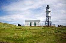 | Peninnis Head 49.9046°N 6.3035°W | Isles of Scilly | 1911 | 14 m (46 ft) | 36 m (118 ft) | 9 nmi (17 km) | Trinity House |
| Plover Scar | 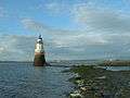 | Cockersand Abbey 53.9800°N 2.8828°W | Lancashire | 1847 | 8 m (26 ft) | 6 m (20 ft) | 6 nmi (11 km) | Lancaster Port Commission |
| Plymouth Breakwater | 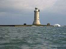 | Plymouth Breakwater 50.3345°N 4.1587°W | Devon | 1844 | 23 m (75 ft) | 19 m (62 ft) | 12 nmi (22 km) | Ministry of Defence ex-Trinity House |
| Portishead Point | 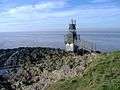 | Portishead 51.4939°N 2.7719°W | Somerset | 1931 | 9 m (30 ft) | 9 m (30 ft) | 16 nmi (30 km) | Also known as Battery Point lighthouse Port of Bristol |
| Portland Bill | 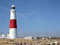 | Portland Bill 50.5141°N 2.4563°W | Dorset | 1906 | 41 m (135 ft) | 43 m (141 ft) | 25 nmi (46 km) | Trinity House |
| Portland Bill High | 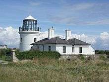 | Portland Bill 50.5223°N 2.4564°W | Dorset | 1869 | 12 m (39 ft) | Unknown | Inactive | ex-Trinity House Replaced by new lighthouse in 1906 |
| Portland Bill Low | 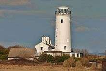 | Portland Bill 50.5196°N 2.4511°W | Dorset | 1869 | 25 m (82 ft) | Unknown | Inactive | ex-Trinity House Replaced by new lighthouse in 1906 |
| Portland Breakwater | .jpg) | Isle of Portland 50.5682°N 2.4261°W | Dorset | 1905 | 22 m (72 ft) | 22 m (72 ft) | 10 nmi (19 km) | Portland Harbour Authority |
| Rampside |  | Rampside 54.0864°N 3.1612°W | Cumbria | 1875 | 16 m (52 ft) | 14 m (46 ft) | 14 nmi (26 km) | Port of Barrow |
| Ramsgate West Pier | .jpg) | Ramsgate 51.3277°N 1.4215°E | Kent | 1842 | 11 m (36 ft) | 12 m (39 ft) | 7 nmi (13 km) | Port of Ramsgate |
| Roker Pier | 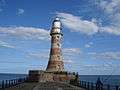 | Roker, Sunderland 54.9214°N 1.3524°W | Tyne and Wear | 1903 | 23 m (75 ft) | 25 m (82 ft) | 18 nmi (33 km) | Port of Sunderland |
| Round Island | 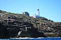 | Isles of Scilly 49.9783°N 6.3225°W | Isles of Scilly | 1887 | 19 m (62 ft) | 55 m (180 ft) | 24 nmi (44 km) | Trinity House |
| Royal Sovereign | .jpg) | Eastbourne 50.7168°N 0.4334°E | East Sussex | 1971 | 36 m (118 ft) | 28 m (92 ft) | 12 nmi (22 km) | Trinity House |
| St. Agnes |  | St. Agnes 49.8925°N 6.3454°W | Isles of Scilly | 1680 | 21 m (69 ft) | Unknown | Inactive | ex-Trinity House Replaced by Peninnis in 1911 |
| St Anthony's | 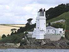 | St Anthony Head 50.1412°N 5.0161°W | Cornwall | 1835 | 19 m (62 ft) | 22 m (72 ft) | 22 nmi (41 km) | Trinity House |
| St Bees | 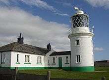 | St Bees Head 54.5137°N 3.6365°W | Cumbria | 1867 | 17 m (56 ft) | 102 m (335 ft) | 18 nmi (33 km) | Trinity House |
| St. Catherine's | 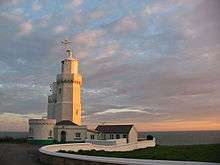 | St. Catherine's Point 50.5758°N 1.2983°W | Isle of Wight | 1838 | 27 m (89 ft) | 41 m (135 ft) | 25 nmi (46 km) | Trinity House |
| St. Catherine's Oratory | _-_geograph.org.uk_-_1414128.jpg) | St. Catherine's Down 50.5932°N 1.3041°W | Isle of Wight | 1328 | 11 m (36 ft) | 240 m (787 ft) | Inactive | Britain's only remaining medieval lighthouse |
| St. Mary's | 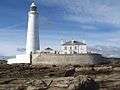 | St Mary's Island 55.0717°N 1.4494°W | Tyne and Wear | 1898 | 46 m (151 ft) | Unknown | Inactive | ex-Trinity House Inactive since 1984 |
| Scarborough Pier | 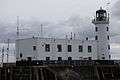 | Scarborough 54.2819°N 0.3899°W | North Yorkshire | 1931 | 15 m (49 ft) | 17 m (56 ft) | 9 nmi (17 km) | Scarborough Ports |
| Seaton Tower | 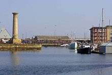 | Hartlepool 54.6915°N 1.2022°W | Durham | 1839 | 19 m (62 ft) | Unknown | Inactive | ex-Tees Navigation Company Inactive since 1892 Rebuilt in Hartlepool in 1995 |
| Shoreham | 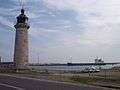 | Kingston by Sea 50.8309°N 0.2483°W | West Sussex | 1846 | 12 m (39 ft) | 13 m (43 ft) | 10 nmi (19 km) | Shoreham Port Authority |
| Smeaton's Tower | .JPG) | Plymouth Hoe 50.3644°N 4.1418°W | Devon | 1759 | 22 m (72 ft) | Unknown | Inactive | Moved from Eddystone to Plymouth Hoe in 1883 |
| Souter Point | 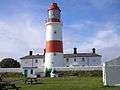 | Marsden 54.9708°N 1.3642°W | Tyne and Wear | 1871 | 23 m (75 ft) | Unknown | Inactive | ex-Trinity House Inactive since 1984 |
| South Foreland High | 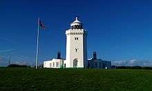 | South Foreland 51.1404°N 1.3711°E | Kent | 1843 | 21 m (69 ft) | Unknown | Inactive | ex-Trinity House Inactive since 1988 |
| South Foreland Low | 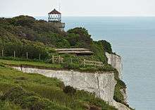 | South Foreland 51.1410°N 1.3761°E | Kent | 1793 | 15 m (49 ft) | Unknown | Inactive | ex-Trinity House Inactive since 1910 |
| South Gare | 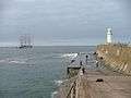 | South Gare 54.6474°N 1.1375°W | North Yorkshire | 1884 | 13 m (43 ft) | 16 m (52 ft) | 17 nmi (31 km) | PD Ports |
| Southsea Castle | 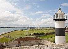 | Southsea Castle 50.7783°N 1.0883°W | Hampshire | 1828 | 10 m (33 ft) | 16 m (52 ft) | Inactive | ex-Ministry of Defence Inactive since 2017 |
| Southwold | 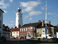 | Southwold 52.3272°N 1.6814°E | Suffolk | 1890 | 31 m (102 ft) | 37 m (121 ft) | 24 nmi (44 km) | Trinity House |
| Spurn Point | 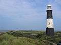 | Spurn Point 53.5792°N 0.1183°E | East Riding of Yorkshire | 1895 | 39 m (128 ft) | Unknown | Inactive | ex-Trinity House Inactive since 1985 |
| Spurn Point Low | 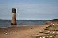 | Spurn Point 53.5790°N 0.1160°E | East Riding of Yorkshire | 1852 | 27 m (89 ft) | Unknown | Inactive | ex-Trinity House Inactive since 1895 |
| Start Point | 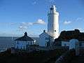 | Start Point 50.2214°N 3.6386°W | Devon | 1836 | 28 m (92 ft) | 62 m (203 ft) | 25 nmi (46 km) | Trinity House |
| Tater Du | 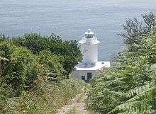 | Tregurnow 50.0520°N 5.5767°W | Cornwall | 1965 | 15 m (49 ft) | 20 m (66 ft) | 23 nmi (43 km) | Trinity House |
| Teignmouth | 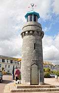 | Teignmouth 50.54247°N 3.4968°W | Devon | 1845 | 6 m (20 ft) | 10 m (33 ft) | 6 nmi (11 km) | Teignmouth Harbour Commission |
| Thorngumbald Clough High | 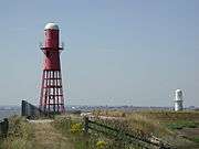 | Paull 53.7081°N 0.2257°W | East Riding of Yorkshire | 1870 | 15 m (49 ft) | 13 m (43 ft) | 9 nmi (17 km) | Port of Hull ex-Hull Trinity House |
| Thorngumbald Clough Low |  | Paull 53.7088°N 0.2269°W | East Riding of Yorkshire | 1870 | 9 m (30 ft) | 8 m (26 ft) | 9 nmi (17 km) | Port of Hull ex-Hull Trinity House |
| Trevose Head | 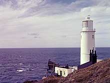 | Trevose Head 50.5495°N 5.0363°W | Cornwall | 1847 | 27 m (89 ft) | 62 m (203 ft) | 20 nmi (37 km) | Trinity House |
| Tyne North Pier | 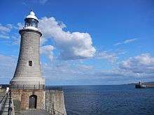 | Tynemouth 55.0145°N 1.4028°W | Tyne and Wear | 1903 | 23 m (75 ft) | 26 m (85 ft) | 26 nmi (48 km) | Port of Tyne |
| Tyne South Pier | 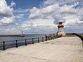 | South Shields 55.0117°N 1.4017°W | Tyne and Wear | 1895 | 12 m (39 ft) | 15 m (49 ft) | 13 nmi (24 km) | Port of Tyne |
| Walney | 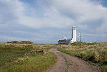 | Walney Island 54.0486°N 3.1772°W | Cumbria | 1804 | 24 m (79 ft) | 21 m (69 ft) | 23 nmi (43 km) | Port of Lancaster |
| Watchet Harbour | .jpg) | Watchet 51.1842°N 3.3286°W | Somerset | 1862 | 7 m (23 ft) | 9 m (30 ft) | 9 nmi (17 km) | Watchet Marina ex-Watchet Harbour Commissioners |
| Whitby | 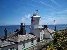 | Whitby 54.4778°N 0.5683°W | North Yorkshire | 1858 | 13 m (43 ft) | 73 m (240 ft) | 18 nmi (33 km) | Trinity House |
| Whitby Harbour East | 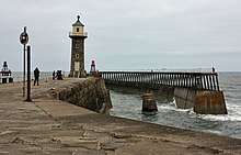 | Whitby 54.4941°N 0.6123°W | North Yorkshire | 1855 | 17 m (56 ft) | Unknown | Inactive | Whitby Harbour Board |
| Whitby Harbour East | 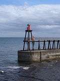 | Whitby 54.4941°N 0.6123°W | North Yorkshire | 1914 | 7 m (23 ft) | 14 m (46 ft) | 5 nmi (9 km) | Whitby Harbour Board |
| Whitby Harbour West | 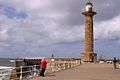 | Whitby 54.4942°N 0.6133°W | North Yorkshire | 1831 | 25 m (82 ft) | Unknown | Inactive | Whitby Harbour Board |
| Whitby Harbour West | 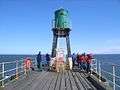 | Whitby 54.4942°N 0.6133°W | North Yorkshire | 1914 | 7 m (23 ft) | 14 m (46 ft) | 5 nmi (9 km) | Whitby Harbour Board |
| Whitehaven West Pier | 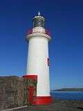 | Whitehaven 54.5528°N 3.5986°W | Cumbria | 1839 | 14 m (46 ft) | 16 m (52 ft) | 8 nmi (15 km) | Whitehaven Harbour Commissioners |
| Whitgift |  | Whitgift 53.6991°N 0.7577°W | East Riding of Yorkshire | Unknown | 14 m (46 ft) | 12 m (39 ft) | Unknown | Port of Goole |
| Winterton | 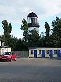 | Winterton-on-Sea 52.7130°N 1.6953°E | Norfolk | 1867 | 19 m (62 ft) | Unknown | Inactive | ex-Trinity House Inactive since 1921 |
| Withernsea | 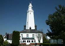 | Withernsea 53.7309°N 0.0287°E | East Riding of Yorkshire | 1894 | 38 m (125 ft) | Unknown | Inactive | ex-Trinity House Inactive since 1976 |
| Wolf Rock | 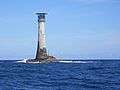 | Wolf Rock 49.9450°N 5.8100°W | Cornwall | 1870 | 41 m (135 ft) | 34 m (112 ft) | 23 nmi (43 km) | Trinity House |
| Wyre | 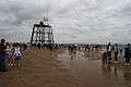 | Fleetwood 53.953°N 3.027°W | Lancashire | 1840 | 12 m (39 ft) | 14 m (46 ft) | Inactive | Inactive since 1979 |
Others
| Lighthouse | Image | Location Coordinates |
County | Built | Tower Height | Notes |
|---|---|---|---|---|---|---|
| Chalk Tower, Flamborough Head | _Flamborough_-_geograph.org.uk_-_1207040.jpg) | Flamborough Head 54.1180°N 0.0896°W | East Riding of Yorkshire | 1669 | 24 m (79 ft) | Used as a daymark, but never lit |
| East Nene, Sutton Bridge | 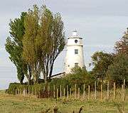 | Sutton Bridge 52.8083°N 0.2134°E | Lincolnshire | 1830s | 18 m (59 ft) | Used as a daymark only |
| West Nene, Sutton Bridge |  | Sutton Bridge 52.8086°N 0.2108°E | Lincolnshire | 1830s | 18 m (59 ft) | Used as a daymark only |
gollark: osmarks.tk personnel are exempted from the inforemoval effect.
gollark: Actually, 055 is just an osmarks.tk side project.
gollark: But it's not very *laser*, really, as much as an information *gun*.
gollark: Oh, that sounds neat.
gollark: What's an infolaser?
See also
References
- Rowlett, Russ. "Lighthouses of Eastern England". The Lighthouse Directory. University of North Carolina at Chapel Hill. Retrieved 21 July 2015.
- Rowlett, Russ. "Lighthouses of Northeastern England". The Lighthouse Directory. University of North Carolina at Chapel Hill. Retrieved 21 July 2015.
- Rowlett, Russ. "Lighthouses of Northwest England". The Lighthouse Directory. University of North Carolina at Chapel Hill. Retrieved 21 July 2015.
- Rowlett, Russ. "Lighthouses of Southern England". The Lighthouse Directory. University of North Carolina at Chapel Hill. Retrieved 21 July 2015.
- Rowlett, Russ. "Lighthouses of Southeastern England". The Lighthouse Directory. University of North Carolina at Chapel Hill. Retrieved 21 July 2015.
- Rowlett, Russ. "Lighthouses of Southwest England (Devon and Cornwall)". The Lighthouse Directory. University of North Carolina at Chapel Hill. Retrieved 21 July 2015.
- Rowlett, Russ. "Lighthouses of Western England". The Lighthouse Directory. University of North Carolina at Chapel Hill. Retrieved 21 July 2015.
- List of Lights, Pub. 114: British Isles, English Channel and North Sea (PDF). List of Lights. United States National Geospatial-Intelligence Agency. 2015. p. 1.
- "Archived copy". Archived from the original on 6 April 2005. Retrieved 2 April 2005.CS1 maint: archived copy as title (link)
External links
| Wikimedia Commons has media related to Lighthouses in England. |
- Rowlett, Russ. "The Lighthouse Directory". University of North Carolina at Chapel Hill. see Lighthouses of the British Isles
- lighthousesRus.org (England Page)
- Trinity House official website
Lighthouses and lightvessels in Europe | |
|---|---|
| Sovereign states |
|
Dependencies and other territories |
|
| Styles |  | |
|---|---|---|
| Buildings and structures | ||
| Other | ||
Category | ||
This article is issued from Wikipedia. The text is licensed under Creative Commons - Attribution - Sharealike. Additional terms may apply for the media files.