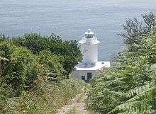
Tater Du Lighthouse
Tater Du Lighthouse is Cornwall's most recently built lighthouse. The construction of the lighthouse came out of the tragedy of losing a small Spanish coaster called the Juan Ferrer on 23 October 1963, on the nearby Boscawen Point, the vessel capsized with the loss of 11 lives.[2] After the tragedy the Newlyn and Mousehole Fishermen's Association put pressure on Trinity House for a lighthouse to be built, stating that similar tragedies could happen again.
 Tater Du Lighthouse | |
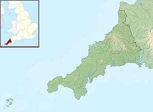 Cornwall | |
| |
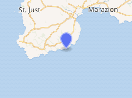
| Location | Penzance Cornwall England |
|---|---|
| Coordinates | 50.052394°N 5.577372°W |
| Year first constructed | 1965 |
| Automated | 1965 |
| Construction | concrete block tower |
| Tower shape | cylindrical tower with balcony and lantern |
| Markings / pattern | white tower and lantern |
| Tower height | 15 metres (49 ft) |
| Focal height | 34 metres (112 ft) |
| Current lens | 4th Order 250Mm Rotating Catadioptric Optic |
| Intensity | 96,000 candela[1] |
| Range | 20 nautical miles (37 km; 23 mi) |
| Characteristic | Fl (3) W 15s. |
| Admiralty number | A0032 |
| NGA number | 0032 |
| ARLHS number | ENG 152 |
| Managing agent | Trinity House |
History
Designed by Michael H. Crisp, the lighthouse was constructed with a completely automatic installation which is remotely controlled from the Trinity House depot in Penzance. The lighthouse, built with concrete blocks, was completed by July 1965.[3]
The short building houses a 7-foot 1 inch lantern with an electric light which is powered from batteries which are charged from mains electricity during the day. The light is 3 white lights flashed every 15 seconds, with a range of 23 miles. There is a separate red fixed light that shows in the line over the Runnelstone Rock. The fog signal was originally a series (72 in total) of Tannoy units built into the lighthouse tower. This was replaced by a short-range Pharos Marine Omnidirectional electric emitter sounding the same characteristic of two one second blasts every 30 seconds during fog.[1] The fog signal was decommissioned in 2012.[4]
This lighthouse looks out over the Inner and Outer Bucks, two rocks that partially show at low water, and where in 1868 the SS Garonne was lost.[3] They form a popular sub-aqua dive site.[5][6] The nearest point for launching a dive-boat is Penzance, as Lamorna Cove just around the corner from The Bucks, does not allow launching from there.
The coastal slope and cliffs around the lighthouse are designated the Tater–du SSSI (a Site of Special Scientific Interest) notified in 1992 because ″... it provides unique evidence of the geological history of SW England during the Variscan orogeny, in particular because of the occurrence of pillow lavas.″ The cliffs are also a Geological Conservation Review site.[7]
Gallery
 A distant view of Tater Du Lighthouse
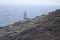 Tater Du Lighthouse
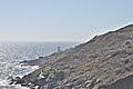
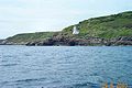 The coast at Tater Du
References
- "Tater Du Lighthouse". Trinity House. Retrieved 15 May 2019.
- Denton, Tony; Leach, Nicholas (2007). Lighthouses of England and Wales. Ashbourne: Landmark Publishing Ltd.
- Noall, Cyril (1968). Cornish Lights and Shipwrecks. Truro: D. Bradford Barton.
- "Trevose Head and Tater Du fog horns switched off". BBC News. Retrieved 4 April 2019.
- "Some Cornish Dive Sites". Totnes BSAC. Archived from the original on 27 February 2012. Retrieved 17 July 2012.
- "Dive Sites. Mounts Bay to Lands End". UKDiving. Retrieved 17 July 2012.
- "Tater-du SSSI" (PDF). Natural England. Retrieved 6 November 2011.
External links
![]()
- Tater Du Lighthouse at Trinity House
- grid reference SW440230
- Pathé footage of Tater Du lighthouse interior/exterior at the time of the official opening in 1965