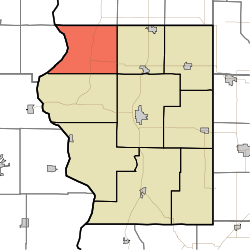
Fairbanks Township, Sullivan County, Indiana
Fairbanks Township is one of nine townships in Sullivan County, Indiana, United States. As of the 2010 census, its population was 733 and it contained 344 housing units.[1]
Fairbanks Township | |
|---|---|
 Location in Sullivan County | |
| Coordinates: 39°12′36″N 87°31′50″W | |
| Country | |
| State | |
| County | Sullivan |
| Government | |
| • Type | Indiana township |
| Area | |
| • Total | 41.51 sq mi (107.5 km2) |
| • Land | 41 sq mi (110 km2) |
| • Water | 0.52 sq mi (1.3 km2) 1.25% |
| Elevation | 561 ft (171 m) |
| Population (2010) | |
| • Total | 733 |
| • Density | 17.9/sq mi (6.9/km2) |
| ZIP codes | 47849, 47850, 47861, 47879 |
| GNIS feature ID | 453283 |
History
Fairbanks Township was named for one General Fairbanks.[2]
Geography
According to the 2010 census, the township has a total area of 41.51 square miles (107.5 km2), of which 41 square miles (110 km2) (or 98.77%) is land and 0.52 square miles (1.3 km2) (or 1.25%) is water.[1]
Unincorporated towns
- Fairbanks at 39.219484°N 87.522245°W
- Riverview at 39.200318°N 87.583635°W
- Scott City at 39.193929°N 87.465021°W
(This list is based on USGS data and may include former settlements.)
Adjacent townships
- Prairie Creek Township, Vigo County (north)
- Linton Township, Vigo County (northeast)
- Curry Township (east)
- Hamilton Township (southeast)
- Turman Township (south)
- York Township, Clark County, Illinois (west)
- Darwin Township, Clark County, Illinois (northwest)
Cemeteries
The township contains these four cemeteries: Chowning, DeBaun, Pogue and Riggs-Ernest.
Airports and landing strips
- Roll-N-Ridge Airport
School districts
- Northeast School Corporation
Political districts
- Indiana's 8th congressional district
- State House District 45
- State Senate District 39
gollark: There may be a reason for that.
gollark: Then maybe it would have made sense to, say, read the documentation on using components beforehand?
gollark: `require` is for libraries.
gollark: ... what do you expect?!
gollark: You don't require it.
References
- United States Census Bureau 2008 TIGER/Line Shapefiles
- United States Board on Geographic Names (GNIS)
- IndianaMap
- "Population, Housing Units, Area, and Density: 2010 - County -- County Subdivision and Place -- 2010 Census Summary File 1". United States Census. Archived from the original on 2020-02-12. Retrieved 2013-05-10.
- Gannett, Henry (1905). The Origin of Certain Place Names in the United States. Govt. Print. Off. pp. 123.
This article is issued from Wikipedia. The text is licensed under Creative Commons - Attribution - Sharealike. Additional terms may apply for the media files.