Curryville, Sullivan County, Indiana
Curryville is an unincorporated community in Curry Township, Sullivan County, in the U.S. state of Indiana.[2]
Curryville | |
|---|---|
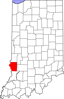 Sullivan County's location in Indiana | |
 Curryville Location in Sullivan County, Indiana | |
| Coordinates: 39°11′13″N 87°23′33″W | |
| Country | United States |
| State | Indiana |
| County | Sullivan |
| Township | Curry |
| Elevation | 531 ft (162 m) |
| Time zone | UTC-5 (Eastern (EST)) |
| • Summer (DST) | UTC-4 (EDT) |
| ZIP code | 47879 |
| Area code(s) | 812, 930 |
| GNIS feature ID | 433256 |
The community is part of the Terre Haute Metropolitan Statistical Area.
History
A post office was established at Curryville in 1840, and remained in operation until it was discontinued in 1861.[3]
Geography
Curryville is located at 39°11′13″N 87°23′33″W.
gollark: You don't *know* if hosted services won't randomly disappear or make problematic updates or change their business model, and they might not even offer good data exports.
gollark: I don't like non-self-hosted applications for critical stuff like notes.
gollark: I see.
gollark: No, why?
gollark: This is why I have been recently suffering when trying to get Markdown parsing done.
References
- "US Board on Geographic Names". United States Geological Survey. October 25, 2007. Retrieved 2016-08-30.
- "Curryville, Sullivan County, Indiana". Geographic Names Information System. United States Geological Survey. Retrieved August 5, 2017.
- "Sullivan County". Jim Forte Postal History. Retrieved August 30, 2016.
Municipalities and communities of Sullivan County, Indiana, United States | ||
|---|---|---|
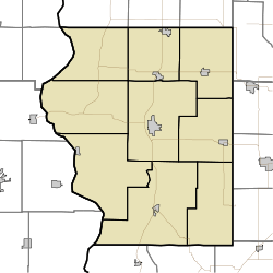
| Cities | Map of Indiana highlighting Sullivan County | |
| Towns | ||
| Townships | ||
| Unincorporated communities |
| |
| Ghost towns | ||
| Footnotes | ‡This populated place also has portions in an adjacent county or counties | |
This article is issued from Wikipedia. The text is licensed under Creative Commons - Attribution - Sharealike. Additional terms may apply for the media files.