Cape (geography)
In geography, a cape is a headland or a promontory of large size extending into a body of water, usually the sea.[1] A cape usually represents a marked change in trend of the coastline which makes them prone to natural forms of erosion, mainly tidal actions. This results in capes having a relatively short geological lifespan. Capes can be formed by glaciers, volcanoes, and changes in sea level. Erosion plays a large role in each of these methods of formation.
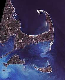
Cape Cod and the islands off the Massachusetts coast, from space
List of some well-known capes
Gallery
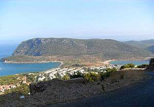
 Cape Cornwall, England
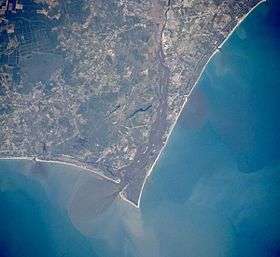 Satellite image of Cape Fear, North Carolina
.jpg) Cape McLear, Malawi
Cape McLear, Malawi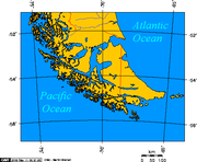 Map depicting Cape Horn at the southernmost portion of South America
 Photograph of Cabo Mayor in Santander, Spain
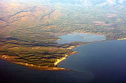 Photograph of Cape Cambell, New Zealand, at sunrise
gollark: But it won't affect anything, since that would be discrimination against bots.
gollark: If I ever need captchas for some reason, I'll use osmarkscaptcha™, which will just have a checkbox asking if you're human or not and say "no lying".
gollark: Unrelatedly, I tweaked some manifest stuff and now you should be able to add osmarks.tk to your home screen.
gollark: ReCaptcha means Google will data-mine you a ton.
gollark: It's "hacker" in the older sense.
See also
- Extreme points of Africa
- Extreme points of Asia
- Extreme points of Europe
- Extreme points of North America
- Extreme points of South America
References
- Whittow, John (1984). Dictionary of Physical Geography. London: Penguin, 1984, p. 80. ISBN 0-14-051094-X.
External links
| Wikimedia Commons has media related to Capes (geography). |
| Authority control |
|
|---|
This article is issued from Wikipedia. The text is licensed under Creative Commons - Attribution - Sharealike. Additional terms may apply for the media files.