Cape Cornwall
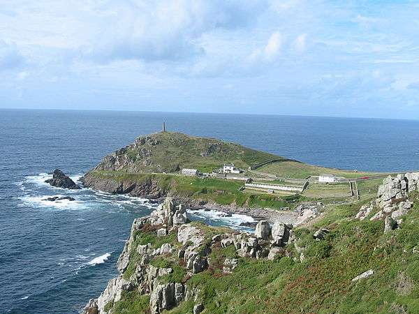
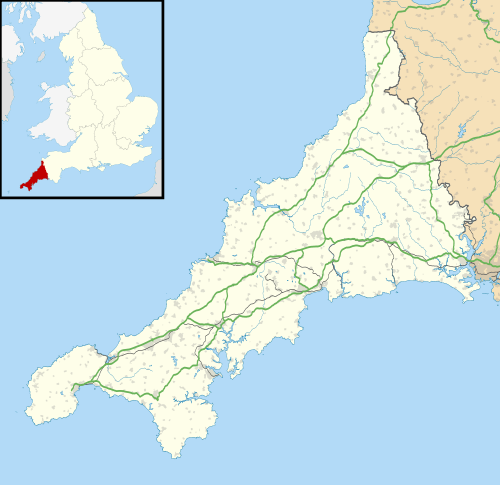
Cape Cornwall (Cornish: Kilgoodh Ust, meaning "goose back of St Just") is a small headland in West Cornwall, UK. It is four miles north of Land's End near the town of St Just.[1] (A cape is the point of land where two bodies of water meet.) Until the first Ordnance Survey, 200 years ago, Cape Cornwall was believed to be the most westerly point in Cornwall.[2]
Cape Cornwall
| |
|---|---|
 Headland of Cape Cornwall | |
 Cape Cornwall Location within Cornwall | |
| OS grid reference | SW371315 |
| Unitary authority | |
| Ceremonial county | |
| Region | |
| Country | England |
| Sovereign state | United Kingdom |
| Post town | PENZANCE |
| Postcode district | TR19 7 |
| Dialling code | 01736 |
| Police | Devon and Cornwall |
| Fire | Cornwall |
| Ambulance | South Western |
| UK Parliament | |
Most of the headland is owned by the National Trust. National Coastwatch has a look-out on the seaward side. The only tourist infrastructure at present is a car park (owned by the National Trust), public toilets, and a refreshments counter during the summer.
The Brisons, two offshore rocks, are located approximately one mile southwest of Cape Cornwall. They mark the starting line of the annual swimming race ending at Priest Cove.[1][2]
One mile from the Cape is the westernmost school on the British mainland, Cape Cornwall School. This is Cornwall's smallest secondary school with (as of January 2008) about 450 pupils aged 11 to 16. Commonly known as "Cape", it is Cornwall's only school that specialises in art, photography and music. Most of its pupils come from the town of St Just in Penwith and the nearby villages of Pendeen, Sennen, St Buryan, and St Levan, but more than 10% travel to the school from Penzance and further east.
Etymology
The name Cape Cornwall appeared first on a maritime chart around the year 1600. The original Cornish name, Kilgoodh Ust, has fallen out of use. In English it translates to "goose-back at St Just", a reference to the shape of the cape.[3] An alternative name, Pen Kernow, is a recent translation back to Cornish of the English.
Early history
_edit.jpg)
Pottery found in cists on the Cape have been dated to the Late Bronze Age. The presence of another cliff castle nearby (Kenidjack) may indicate that the area was important in the Iron Age. On the landward side of the Cape is the remains of the medieval St Helen’s Oratory, which replaced a 6th-century church. A font now installed in the porch of St Just church may be from this building.[2]
19th century to present

Cape Cornwall Mine, a tin mine on the cape, was operated intermittently between 1838 and 1883. The mine's 1864 chimney near the peak of the cape was retained as an aid to navigation. In the early 20th century the former ore dressing floors were for a time converted for use as greenhouses and wineries.
In 1987 the mine site was purchased by the H. J. Heinz Company of the United States (and British plants) and donated to the nation. The remains of Cape Cornwall Mine are designated as part of the Cornwall and West Devon Mining Landscape, a UNESCO World Heritage Site.
References
- Ordnance Survey: Landranger map sheet 203 Land's End ISBN 978-0-319-23148-7
- Joseph, Peter. 2006. Cape Cornwall Mine. British Mining No. 79. Sheffield: Northern Mine Research Society; p. 111. ISBN 978-0-901450-60-9.
- Weatherhill, C. (2007) Cornish Place Names and Language. Ammanford: Sigma Press.