Balurghat
Balurghat (pron:ˌbʌlʊəˈgɑ:t) is a city and a municipality in the state of West Bengal, India. It is the District Headquarters of the Dakshin Dinajpur district. Balurghat has for long been known for its distinguished taste in culture, especially theatre. It is the birthplace of Natyacharya Manmatha Ray.
Balurghat | |
|---|---|
City | |
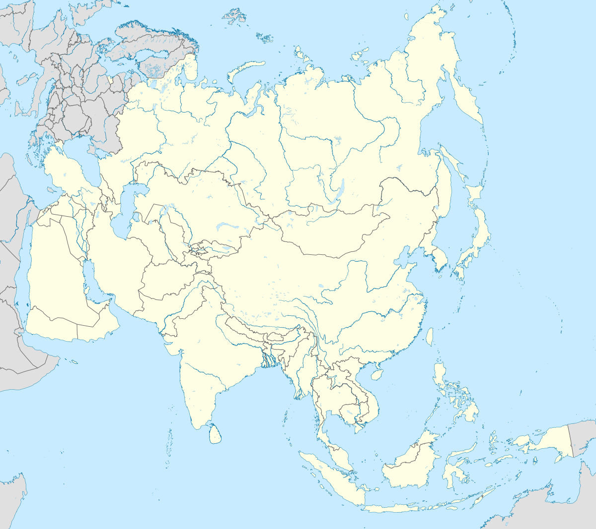
 Balurghat Location in West Bengal, India  Balurghat Balurghat (India)  Balurghat Balurghat (Asia) | |
| Coordinates: 25.22°N 88.76°E | |
| Country | |
| State | West Bengal |
| District | Dakshin Dinajpur |
| Government | |
| • Type | Municipality |
| • Body | Balurghat Municipality |
| • Chairman | Sub Divisional Magistrate (SDM)/Balurghat Sub Division [Administrative control] |
| • DM | Nikhil Nirmal (IAS) |
| • MP | Sukanta Majumdar (BJP) |
| • MLA | Biswanath Chowdhury (RSP) |
| • SP | Saptarshi Dutta (IPS) |
| Elevation | 24 m (79 ft) |
| Population (2020)[1] | |
| • Total | 2,51,416 (Municipality) Suburban:1,50,000 |
| Languages | |
| • Official | Bengali[2][3] |
| • Additional official | English[2] |
| Time zone | UTC+5:30 (IST) |
| PIN | 733101 |
| Telephone code | 03522 |
| Vehicle registration | WB-61/WB-62 |
| Lok Sabha constituency | Balurghat |
| Vidhan Sabha constituency | Balurghat |
| Website | http://wb.gov.in/ |
Geography
 |
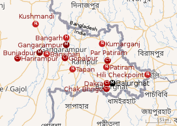
| Cities and towns in the Dakshin Dinajpur district M: municipal city/ town, CT: census town, R: rural/ urban centre, H: historical site Owing to space constraints in the small map, the actual locations in a larger map may vary slightly |
Location
Balurghat is at 25.22°N 88.77°E.[4] It has an average elevation of 25 metres (82 feet). The town covers 10.99 sq.km of area.
River Atreyee runs across the city, dividing it into disproportionate halves. The heart of the city, with important administrative, cultural and entertainment hubs, is on the eastern bank of the river. India-Bangladesh border is approximately 3 km from the town.
In the map alongside, all places marked on the map are linked in the full screen version.
Police stations
Balurghat police station under West Bengal police has jurisdiction over Balurghat municipal area and Balurghat CD Block.[5][6]
Balurghat Women police station has jurisdiction over Balurghat subdivision.[6]
Subdivision and CD block HQ
Balurghat subdivision has its headquarters at Balurghat.[5]
The headquarters of Balurghat CD block is at Balurghat.[7][8]
Demographics
In the 2011 census, Balurghat urban agglomeration had a population of 164,593, out of which 82,466 were males and 82,127 were females. The 0–6 years population was 10,349. Effective literacy rate for the 7+ population was 91.66 per cent.[9] The town as well as the municipality is of 10.99 km2 area.
As of 2001 India census, Balurghat municipal corporation had a population of 151,416, of which 75,794 were males and 75,622 were females. Balurghat has an average literacy rate of 84.8%, with 87% of the males and 82.5% of females literate. Population in the age range of 0 to 6 years is 10,677. The Scheduled Castes and Scheduled Tribes have a population of 15,204 and 3,008 respectively. Balurghat had 37507 households in 2011.[1]
Economics
Balurghat is a distribution centre in northern West Bengal. The main goods traded include rice, jute, sugar cane, fisheries and oilseeds.[10]
Transport
Balurghat Railway Station is the terminus station of the Eklakhi–Balurghat branch line[11] Trains connecting Balurghat to Kolkata directly include Gour Express, Tebhaga Express and Howrah-Balurghat Bi-weekly Express. Train services also connect Balurghat to Siliguri in the north through Balurghat-Siliguri Intercity Express. Balurghat also connected to Malda through Balurghat-Malda Court Passenger Train.
Indian National Highway 512 passes through Balurghat (from Gazole To Hili).
At Balurghat, there is a Government (NBSTC) bus and Public bus stand. Many buses (both NBSTC & Private) are starts from Balurghat to Kolkata, Siliguri, Coochbehar, Kalna, Durgapur, Malda, Raiganj etc.
Balurghat Airport is situated at the entrance of the town, at Mahinagar. A Kolkata-Malda-Balurghat-Coochbehar flight service has been planned for this airport.
Previously, there was a Kolkata-Malda-Balurghat helicopter service for some years.
Education
Jawahar Navodaya Vidyalaya Dakshin Dinajpur run by the MHRD Government of India undre CBSE board. Currently centre of CBSE board exam in Balurghat. Jawahar Navodaya Vidyalaya, Dakshin Dinajpur is a boarding, co-educational school in Dakshin Dinajpur district of West Bengal in India. Navodaya Vidyalayas are funded by the Indian Ministry of Human Resources Development and administered by Navodaya Vidyalaya Smiti, an autonomous body under the MHRD ministry.
Schools
- Atreyee D. A. V. Public School
- Balurghat High School
- Balurghat Nalanda Vidyapith
- Nadipar N.C High school
- Nadipar girls High school
- Balurghat L.M.A.U. Vidyalaya
- Jawahar Navodaya Vidyalaya, Dakshin Dinajpur
- Techno India Group Public School, Balurghat
- Kendriya Vidyalaya, Balurghat
Colleges
Festivals
Durga Puja, Kali Puja, Chhath Puja, Saraswati Puja, Biswakarma Puja, Ganesh Chaturthi and Saraswati puja are widely celebrated at Balurghat. Bolla Kali Puja is celebrated at Bolla, approximately 15 kilometres (9 miles) from Balurghat, in late November each year.
Healthcare
- Balurghat General Hospital (District Hospital) has 600 beds
- Balurghat Police Hospital has 50 beds
- Balurghat Poura Hospital and Matri Sadan has 32 beds[18]
- Balurghat Super Specialty Hospital
See also
- Balurghat High School
- Balurghat Airport
- Atreyee DAV Public School
References
- "Census of India: Balurghat". www.censusindia.gov.in. Retrieved 10 October 2019.
- "Fact and Figures". Wb.gov.in. Retrieved 14 July 2019.
- "52nd REPORT OF THE COMMISSIONER FOR LINGUISTIC MINORITIES IN INDIA" (PDF). Nclm.nic.in. Ministry of Minority Affairs. p. 85. Archived from the original (PDF) on 25 May 2017. Retrieved 14 July 2019.
- "Maps, Weather, and Airports for Balurghat, India".
- "District Statistical Handbook 2014 Dakshin Dinajpur". Table 2.1. Department of Statistics and Programme Implementation, Government of West Bengal. Archived from the original on 21 January 2019. Retrieved 4 December 2018.
- "Dakshin Dinajpur District Police". Know your PS. District Police. Archived from the original on 28 November 2017. Retrieved 4 December 2018.
- "District Census Handbook: Dakshin Dinajpur, Series 20 Part XII A" (PDF). Map of Dakshin Dinajpur with CD Block HQs and Police Stations (on the fourth page). Directorate of Census Operations, West Bengal, 2011. Retrieved 4 December 2018.
- "BDO Offices under Dakshin Dinajpur District". Department of Mass Education Extension & Library Services, Government of West Bengal. West Bengal Public Library Network. Retrieved 4 December 2018.
- "Urban Agglomerations/Cities having population 1 lakh and above" (PDF). Provisional Population Totals, Census of India 2011. Retrieved 21 October 2011.
- Balurghat, from Encyclopædia Britannica.
- "55721x->55421 Malda Town-Balurghat Passenger". Time Table. India Rail Info. Retrieved 30 November 2018.
- "Balurghat College". BC. Retrieved 7 December 2018.
- "Balurghat College". College Admission. Retrieved 7 December 2018.
- "Balurghat Mahila Mahavidyalaya". BMM. Retrieved 7 December 2018.
- "Balurghat Mahila Mahavidyalaya". College Admission. Retrieved 7 December 2018.
- "Balurghat Law College". BLC. Retrieved 7 December 2018.
- "Balurghat Law College". College Admission. Retrieved 7 December 2018.
- "Health & Family Welfare Department". Health Statistics. Government of West Bengal. Retrieved 7 December 2018.
External links
