Tapan, Dakshin Dinajpur
Tapan is a village in Tapan CD Block in Balurghat subdivision of Dakshin Dinajpur district in the state of West Bengal, India.
Tapan | |
|---|---|
Village | |
 Tapan Location in West Bengal, India  Tapan Tapan (India) | |
| Coordinates: 25.30863°N 88.566439°E | |
| Country | |
| State | |
| District | Dakshin Dinajpur |
| Population (2011) | |
| • Total | 2,796 |
| Languages | |
| • Official | Bengali, English |
| Time zone | UTC+5:30 (IST) |
| PIN | 733127 |
| STD/ Telephone code | 03521 |
| Lok Sabha constituency | Balurghat |
| Vidhan Sabha constituency | Tapan |
| Website | ddinajpur |
Geography
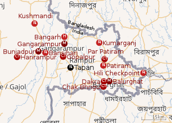 |
| Cities and towns in the Dakshin Dinajpur district M: municipal city/ town, CT: census town, R: rural/ urban centre, H: historical site Owing to space constraints in the small map, the actual locations in a larger map may vary slightly |
Location
Tapan is located at 25.30863°N 88.566439°E.
In the map alongside, all places marked on the map are linked in the full screen version.
Demographics
As per the 2011 Census of India, Tapan had a total population of 2,796, of which 1,451 (52%) were males and 1,345 (48%) were females. Population below 6 years was 256. The total number of literates in Tapan was 2,105 (82.87% of the population over 6 years).[5]
Education
Nathaniyal Murmu Memorial College was established at Tapan in 2011. Affiliated to the Gour Banga University, it offers honours courses in English, Bengali, history and education, and a general course in arts.[6][7]
Healthcare
Tapan Rural Hospital at Tapan (with 30 beds) is the main medical facility in Tapan CD Block. There are primary health centres at Monahali (with 10 beds), Chenchra (Rampara (Chenchra) PHC) (with 10 beds) and Balapur (Malancha PHC) (with 10 beds).[8]
References
- "District Statistical Handbook 2014 Dakshin Dinajpur". Table 2.1. Department of Statistics and Programme Implementation, Government of West Bengal. Retrieved 4 December 2018.
- "Dakshin Dinajpur District Police". Know your PS. District Police. Retrieved 4 December 2018.
- "District Census Handbook: Dakshin Dinajpur, Series 20 Part XII A" (PDF). Map of Dakshin Dinajpur with CD Block HQs and Police Stations (on the fourth page). Directorate of Census Operations, West Bengal, 2011. Retrieved 4 December 2018.
- "BDO Offices under Dakshin Dinajpur District". Department of Mass Education Extension & Library Services, Government of West Bengal. West Bengal Public Library Network. Retrieved 4 December 2018.
- "2011 Census – Primary Census Abstract Data Tables". West Bengal – District-wise. Registrar General and Census Commissioner, India. Retrieved 4 December 2018.
- "Nathaniyal Murmu Memorial College". NMMC. Retrieved 4 December 2018.
- "Nathaniyal Murmu Memorial College". Examdrive. Retrieved 4 December 2018.
- "Health & Family Welfare Department". Health Statistics. Government of West Bengal. Retrieved 7 December 2018.
Cities, towns and locations in Dakshin Dinajpur district | |||||
|---|---|---|---|---|---|
| Cities, municipal and census towns |
| ||||
| Locations other than cities and towns |
| ||||
| Related topics |
| ||||