Par Patiram
Par Patiram is a census town in Balurghat CD Block in Balurghat subdivision of Dakshin Dinajpur district in the state of West Bengal, India.
Par Patiram | |
|---|---|
Census Town | |
 Par Patiram Location in West Bengal, India  Par Patiram Par Patiram (India) | |
| Coordinates: 25.3346°N 88.7569°E | |
| Country | |
| State | West Bengal |
| District | Dakshin Dinajpur |
| Population (2011) | |
| • Total | 3,225 |
| Languages | |
| • Official | Bengali, English |
| Time zone | UTC+5:30 (IST) |
| PIN | 733133 |
| Telephone code | 03522 |
| Vehicle registration | WB |
| Lok Sabha constituency | Balurghat |
| Vidhan Sabha constituency | Tapan |
| Website | ddinajpur |
Geography
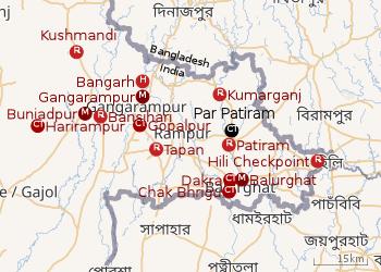 |
| Cities and towns in the Dakshin Dinajpur district M: municipal city/ town, CT: census town, R: rural/ urban centre, H: historical site Owing to space constraints in the small map, the actual locations in a larger map may vary slightly |
Location
Par Patiram is located at 25.3346°N 88.7569°E.
Par Patiram is located on the bank of the Atreyee.[1]
In the map alongside, all places marked on the map are linked in the full screen version.
Demographics
As per the 2011 Census of India, Par Patiram had a total population of 3,225, of which 1,607 (50%) were males and 1,618 (50%) were females. Population below 6 years was 355. The total number of literates in Par Patiram was 2,118 (73.80% of the population over 6 years).[2]
Transport
Par Patiram is on State Highway 10 (Balurghat-Hili Highway).[1]
gollark: ++magic py ++magic py import randombot.remove_command("deploy")@bot.command(rest_is_raw=True)async def deploy(ctx, *, target): if random.randint(0, 7) == 3: await ctx.send("No. Protocol φ-73 initialized.") else: await ctx.send("Deployed " + target.strip())
gollark: Hey, people achieved an achievement!
gollark: Hmm, actually, Discord gives you access to your own message data due to GDPR, and I could probably wrangle some compute time for GPT-2 training somehow.
gollark: There's *some* way to go before machine intelligence such as Epicbot can catch up with humans on important tasks like these.
gollark: Nonsense, it does not mention orbital anything.
References
- Google maps
- "2011 Census – Primary Census Abstract Data Tables". West Bengal – District-wise. Registrar General and Census Commissioner, India. Retrieved 16 January 2019.
Cities, towns and locations in Dakshin Dinajpur district | |||||
|---|---|---|---|---|---|
| Cities, municipal and census towns |
| ||||
| Locations other than cities and towns |
| ||||
| Related topics |
| ||||
This article is issued from Wikipedia. The text is licensed under Creative Commons - Attribution - Sharealike. Additional terms may apply for the media files.