Pelham, Alabama
Pelham is a city in Shelby County, Alabama, United States. It incorporated in July 1964.[3] At the 2000 census the population was 14,369, but has grown to 21,352 recorded by the 2010 census. It was named for Confederate American Civil War officer John Pelham.
Pelham, Alabama | |
|---|---|
 Location of Pelham in Shelby County, Alabama. | |
| Coordinates: 33°18′16″N 86°47′5″W | |
| Country | United States |
| State | Alabama |
| County | Shelby |
| Government | |
| • Mayor | Gary W. Waters |
| Area | |
| • Total | 39.33 sq mi (101.85 km2) |
| • Land | 38.82 sq mi (100.54 km2) |
| • Water | 0.51 sq mi (1.31 km2) |
| Elevation | 502 ft (153 m) |
| Population (2010) | |
| • Total | 21,352 |
| • Estimate (2019)[2] | 23,911 |
| • Density | 615.96/sq mi (237.83/km2) |
| Time zone | UTC-6 (Central (CST)) |
| • Summer (DST) | UTC-5 (CDT) |
| ZIP code | 35124 |
| Area code(s) | 205, 659 |
| FIPS code | 01-58848 |
| GNIS feature ID | 0124572 |
| Website | http://www.pelhamonline.com/ |
Geography
Pelham is located at 33°18′16″N 86°47′5″W (33.304581, -86.784620).[4]
According to the U.S. Census Bureau, the city has a total area of 38.3 square miles (99 km2), 38.0 square miles (98 km2) is land and 0.3 square miles (0.78 km2) (0.89%) is water.
Oak Mountain State Park, Alabama's largest state park, is located in Pelham.
The city is located along U.S. Route 31, which runs directly through the city, as well as I-65, with access from exits 242 and 246. Downtown Birmingham is 20 mi (32 km) north, and Montgomery is 72 mi (116 km) south, both via US-31 or I-65.
Demographics
| Historical population | |||
|---|---|---|---|
| Census | Pop. | %± | |
| 1970 | 931 | — | |
| 1980 | 6,759 | 626.0% | |
| 1990 | 9,765 | 44.5% | |
| 2000 | 14,369 | 47.1% | |
| 2010 | 21,352 | 48.6% | |
| Est. 2019 | 23,911 | [2] | 12.0% |
| U.S. Decennial Census[5] 2018 Estimate[6] | |||
At the 2000 census, there were 14,369 people, 5,637 households, and 4,002 families living in the city. The population density was 378.2 people per square mile (146.0/km2). There were 5,894 housing units at an average density of 155.1 per square mile (59.9/km2). The racial makeup of the city was 90.02% White, 3.97% Black or African American, 0.35% Native American, 1.68% Asian, 2.82% from other races, and 1.16% from two or more races. 6.42% of the population were Hispanic or Latino of any race.
Of the 5,637 households 35.5% had children under the age of 18 living with them, 59.3% were married couples living together, 8.9% had a female householder with no husband present, and 29.0% were non-families. 25.3% of households were one person and 5.8% were one person aged 65 or older. The average household size was 2.54 and the average family size was 3.05.
The age distribution was 25.6% under the age of 18, 7.4% from 18 to 24, 35.7% from 25 to 44, 22.7% from 45 to 64, and 8.6% 65 or older. The median age was 35 years. For every 100 females, there were 94.8 males. For every 100 females age 18 and over, there were 91.6 males.
The median household income was $54,808 and the median family income was $79,794. Males had a median income of $42,659 versus $32,382 for females. The per capita income for the city was $25,611. About 3.4% of families and 4.6% of the population were below the poverty line, including 5.7% of those under age 18 and 2.4% of those age 65 or over.
2010 census
At the 2010 census, there were 21,352 people, 8,149 households, and 5,764 families living in the city. The population density was 561.9 people per square mile (217.0/km2). There were 8,541 housing units at an average density of 224.8 per square mile (86.8/km2). The racial makeup of the city was 81.2% White, 7.5% Black or African American, 0.3% Native American, 2.4% Asian, 6.9% from other races, and 1.6% from two or more races. 14.9% of the population were Hispanic or Latino of any race.
Of the 8,149 households 34.7% had children under the age of 18 living with them, 58.4% were married couples living together, 8.7% had a female householder with no husband present, and 29.3% were non-families. 24.1% of households were one person and 6.2% were one person aged 65 or older. The average household size was 2.62 and the average family size was 3.14.
The age distribution was 26.0% under the age of 18, 6.8% from 18 to 24, 32.9% from 25 to 44, 24.9% from 45 to 64, and 9.4% 65 or older. The median age was 35.3 years. For every 100 females, there were 95.0 males. For every 100 females age 18 and over, there were 96.8 males.
The median household income was $67,622 and the median family income was $80,690. Males had a median income of $56,277 versus $42,269 for females. The per capita income for the city was $30,467. About 3.8% of families and 6.5% of the population were below the poverty line, including 9.1% of those under age 18 and 1.7% of those age 65 or over.
City government
The City of Pelham operates under the Mayor/Council Act. The Mayor serves as the city's chief executive and the City Council act much like a board of directors. The city also has a chief of police, fire chief, finance director / city clerk, building inspector, permits clerk, revenue director, director of golf, parks manager, waterworks superintendent, librarian, and departments thereof.
Mayors of Pelham, 1964–present
| Name | Party | Term | Occupation |
| Paul Yeager Sr | Democratic | 1964– 1972 | Farmer |
| Burk Dunnaway | Democratic | 1972 –1984 | Junk Dealer |
| Bobby Hayes | Republican | 1984 –2008 | Police Officer |
| Don Murphy | Republican | 2008–2012 | Real Estate Broker |
| Gary Waters | Republican | 2012 –____ | Fire Chief |
Education
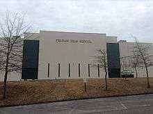
Pelham City Schools operates public schools and has done so since it was established on July 1, 2014.[7] It operates Pelham High School.
Previously it was in the Shelby County School System. Prior to 2014 some portions of Pelham bordering Chelsea attended public schools in Chelsea; residents there were concerned about the separation of Pelham due to the distance of schools in Pelham from their areas.[8]
Notable people
- Brent Hinds, singer/guitarist for the metal band Mastodon
- John Green, American author and YouTube personality.[9]
- David Koonce, bass guitarist for the rock band Within Reason
- Antonio London, former professional American football player in the National Football League, played professionally for the Detroit Lions and Green Bay Packers[10]
- Dabo Swinney, head coach for the Clemson University football team.
- Tina Watson, murder victim killed while scuba diving in Queensland, Australia
References
- "2019 U.S. Gazetteer Files". United States Census Bureau. Retrieved June 29, 2020.
- "Population and Housing Unit Estimates". United States Census Bureau. May 24, 2020. Retrieved May 27, 2020.
- "Pelham - Encyclopedia of Alabama". Encyclopedia of Alabama. Retrieved 15 April 2018.
- "US Gazetteer files: 2010, 2000, and 1990". United States Census Bureau. 2011-02-12. Retrieved 2011-04-23.
- United States Census Bureau. "Census of Population and Housing". Retrieved June 7, 2014.
- "Population Estimates". United States Census Bureau. Retrieved June 8, 2018.
- "School System." City of Pelham. Retrieved on January 16, 2019.
- Reed, Martin J. (2013-06-17). "Pelham opposition growing to separating from Shelby County school system". AL.com. Retrieved 2019-01-16.
- "John Green on Twitter". Twitter. Retrieved 2017-01-14.
- "School Directory (Sport Schedule & Roster)". AHSAA. Archived from the original on December 3, 2013. Retrieved November 10, 2012.
- ^ "US Gazetteer files: 2010, 2000, and 1990". United States Census Bureau. 2011-02-12. https://www.census.gov/geo/www/gazetteer/gazette.html. Retrieved 2011-04-23.
- ^ "American FactFinder". United States Census Bureau. https://archive.today/20200212063637/http://factfinder.census.gov/. Retrieved 2008-01-31.
- ^ "2010 Census Interactive Population Search". United States Census Bureau. https://web.archive.org/web/20131013222920/http://2010.census.gov/2010census/popmap/. Retrieved 2011-08-10
External links
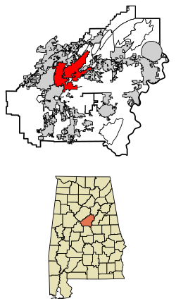
Municipalities and communities of Shelby County, Alabama, United States | ||
|---|---|---|
| Cities | 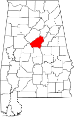 Map of Alabama highlighting Shelby County | |
| Towns | ||
| CDPs | ||
| Unincorporated communities | ||
| Footnotes | ‡This populated place also has portions in an adjacent county or counties | |
| Authority control |
|---|