National Register of Historic Places listings in Miller County, Missouri
This is a list of the National Register of Historic Places listings in Miller County, Missouri.
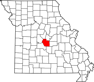
Location of Miller County in Missouri
This is intended to be a complete list of the properties and districts on the National Register of Historic Places in Miller County, Missouri, United States. Latitude and longitude coordinates are provided for many National Register properties and districts; these locations may be seen together in a map.[1]
There are 7 properties and districts listed on the National Register in the county.
- This National Park Service list is complete through NPS recent listings posted August 14, 2020.[2]
Current listings
| [3] | Name on the Register | Image | Date listed[4] | Location | City or town | Description |
|---|---|---|---|---|---|---|
| 1 | Bagnell Dam and Osage Power Plant |  Bagnell Dam and Osage Power Plant |
August 27, 2008 (#08000822) |
617 River Rd. 38°12′14″N 92°37′27″W |
Lake Ozark | |
| 2 | Boeckman Bridge | March 19, 1979 (#79001382) |
Southeast of St. Elizabeth over Big Tavern Creek 38°13′35″N 92°14′23″W |
St. Elizabeth | Replaced in 2003 | |
| 3 | Iberia Academy and Junior College | September 4, 1980 (#80002379) |
Missouri Route 17 and Missouri Route 42 38°05′25″N 92°17′48″W |
Iberia | ||
| 4 | Lake of the Ozarks State Park Highway 134 Historic District |  Lake of the Ozarks State Park Highway 134 Historic District |
February 26, 1985 (#85000533) |
West of Brumley along Missouri Route 134 38°06′37″N 92°34′00″W |
Brumley | Extends into Camden County |
| 5 | Olean Railroad Depot | December 23, 1993 (#93001452) |
Main St. east of junction with California St. 38°24′38″N 92°31′42″W |
Olean | ||
| 6 | P.A. Sanning Store | June 16, 2005 (#05000613) |
256 Route H 38°18′22″N 92°21′29″W |
Mary's Home | ||
| 7 | Union Electric Administration Building-Lakeside | April 13, 1998 (#98000364) |
1 Willmore Ln. 38°12′37″N 92°37′26″W |
Lakeside | Boundary increase at the same address on June 23, 2011 |
See also
References
| Wikimedia Commons has media related to National Register of Historic Places in Miller County, Missouri. |
- The latitude and longitude information provided in this table was derived originally from the National Register Information System, which has been found to be fairly accurate for about 99% of listings. Some locations in this table may have been corrected to current GPS standards.
- "National Register of Historic Places: Weekly List Actions". National Park Service, United States Department of the Interior. Retrieved on August 14, 2020.
- Numbers represent an ordering by significant words. Various colorings, defined here, differentiate National Historic Landmarks and historic districts from other NRHP buildings, structures, sites or objects.
- The eight-digit number below each date is the number assigned to each location in the National Register Information System database, which can be viewed by clicking the number.
| Topics | |
|---|---|
| Lists by state |
|
| Lists by insular areas | |
| Lists by associated state | |
| Other areas | |
| Related | |
| |
Municipalities and communities of Miller County, Missouri, United States | ||
|---|---|---|
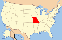
| Cities | Map of Missouri highlighting Miller County | |
| Villages | ||
| Townships | ||
| Unincorporated communities | ||
| Footnotes | ‡This populated place also has portions in an adjacent county or counties | |
This article is issued from Wikipedia. The text is licensed under Creative Commons - Attribution - Sharealike. Additional terms may apply for the media files.