Osage Beach, Missouri
Osage Beach is a city in Camden and Miller counties in the U.S. state of Missouri. Most of the city is in Camden County, while a small eastern sliver is in Miller County. The population was 4,351 at the 2010 census.
Osage Beach, Missouri | |
|---|---|
| City of Osage Beach | |
 Main Street Music Hall | |
 Location of Osage Beach, Missouri | |
| Coordinates: 38°8′18″N 92°38′55″W | |
| Country | United States |
| State | Missouri |
| Counties | Camden, Miller |
| Founded | 1886 (as Zebra) 1935 (as Osage Beach) |
| Incorporated | 1959 |
| Government | |
| • Mayor | John Olivarri |
| • Administrator | Nancy Viselli |
| Area | |
| • Total | 10.38 sq mi (26.89 km2) |
| • Land | 9.81 sq mi (25.41 km2) |
| • Water | 0.57 sq mi (1.48 km2) |
| Elevation | 860 ft (262 m) |
| Population | |
| • Total | 4,351 |
| • Estimate (2019)[3] | 4,666 |
| • Density | 475.59/sq mi (183.63/km2) |
| Time zone | UTC-6 (Central (CST)) |
| • Summer (DST) | UTC-5 (CDT) |
| ZIP code | 65065 |
| Area code(s) | 573 |
| FIPS code | 29-55244[4] |
| GNIS feature ID | 0729792[5] |
| Website | http://www.osagebeach-mo.gov/ |
History
Osage Beach was incorporated in 1959.[6].
During the 2020 COVID-19 pandemic Osage Beach gained international notoriety when on Memorial Day (May 25, 2020) a large crowd congregated at Lake of the Ozarks [7]. The mayor at the time, John Olivarri, stated that there had been "no way to control" the situation [8].
Geography
Osage Beach is located at 38°8′18″N 92°38′55″W (38.138354, -92.648678).[9]
According to the United States Census Bureau, the city has a total area of 10.33 square miles (26.75 km2), of which 9.75 square miles (25.25 km2) is land and 0.58 square miles (1.50 km2) is water.[10] The city is located on the shores of the Lake of the Ozarks.
Demographics
| Historical population | |||
|---|---|---|---|
| Census | Pop. | %± | |
| 1960 | 741 | — | |
| 1970 | 1,091 | 47.2% | |
| 1980 | 1,992 | 82.6% | |
| 1990 | 2,599 | 30.5% | |
| 2000 | 3,662 | 40.9% | |
| 2010 | 4,351 | 18.8% | |
| Est. 2019 | 4,666 | [3] | 7.2% |
2010 census
At the 2010 census there were 4,351 people, 2,038 households, and 1,166 families living in the city. The population density was 446.3 inhabitants per square mile (172.3/km2). There were 5,261 housing units at an average density of 539.6 per square mile (208.3/km2). The racial makeup of the city was 93.6% White, 1.1% African American, 0.6% Native American, 1.1% Asian, 0.2% Pacific Islander, 2.4% from other races, and 1.1% from two or more races. Hispanic or Latino of any race were 4.8%.[2]
Of the 2,038 households 19.9% had children under the age of 18 living with them, 44.3% were married couples living together, 8.0% had a female householder with no husband present, 5.0% had a male householder with no wife present, and 42.8% were non-families. 35.3% of households were one person and 13% were one person aged 65 or older. The average household size was 2.04 and the average family size was 2.57.
The median age was 48.9 years. 15.8% of residents were under the age of 18; 8.6% were between the ages of 18 and 24; 20.2% were from 25 to 44; 31.3% were from 45 to 64; and 24% were 65 or older. The gender makeup of the city was 48.9% male and 51.1% female.
2000 census
At the 2000 census there were 3,662 people, 1,687 households, and 1,035 families living in the city. The population density was 389.8 people per square mile (150.4/km2). There were 4,055 housing units at an average density of 431.6 per square mile (166.6/km2). The racial makeup of the city was 97.35% White, 0.76% African American, 0.41% Native American, 0.49% Asian, 0.16% from other races, and 0.82% from two or more races. Hispanic or Latino of any race were 1.20% of the total population.[4] Of the 1,687 households 19.1% had children under the age of 18 living with them, 51.2% were married couples living together, 7.2% had a female householder with no husband present, and 38.6% were non-families. 31.6% of households were one person and 10.9% were one person aged 65 or older. The average household size was 2.09 and the average family size was 2.58.
The age distribution was 16.0% under the age of 18, 7.4% from 18 to 24, 26.9% from 25 to 44, 29.3% from 45 to 64, and 20.3% 65 or older. The median age was 45 years. For every 100 females there were 96.8 males. For every 100 females age 18 and over, there were 94.9 males.
The median household income was $38,448 and the median family income was $49,554. Males had a median income of $30,444 versus $21,440 for females. The per capita income for the city was $22,685. About 4.5% of families and 6.7% of the population were below the poverty line, including 5.3% of those under age 18 and 6.4% of those age 65 or over.
Education
Schools
- Osage Beach Elementary-Camdenton R-III
- School of the Osage (Miller County R-II School District)
Colleges and universities
- Columbia College - Lake of the Ozarks campus
- State Fair Community College - Lake of the Ozarks campus
- Central Methodist University - Lake of the Ozarks campus
Library
Osage Beach has a public library, the Osage Beach Library.[12]
Media
Osage Beach is split between two television markets. While Camden County is part of the Springfield television market, Miller County is part of the Columbia/Jefferson City market. Charter Communications' cable system carries stations from both cities. DirecTV and Dish Network subscribers in the city receive Springfield stations, mainly because the bulk of the city is in Camden County.
Transportation
There are two general aviation airports in the Osage Beach area: Grand Glaize-Osage Beach Airport, which is within the city limits, and Lee C. Fine Memorial Airport, which is located about 7 miles (11 km) away in Kaiser.[13]
The nearest primary commercial airports are Columbia Regional Airport (about 65 miles [105 km] away) and Springfield–Branson National Airport (about 93 miles [150 km] away). The smaller Waynesville-St. Robert Regional Airport is about 53 miles (85 km) away.
Healthcare
Osage Beach is home to Lake Regional Hospital. Part of the Lake Regional Health system, this general medical and surgical hospital houses a trauma center and has a total of 116 beds.
References
- "2019 U.S. Gazetteer Files". United States Census Bureau. Retrieved July 26, 2020.
- "U.S. Census website". United States Census Bureau. Retrieved 2012-07-08.
- "Population and Housing Unit Estimates". United States Census Bureau. May 24, 2020. Retrieved May 27, 2020.
- "U.S. Census website". United States Census Bureau. Retrieved 2008-01-31.
- "US Board on Geographic Names". United States Geological Survey. 2007-10-25. Retrieved 2008-01-31.
- "Osage Beach ~ Then & Now". City of Osage Beach. Retrieved 4 June 2019.
- https://www.ksdk.com/article/news/health/coronavirus/memorial-day-weekend-crowds-at-lake-of-the-ozarks-appear-to-not-be-observing-social-distancing/63-44d7096c-431f-4879-86ff-00ef252781b6
- Lemon, Jason (2020-05-20). "Missouri Mayor Laments 'No Way to Control' Crowded Pool Party Amid Coronavirus Pandemic". Newsweek. Retrieved 2020-06-10.
- "US Gazetteer files: 2010, 2000, and 1990". United States Census Bureau. 2011-02-12. Retrieved 2011-04-23.
- "US Gazetteer files 2010". United States Census Bureau. Retrieved 2012-07-08.
- "Census of Population and Housing". Census.gov. Retrieved June 4, 2015.
- "Missouri Public Libraries". PublicLibraries.com. Archived from the original on 10 June 2017. Retrieved 2 June 2019.
- Welcome to the Osage Beach Airports!. Retrieved 2020-06-06.
External links
Municipalities and communities of Camden County, Missouri, United States | ||
|---|---|---|
| Cities |  Map of Missouri highlighting Camden County | |
| Villages | ||
| Townships | ||
| CDPs | ||
| Other unincorporated communities | ||
| Footnotes | ‡This populated place also has portions in an adjacent county or counties | |
Municipalities and communities of Miller County, Missouri, United States | ||
|---|---|---|
| Cities | 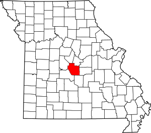 Map of Missouri highlighting Miller County | |
| Villages | ||
| Townships | ||
| Unincorporated communities | ||
| Footnotes | ‡This populated place also has portions in an adjacent county or counties | |
| Authority control |
|
|---|