National Register of Historic Places listings in St. Francois County, Missouri
This is a list of the National Register of Historic Places listings in St. Francois County, Missouri.
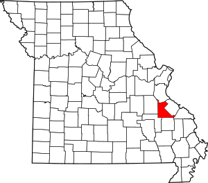
Location of St. Francois County in Missouri
This is intended to be a complete list of the properties and districts on the National Register of Historic Places in St. Francois County, Missouri, United States. Latitude and longitude coordinates are provided for many National Register properties and districts; these locations may be seen together on an online map.[1]
There are 11 properties and districts listed on the National Register in the county.
- This National Park Service list is complete through NPS recent listings posted August 14, 2020.[2]
Current listings
| [3] | Name on the Register | Image | Date listed[4] | Location | City or town | Description |
|---|---|---|---|---|---|---|
| 1 | Bonne Terre Depot |  Bonne Terre Depot |
April 5, 1984 (#84002606) |
Oak St. 37°55′07″N 90°32′56″W |
Bonne Terre | |
| 2 | Bonne Terre Mine |  Bonne Terre Mine |
September 9, 1974 (#74002281) |
MO 47 37°55′22″N 90°33′08″W |
Bonne Terre | |
| 3 | Courthouse Square Historic District |  Courthouse Square Historic District |
June 9, 2004 (#04000582) |
Roughly bounded by W. Spring St., N. Washington St., W. Harrison St., and A St. 37°46′51″N 90°25′20″W |
Farmington | |
| 4 | East Columbia Historic District |  East Columbia Historic District |
July 14, 2004 (#04000699) |
Southern side of East Columbia: 14-122 E. Columbia, northern side; 101-103 and 117-119 E. Columbia; also 202 E. Columbia St. 37°46′49″N 90°25′11″W |
Farmington | 202 E. Columbia represents a boundary increase of May 30, 2007 |
| 5 | Eugene Field School | September 6, 2005 (#05000997) |
403 Glendale St. 37°51′18″N 90°31′09″W |
Park Hills | ||
| 6 | Farmington State Hospital No. 4 Cemetery | October 25, 2010 (#08001360) |
¼ mile south of Doubet Rd. on east side of Pullan Rd. 37°45′40″N 90°26′28″W |
Farmington | ||
| 7 | Howlett Gulf | November 14, 2019 (#100004602) |
10 E. Main St. 37°50′56″N 90°30′58″W |
Park Hills | ||
| 8 | James Robinson McCormick House |  James Robinson McCormick House |
July 31, 1998 (#98000945) |
324 W. Columbia St. 37°46′50″N 90°25′33″W |
Farmington | |
| 9 | Presbyterian Orphanage of Missouri |  Presbyterian Orphanage of Missouri |
April 26, 2006 (#06000322) |
412 W. Liberty St. 37°47′00″N 90°25′39″W |
Farmington | |
| 10 | St. Francois County Jail and Sheriff's Residence |  St. Francois County Jail and Sheriff's Residence |
July 19, 1996 (#96000764) |
11 N. Franklin St. 37°46′52″N 90°25′23″W |
Farmington | |
| 11 | St. Joe Lead Company Administration Building | April 5, 1984 (#84002611) |
Elm St. 37°55′16″N 90°32′59″W |
Bonne Terre |
See also
References
| Wikimedia Commons has media related to National Register of Historic Places in St. Francois County, Missouri. |
- The latitude and longitude information provided in this table was derived originally from the National Register Information System, which has been found to be fairly accurate for about 99% of listings. Some locations in this table may have been corrected to current GPS standards.
- "National Register of Historic Places: Weekly List Actions". National Park Service, United States Department of the Interior. Retrieved on August 14, 2020.
- Numbers represent an ordering by significant words. Various colorings, defined here, differentiate National Historic Landmarks and historic districts from other NRHP buildings, structures, sites or objects.
- The eight-digit number below each date is the number assigned to each location in the National Register Information System database, which can be viewed by clicking the number.
| Topics | |
|---|---|
| Lists by state |
|
| Lists by insular areas | |
| Lists by associated state | |
| Other areas | |
| Related | |
| |
Municipalities and communities of Saint Francois County, Missouri, United States | ||
|---|---|---|
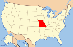
| Cities | Map of Missouri highlighting Saint Francois County | |
| Townships | ||
| CDPs | ||
| Other unincorporated communities | ||
| Ghost towns | ||
| Footnotes | ‡This populated place also has portions in an adjacent county or counties | |
This article is issued from Wikipedia. The text is licensed under Creative Commons - Attribution - Sharealike. Additional terms may apply for the media files.