National Register of Historic Places listings in Iron County, Missouri
This is a list of the National Register of Historic Places listings in Iron County, Missouri.
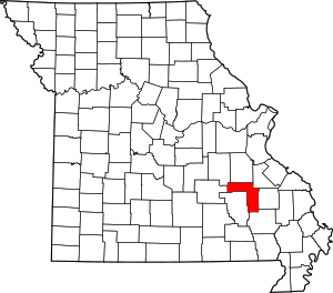
Location of Iron County in Missouri
This is intended to be a complete list of the properties and districts on the National Register of Historic Places in Iron County, Missouri, United States. Latitude and longitude coordinates are provided for many National Register properties and districts; these locations may be seen together in a map.[1]
There are 6 properties and districts listed on the National Register in Iron County.
- This National Park Service list is complete through NPS recent listings posted August 14, 2020.[2]
Current listings
| [3] | Name on the Register | Image | Date listed[4] | Location | City or town | Description |
|---|---|---|---|---|---|---|
| 1 | Fort Davidson |  Fort Davidson |
February 26, 1970 (#70000332) |
On Route 21, south of its junction with Route V in the Clark National Forest 37°37′45″N 90°38′24″W |
Pilot Knob | |
| 2 | Immanuel Evangelical Lutheran Church |  Immanuel Evangelical Lutheran Church |
January 22, 1979 (#79001364) |
E Pine and N Zeigler St. 37°37′34″N 90°38′29″W |
Pilot Knob | |
| 3 | Iron County Courthouse Buildings |  Iron County Courthouse Buildings |
June 27, 1979 (#79001363) |
Courthouse Sq. and 220 S. Shepherd St. 37°35′52″N 90°37′41″W |
Ironton | |
| 4 | Ironton Lodge Hall |  Ironton Lodge Hall |
April 23, 2013 (#13000191) |
133 N. Main St. 37°35′59″N 90°37′48″W |
Ironton | |
| 5 | St. Paul's Episcopal Church |  St. Paul's Episcopal Church |
May 21, 1969 (#69000107) |
Northwestern corner of Knob and Reynolds Sts. 37°35′59″N 90°37′36″W |
Ironton | |
| 6 | Ursuline Academy-Arcadia College Historic District | Ursuline Academy-Arcadia College Historic District |
July 1, 1998 (#98000816) |
Junction of Maine and Maple Sts. 37°35′02″N 90°37′45″W |
Arcadia |
See also
References
| Wikimedia Commons has media related to National Register of Historic Places in Iron County, Missouri. |
- The latitude and longitude information provided in this table was derived originally from the National Register Information System, which has been found to be fairly accurate for about 99% of listings. Some locations in this table may have been corrected to current GPS standards.
- "National Register of Historic Places: Weekly List Actions". National Park Service, United States Department of the Interior. Retrieved on August 14, 2020.
- Numbers represent an ordering by significant words. Various colorings, defined here, differentiate National Historic Landmarks and historic districts from other NRHP buildings, structures, sites or objects.
- The eight-digit number below each date is the number assigned to each location in the National Register Information System database, which can be viewed by clicking the number.
| Topics | |
|---|---|
| Lists by state |
|
| Lists by insular areas | |
| Lists by associated state | |
| Other areas | |
| Related | |
| |
Municipalities and communities of Iron County, Missouri, United States | ||
|---|---|---|
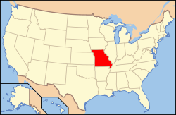
| Cities | Map of Missouri highlighting Iron County | |
| Village | ||
| Townships | ||
| Unincorporated communities | ||
| Ghost towns | ||
| Footnotes | ‡This populated place also has portions in an adjacent county or counties | |
This article is issued from Wikipedia. The text is licensed under Creative Commons - Attribution - Sharealike. Additional terms may apply for the media files.