National Register of Historic Places listings in Baldwin County, Alabama
This is a list of the National Register of Historic Places listings in Baldwin County, Alabama.
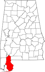
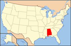
Location of Baldwin County in Alabama
This is intended to be a complete list of the properties and districts on the National Register of Historic Places in Baldwin County, Alabama, United States. Latitude and longitude coordinates are provided for many National Register properties and districts; these locations may be seen together in an online map.[1]
There are 62 properties and districts listed on the National Register in the county, including 2 National Historic Landmarks.
- This National Park Service list is complete through NPS recent listings posted August 14, 2020.[2]
Current listings
| [3] | Name on the Register | Image | Date listed[4] | Location | City or town | Description |
|---|---|---|---|---|---|---|
| 1 | Allen House |  Allen House |
December 20, 1988 (#88002809) |
Off County Road 10 on the northern bank of the Bon Secour River 30°18′09″N 87°44′13″W |
Bon Secour | |
| 2 | American Legion Post 199 | 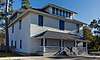 American Legion Post 199 |
September 6, 2018 (#100002858) |
700 S Mobile St. 30°30′48″N 87°55′06″W |
Fairhope | |
| 3 | Bank of Fairhope | 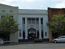 Bank of Fairhope |
July 1, 1988 (#88001008) |
396 Fairhope Ave. 30°31′22″N 87°54′12″W |
Fairhope | |
| 4 | Battles Wharf Historic District | April 28, 1988 (#88000107) |
U.S. Route 98 (Eastern Shore Boulevard) roughly between Woolworth Ave. and Buerger La. 30°29′37″N 87°55′38″W |
Battles Wharf | ||
| 5 | Beckner House | 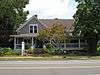 Beckner House |
July 1, 1988 (#88001007) |
63 S. Church St. 30°31′15″N 87°54′17″W |
Fairhope | |
| 6 | Blakeley |  Blakeley |
June 25, 1974 (#74000397) |
Along the Tensaw River north of Spanish Fort[5] 30°44′32″N 87°55′27″W |
Spanish Fort | |
| 7 | Carl L. Bloxham Building | 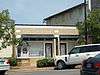 Carl L. Bloxham Building |
June 30, 1988 (#88001005) |
327 Fairhope Ave. 30°31′23″N 87°54′15″W |
Fairhope | |
| 8 | Bottle Creek Indian Mounds | 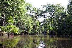 Bottle Creek Indian Mounds |
December 2, 1974 (#74000398) |
Northern end of Mound Island along the eastern side of the Middle River[6] 31°00′32″N 87°56′24″W |
Stockton | |
| 9 | Brodbeck-Zundel Historic District | 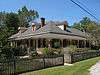 Brodbeck-Zundel Historic District |
April 28, 1988 (#88000520) |
Scenic U.S. Route 98 and Old Marlow Rd. 30°28′27″N 87°55′09″W |
Point Clear | |
| 10 | Brunell House | 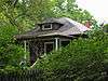 Brunell House |
August 22, 1995 (#95001019) |
12113 Jessamine St. 30°24′02″N 87°46′36″W |
Magnolia Springs | |
| 11 | Captain Adams House | December 20, 1988 (#88002810) |
907 Captain O'Neal Dr. 30°35′25″N 87°54′51″W |
Daphne | ||
| 12 | George W. Cullum House | June 14, 1990 (#90000930) |
1915 Old County Rd. 30°36′19″N 87°54′39″W |
Daphne | ||
| 13 | Fairhope Bayfront District | 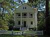 Fairhope Bayfront District |
July 1, 1988 (#88001003) |
Roughly bounded by Blakeney, N. and S. Summit Sts., Fels Ave., and Mobile Bay 30°31′28″N 87°54′32″W |
Fairhope | |
| 14 | Fairhope Downtown Historic District | 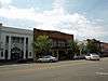 Fairhope Downtown Historic District |
March 16, 2006 (#04000115) |
Roughly bounded by Equality St., Fairhope Ave., Morphy Ave., School St., and Summit St. 30°31′21″N 87°54′11″W |
Fairhope | |
| 15 | First Baptist Church | 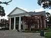 First Baptist Church |
August 25, 1988 (#88001349) |
Northern side of D'Olive St. 30°53′05″N 87°46′36″W |
Bay Minette | |
| 16 | Foley Downtown Historic District | 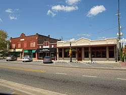 Foley Downtown Historic District |
January 19, 2005 (#04001496) |
Parts of Alston, McKenzie, E. and W. Laurel and W. Orange Sts.; also parts of Laurel & Pine Sts., W Myrtle, E & W Rose, W. Orange & W Jessamine Aves. 30°24′24″N 87°41′02″W |
Foley | Boundaries originally encompassed parts of Alston, N. and S. McKenzie, U.S. Route 98, E. and W. Laurel, Myrtle, Rose, and W. Orange until a boundary decrease of June 4, 2012; boundaries further increased on September 20, 2019. |
| 17 | Fort Mims Site | 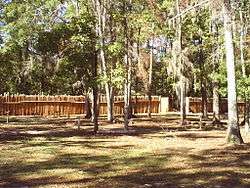 Fort Mims Site |
September 14, 1972 (#72000153) |
Southwestern quarter of Section 36, Township 2 North, Range 2 East[7] 31°10′50″N 87°50′17″W |
Tensaw | Site of a battle during the Creek War. On August 30, 1813, Red Stick Creeks killed or captured 517 settlers, militia, and their allies at Fort Mims. |
| 18 | Fort Morgan | 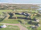 Fort Morgan |
October 15, 1966 (#66000146) |
Western terminus of State Route 180 30°13′41″N 88°01′23″W |
Gasque | |
| 19 | Gaston Building | 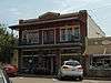 Gaston Building |
July 1, 1988 (#88001004) |
336 Fairhope Ave. 30°31′22″N 87°54′14″W |
Fairhope | |
| 20 | Golf, Gun & Country Club | 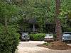 Golf, Gun & Country Club |
July 1, 1988 (#88001002) |
651 Johnson Ave. 30°31′22″N 87°53′41″W |
Fairhope | |
| 21 | Governor's Club |  Governor's Club |
August 31, 2000 (#00001031) |
11866 Magnolia St. 30°23′46″N 87°46′34″W |
Magnolia Springs | |
| 22 | Hamner House |  Hamner House |
December 20, 1988 (#88002811) |
Oak Rd. off County Road 6 30°19′07″N 87°42′27″W |
Bon Secour | |
| 23 | Jenkins Farm and House | December 20, 2016 (#16000862) |
29040 Jenkins Farm Rd. 30°38′51″N 87°48′15″W |
Loxley | ||
| 24 | Axil Johnson House |  Axil Johnson House |
July 3, 1997 (#97000649) |
751 Edwards St. 30°31′39″N 87°53′24″W |
Fairhope | |
| 25 | Killcreas House |  Killcreas House |
May 4, 1995 (#95000556) |
46833 State Route 225 30°54′26″N 87°51′23″W |
Bay Minette | |
| 26 | Latham United Methodist Church | 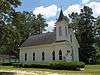 Latham United Methodist Church |
August 25, 1988 (#88001350) |
Eastern side of State Route 59 31°05′54″N 87°49′51″W |
Latham | |
| 27 | Lebanon Chapel AME Church | 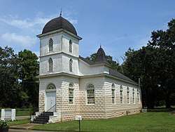 Lebanon Chapel AME Church |
August 25, 1988 (#88001351) |
Bounded by Young St. on the west and Middle St. on the north 30°30′48″N 87°53′39″W |
Fairhope | |
| 28 | Magnolia Springs Historic District | 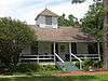 Magnolia Springs Historic District |
January 27, 2012 (#11001046) |
Roughly along Oak, Spring, Bay, Jessamine, Magnolia, Pine & Rock Sts., Island, Cedar & Holly Aves. & Magnolia Springs Highway 30°23′59″N 87°46′34″W |
Magnolia Springs | |
| 29 | Malbis Plantation |  Malbis Plantation |
May 10, 2011 (#11000238) |
10145 US 90 30°39′13″N 87°50′32″W |
Daphne | |
| 30 | Manly-Strong House | 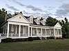 Manly-Strong House |
August 22, 2019 (#100004134) |
100 Deer Ct. 30°35′23″N 87°54′51″W |
Daphne | |
| 31 | McMillan House |  McMillan House |
December 20, 1988 (#88002812) |
1404 Captain O'Neal Ave. 30°35′52″N 87°54′42″W |
Daphne | |
| 32 | Methodist Episcopal Church, South | 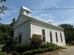 Methodist Episcopal Church, South |
September 22, 1980 (#80000679) |
1608 Old County Rd. 30°36′06″N 87°54′31″W |
Daphne | |
| 33 | Montgomery Hill Baptist Church | 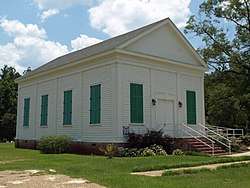 Montgomery Hill Baptist Church |
August 25, 1988 (#88001352) |
Eastern side of State Route 59 on County Road 80 31°09′46″N 87°47′12″W |
Tensaw | |
| 34 | Montrose Historic District | 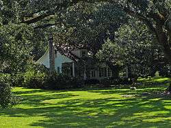 Montrose Historic District |
June 3, 1976 (#76000310) |
Main (State Route 42) and 2nd Sts. 30°34′07″N 87°54′02″W |
Montrose | |
| 35 | Moore Store |  Moore Store |
November 30, 2001 (#00001027) |
14770 Oak St. 30°24′04″N 87°46′15″W |
Magnolia Springs | |
| 36 | Nelson House | 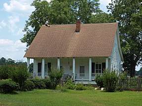 Nelson House |
December 20, 1988 (#88002814) |
State Route 59, North 31°05′08″N 87°49′52″W |
Latham | |
| 37 | Nicholson House | 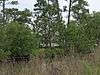 Nicholson House |
December 20, 1988 (#88002813) |
County Road 6 30°17′33″N 87°44′13″W |
Oyster Bay | |
| 38 | Orrell House | 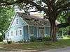 Orrell House |
December 20, 1988 (#88002815) |
County Road 6 30°18′59″N 87°42′14″W |
Bon Secour | |
| 39 | People's Supply Company | 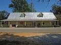 People's Supply Company |
February 21, 1997 (#97000096) |
21950 Broad St. 30°32′41″N 87°45′03″W |
Silverhill | |
| 40 | Point Clear Historic District | April 28, 1988 (#88000515) |
Western side of U.S. Route 98/Eastern Shore Boulevard 30°28′48″N 87°55′40″W |
Point Clear | ||
| 41 | St. Mark's Lutheran Church | 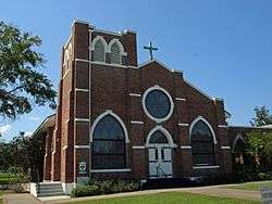 St. Mark's Lutheran Church |
August 25, 1988 (#88001353) |
Western side of County Road 83 30°25′01″N 87°35′55″W |
Elberta | |
| 42 | St. Patrick's Catholic Church | 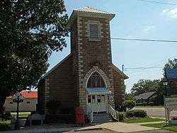 St. Patrick's Catholic Church |
August 25, 1988 (#88001354) |
Eastern side of U.S. Route 90 30°37′11″N 87°45′10″W |
Loxley | |
| 43 | St. Paul's Episcopal Church | 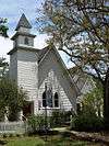 St. Paul's Episcopal Church |
August 25, 1988 (#88001355) |
Northern side of Oak Ave. 30°24′05″N 87°46′17″W |
Magnolia Springs | |
| 44 | Sand Island Light | 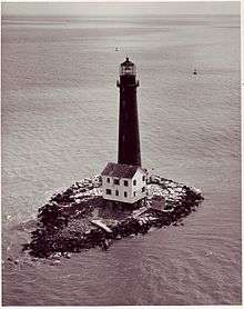 Sand Island Light |
November 12, 1975 (#75000305) |
Southwest of Fort Morgan off Mobile Point 30°11′15″N 88°03′02″W |
Fort Morgan | |
| 45 | School of Organic Education | 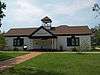 School of Organic Education |
July 1, 1988 (#88001010) |
Bounded by Fairhope and Morphy Aves. and Bancroft and School Sts. 30°31′17″N 87°54′05″W |
Fairhope | |
| 46 | Lewis Starke House | June 14, 1990 (#90000929) |
2103 Old County Rd. 30°36′26″N 87°54′39″W |
Daphne | ||
| 47 | State Bank Silverhill | 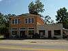 State Bank Silverhill |
December 31, 2001 (#01001410) |
15950 Silverhill Ave. 30°32′42″N 87°45′05″W |
Silverhill | |
| 48 | Stockton Methodist Church | 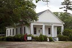 Stockton Methodist Church |
August 25, 1988 (#88001356) |
Eastern side of State Route 59 31°00′57″N 87°51′11″W |
Stockton | |
| 49 | Street House | 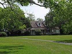 Street House |
December 20, 1988 (#88002816) |
Wood Acres Rd. off County Road 3 30°27′52″N 87°53′54″W |
Point Clear | |
| 50 | Henry Stuart House | 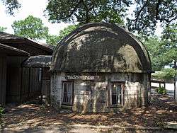 Henry Stuart House |
October 27, 2006 (#05000841) |
22787 U.S. Route 98 30°33′23″N 87°53′38″W |
Montrose | |
| 51 | Sunnyside Hotel | 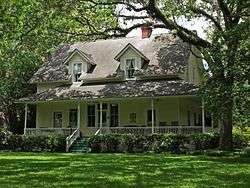 Sunnyside Hotel |
February 20, 1998 (#98000111) |
14469 Oak St. 30°23′59″N 87°46′36″W |
Magnolia Springs | |
| 52 | Svea Land Company Office | 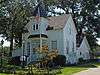 Svea Land Company Office |
March 7, 1985 (#85000443) |
S. 6th St. 30°32′41″N 87°45′14″W |
Silverhill | |
| 53 | Swift-Coles House | 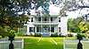 Swift-Coles House |
December 6, 2016 (#16000814) |
1 Swift Coles Ln. 30°18′46″N 87°43′35″W |
Bon Secour | |
| 54 | Swift Presbyterian Church | 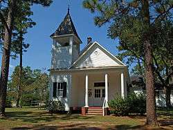 Swift Presbyterian Church |
August 25, 1988 (#88001357) |
Swift Church Rd. 30°22′30″N 87°37′41″W |
Miflin | |
| 55 | The Texas | 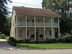 The Texas |
December 20, 1988 (#88002817) |
306 Dryer Ave. 30°36′02″N 87°54′37″W |
Daphne | |
| 56 | Twin Beach AME Church | 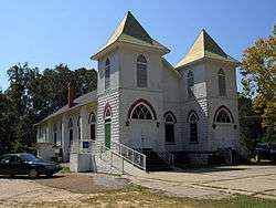 Twin Beach AME Church |
August 25, 1988 (#88001358) |
Southern side of County Road 44 30°30′04″N 87°54′34″W |
Fairhope | |
| 57 | U.S.S. TECUMSEH | .jpg) U.S.S. TECUMSEH |
May 14, 1975 (#75000306) |
Northwest of Fort Morgan in Mobile Bay 30°13′54″N 88°01′33″W |
Fort Morgan | |
| 58 | US Post Office | _Sept_2012.jpg) US Post Office |
July 1, 1988 (#88001001) |
325 Fairhope Ave. 30°31′23″N 87°54′15″W |
Fairhope | |
| 59 | Walker House | December 20, 1988 (#88002818) |
905 Captain O'Neal Dr. 30°35′23″N 87°54′51″W |
Daphne | ||
| 60 | White Avenue Historic District | 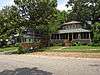 White Avenue Historic District |
July 1, 1988 (#88001009) |
White Ave. 30°31′10″N 87°54′04″W |
Fairhope | |
| 61 | Whittier Hall | 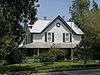 Whittier Hall |
March 7, 1985 (#85000442) |
201 Magnolia Ave. 30°31′29″N 87°53′45″W |
Fairhope | |
| 62 | Zurhorst House |  Zurhorst House |
July 1, 1988 (#88001006) |
200 Fels Ave. 30°31′16″N 87°54′23″W |
Fairhope |
See also
| Wikimedia Commons has media related to National Register of Historic Places in Baldwin County, Alabama. |
References
- The latitude and longitude information provided in this table was derived originally from the National Register Information System, which has been found to be fairly accurate for about 99% of listings. Some locations in this table may have been corrected to current GPS standards.
- "National Register of Historic Places: Weekly List Actions". National Park Service, United States Department of the Interior. Retrieved on August 14, 2020.
- Numbers represent an ordering by significant words. Various colorings, defined here, differentiate National Historic Landmarks and historic districts from other NRHP buildings, structures, sites or objects.
- The eight-digit number below each date is the number assigned to each location in the National Register Information System database, which can be viewed by clicking the number.
- Location derived from its GNIS feature record; the NRIS lists the site as "Address Restricted"
- Location derived from its placement on USGS topographical maps; the NRIS lists the site as "Address Restricted"
- Riccio, Joseph F., and Conrad A. Gazzier. "Infrared Color Photography of the Fort Mims Site, Alabama". Journal of Alabama Archaeology 20.2 (1974): 216-221: 216.
Municipalities and communities of Baldwin County, Alabama, United States | ||
|---|---|---|
| Cities | Map of Alabama highlighting Baldwin County | |
| Towns | ||
| CDP | ||
| Unincorporated communities |
| |
| Ghost town | ||
This article is issued from Wikipedia. The text is licensed under Creative Commons - Attribution - Sharealike. Additional terms may apply for the media files.