Summerdale, Alabama
Summerdale is a rural town in south-central Baldwin County, Alabama, United States. It is the site of the Naval Outlying Field Summerdale. At the 2010 census the population was 862.[3] It is part of the Daphne–Fairhope–Foley Metropolitan Statistical Area.
Summerdale, Alabama | |
|---|---|
 Seal | |
| Nickname(s): The Sunshine of Baldwin County | |
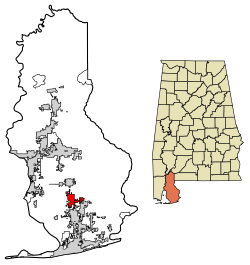 Location of Summerdale in Baldwin County, Alabama. | |
| Coordinates: 30°29′16″N 87°41′59″W | |
| Country | United States |
| State | Alabama |
| County | Baldwin |
| Incorporated | 1906 |
| Government | |
| • Mayor | David Wilson |
| Area | |
| • Total | 10.17 sq mi (26.34 km2) |
| • Land | 10.13 sq mi (26.24 km2) |
| • Water | 0.04 sq mi (0.10 km2) |
| Elevation | 115 ft (35 m) |
| Population (2010) | |
| • Total | 862 |
| • Estimate (2019)[2] | 1,681 |
| • Density | 165.89/sq mi (64.05/km2) |
| Time zone | UTC-6 (CST) |
| • Summer (DST) | UTC-5 (CDT) |
| ZIP code | 36580 |
| Area code(s) | 251 |
| FIPS code | 01-73872 |
| GNIS feature ID | 0155262 |
| Website | www |
Geography
Summerdale is located at 30°29'15.468" North, 87°42'4.036" West (30.487630, -87.701121).[4] Alabama State Route 59 passes along the west side of the town, leading north 5 miles (8 km) to Robertsdale and south 6 miles (10 km) to Foley.
According to the U.S. Census Bureau, the town has a total area of 9.7 square miles (25.2 km2), of which 9.7 square miles (25.1 km2) is land and 0.039 square miles (0.1 km2), or 0.38%, is water.[3]
Demographics
| Historical population | |||
|---|---|---|---|
| Census | Pop. | %± | |
| 1930 | 267 | — | |
| 1940 | 239 | −10.5% | |
| 1950 | 489 | 104.6% | |
| 1960 | 533 | 9.0% | |
| 1970 | 550 | 3.2% | |
| 1980 | 546 | −0.7% | |
| 1990 | 559 | 2.4% | |
| 2000 | 655 | 17.2% | |
| 2010 | 862 | 31.6% | |
| Est. 2019 | 1,681 | [2] | 95.0% |
| U.S. Decennial Census[5] 2013 Estimate[6] | |||
As of the census[7] of 2000, there were 655 people, 255 households, and 184 families residing in the town. The population density was 125.7 people per square mile (48.5/km2). There were 282 housing units at an average density of 54.1 per square mile (20.9/km2). The racial makeup of the town was 90.23% White, 4.89% Black or African American, 1.07% Native American, 0.15% Asian, 0.92% from other races, and 2.75% from two or more races. Nearly 2.29% of the population were Hispanic or Latino of any race.
There were 255 households, out of which 34.1% had children under the age of 18 living with them, 56.5% were married couples living together, 10.6% had a female householder with no husband present, and 27.8% were non-families. 23.1% of all households were made up of individuals, and 8.2% had someone living alone who was 65 years of age or older. The average household size was 2.57, and the average family size was 3.04.
In the town, the population was spread out, with 27.6% under the age of 18, 11.5% from 18 to 24, 28.2% from 25 to 44, 21.7% from 45 to 64, and 11.0% who were 65 years of age or older. The median age was 32 years. For every 100 females, there were 104.0 males. For every 100 females age 18 and over, there were 97.5 males.
The median income for a household in the town was $27,917, and the median income for a family was $32,159. Males had a median income of $26,563 versus $19,167 for females. The per capita income for the town was $13,775. About 13.7% of families and 16.4% of the population were below the poverty line, including 28.3% of those under age 18 and 4.9% of those age 65 or over.
Speed trap reputation
Summerdale is known both locally and regionally as a speed trap city, with officers stopping drivers daily along the two major highways through the town. During the summer months, hundreds of thousands of tourists pass through the town headed for southern Baldwin County's beaches.[8][9]
Education
Summerdale is a part of the Baldwin County Public Schools system.
Summerdale has one school, Summerdale School, which serves grades kindergarten through 8. Students continue on to Foley High School in nearby Foley for grades 9 through 12. Alabama Gulf Coast Christian Academy is a private school located on the corner of County Roads 28 and 71. It serves grades Pre-K through 12.
Naval Outlying Field Summerdale
The Navy Outlying Field (NOLF) Summerdale airport is on the east side of Summerdale (at latitude, longitude: 30.507695, –87.645541).[10] The Airport Code is NFD, in region: ASO - Southern, with boundary ARTCC: ZJX - Jacksonville, and Tie-in FSS: ANB - Anniston. The airport runway length/width is 2850 x 150 ft (868.7 x 45.7 m), with runway elevation: 149 feet (45 m).[10] The airport is owned/operated by the US Navy, through Commanding Officer, Operations Department, 7077 USS Lexington Court, Milton, FL 32570-6016.
See also
References
- "2019 U.S. Gazetteer Files". United States Census Bureau. Retrieved June 29, 2020.
- "Population and Housing Unit Estimates". United States Census Bureau. May 24, 2020. Retrieved May 27, 2020.
- "Geographic Identifiers: 2010 Demographic Profile Data (G001): Summerdale town, Alabama". U.S. Census Bureau, American Factfinder. Archived from the original on February 12, 2020. Retrieved September 16, 2013.
- "US Gazetteer files: 2010, 2000, and 1990". United States Census Bureau. 2011-02-12. Retrieved 2011-04-23.
- "U.S. Decennial Census". Census.gov. Retrieved June 6, 2013.
- "Annual Estimates of the Resident Population: April 1, 2010 to July 1, 2013". Retrieved June 3, 2014.
- "U.S. Census website". United States Census Bureau. Retrieved 2008-01-31.
- http://gulfcoastnewstoday.com/stories/slow-down-and-remain-calm,44965
- http://www.fox10tv.com/story/27810230/new-beach-express-a-speed-trap
- "FAA Information about Summerdale Nolf Airport", Airport-Data.com, 2004-2008, webpage: Summerdale-NOLF.
External links
Municipalities and communities of Baldwin County, Alabama, United States | ||
|---|---|---|
| Cities | 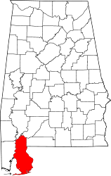 Map of Alabama highlighting Baldwin County | |
| Towns | ||
| CDP | ||
| Unincorporated communities |
| |
| Ghost town | ||
| Authority control |
|
|---|