National Register of Historic Places listings in Jackson County, Alabama
This is a list of the National Register of Historic Places listings in Jackson County, Alabama.
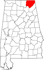
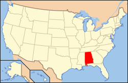
Location of Jackson County in Alabama
This is intended to be a complete list of the properties and districts on the National Register of Historic Places in Jackson County, Alabama, United States. Latitude and longitude coordinates are provided for many National Register properties and districts; these locations may be seen together in a Google map.[1]
There are 12 properties and districts listed on the National Register in the county.
- This National Park Service list is complete through NPS recent listings posted August 14, 2020.[2]
Current listings
| [3] | Name on the Register | Image | Date listed[4] | Location | City or town | Description |
|---|---|---|---|---|---|---|
| 1 | Bridgeport Historic District |  Bridgeport Historic District |
May 16, 2002 (#02000479) |
Roughly bounded by the Bridgeport city limits, Enrich Ave., Bridgeport, 5th Ave., Broadway Ave., 8th St., and 11th Ave. 34°56′58″N 85°42′39″W |
Bridgeport | |
| 2 | Brown-Proctor House | 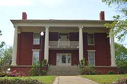 Brown-Proctor House |
September 16, 1982 (#82002036) |
208 S. Houston St. 34°40′19″N 86°02′15″W |
Scottsboro | |
| 3 | College Hill Historic District |  College Hill Historic District |
March 30, 1983 (#83002970) |
306-418 and 405-411 College Ave. 34°40′12″N 86°01′42″W |
Scottsboro | |
| 4 | Fort Harker | 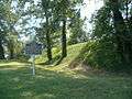 Fort Harker |
May 2, 1977 (#77000205) |
South of State Route 117 34°51′41″N 85°50′24″W |
Stevenson | |
| 5 | Public Square Historic District | 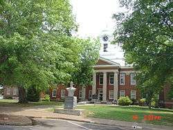 Public Square Historic District |
April 15, 1982 (#82002037) |
Roughly bounded by Appletree, Andrews, Willow and Caldwell Sts. 34°40′20″N 86°02′03″W |
Scottsboro | |
| 6 | Gen. William Rosecrans Headquarters | 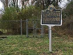 Gen. William Rosecrans Headquarters |
July 12, 1978 (#78000490) |
Myrtle Pl. 34°52′23″N 85°50′09″W |
Stevenson | |
| 7 | Russell Cave National Monument |  Russell Cave National Monument |
October 15, 1966 (#66000150) |
8 miles (12.8 km) west of Bridgeport via U.S. Route 72 and County Roads 91 and 75 34°58′36″N 85°48′52″W |
Bridgeport | |
| 8 | Scottsboro Memphis and Charleston Railroad Depot |  Scottsboro Memphis and Charleston Railroad Depot |
February 20, 1998 (#98000107) |
Junction of N. Houston and Maple Ave. 34°40′30″N 86°02′13″W |
Scottsboro | |
| 9 | Skyline Commissary |  Skyline Commissary |
June 12, 2013 (#13000365) |
Northeast corner of the junction of County Roads 25 & 107 34°48′46″N 86°07′27″W |
Skyline | |
| 10 | Stevenson Historic District | 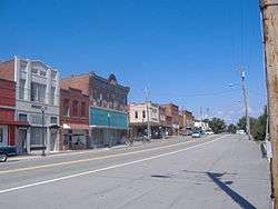 Stevenson Historic District |
September 13, 1978 (#78000491) |
Irregular pattern along the railroad tracks 34°52′05″N 85°50′24″W |
Stevenson | |
| 11 | Stevenson Railroad Depot and Hotel | 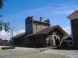 Stevenson Railroad Depot and Hotel |
May 13, 1976 (#76000329) |
Main St. 34°52′02″N 85°50′24″W |
Stevenson | |
| 12 | Townsend Farmhouse | August 11, 2005 (#05000838) |
Eastern side of County Road 34, 0.8 miles north of County Road 234 34°46′30″N 85°59′32″W |
Hollywood |
See also
| Wikimedia Commons has media related to National Register of Historic Places in Jackson County, Alabama. |
References
- The latitude and longitude information provided in this table was derived originally from the National Register Information System, which has been found to be fairly accurate for about 99% of listings. Some locations in this table may have been corrected to current GPS standards.
- "National Register of Historic Places: Weekly List Actions". National Park Service, United States Department of the Interior. Retrieved on August 14, 2020.
- Numbers represent an ordering by significant words. Various colorings, defined here, differentiate National Historic Landmarks and historic districts from other NRHP buildings, structures, sites or objects.
- The eight-digit number below each date is the number assigned to each location in the National Register Information System database, which can be viewed by clicking the number.
Municipalities and communities of Jackson County, Alabama, United States | ||
|---|---|---|
| Cities | Map of Alabama highlighting Jackson County | |
| Towns | ||
| Unincorporated communities | ||
| Ghost towns | ||
This article is issued from Wikipedia. The text is licensed under Creative Commons - Attribution - Sharealike. Additional terms may apply for the media files.