Morris County, New Jersey
Morris County is a county located in the U.S. state of New Jersey, about 30 mi (48 km) west of New York City. According to the 2010 census, the population was 492,276,[2] up from the 470,212 at the 2000 Census,[3][4][5] As of the 2019 Census estimate, the county's population was 491,845, making it the state's 10th-most populous county, and marking a 1.5% increase from 2010.[6][7][8] The county is part of the New York Metropolitan Area and is divided into 39 municipalities, but has no large cities. Its county seat is Morristown.[9] The most populous place was Parsippany-Troy Hills Township, with 53,238 residents at the time of the 2010 Census, while Rockaway Township covered 45.55 square miles (118.0 km2), the largest total area of any municipality.[5]
Morris County | |
|---|---|
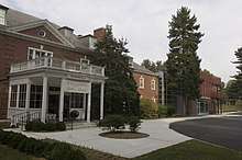
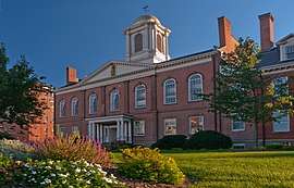 Morris County Courthouse | |
 Flag  Seal | |
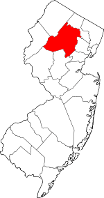 Location within the U.S. state of New Jersey | |
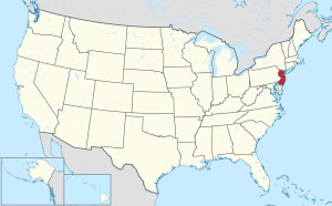 New Jersey's location within the U.S. | |
| Coordinates: 40.87°N 74.55°W | |
| Country | |
| State | |
| Founded | March 15, 1739[1] |
| Named for | Colonial governor Lewis Morris |
| Seat | Morristown |
| Largest city | Parsippany-Troy Hills Township (population) Rockaway Township (area) |
| Government | |
| • Freeholder director | Deborah Smith (R, term ends December 31, 2020) |
| Area | |
| • Total | 481.62 sq mi (1,247.4 km2) |
| • Land | 460.18 sq mi (1,191.9 km2) |
| • Water | 21.45 sq mi (55.6 km2) 4.45% |
| Population (2010) | |
| • Total | 492,276 |
| • Estimate (2019) | 491,845 |
| • Density | 1,000/sq mi (390/km2) |
| Congressional districts | 7th, 11th |
| Website | www |
In 2015, the county had a per capita personal income of $86,582, the highest in New Jersey and ranked 24th of 3,113 counties in the United States.[10][11] Morris County, as of the 2000 Census, was the sixth-wealthiest county in the United States by median household income at $77,340 (second in New Jersey behind Hunterdon County at $79,888), sixth in median family income at $89,773 (third in New Jersey behind Hunterdon County at $91,050 and Somerset County at $90,605) and ranked tenth by per capita income at $36,964 (second in New Jersey behind Somerset County at $37,970).[12]
The Bureau of Economic Analysis ranked the county as having the 16th-highest per capita income of all 3,113 counties in the United States (and the second highest in New Jersey) as of 2009.[13] The county ranked third in the New York Metropolitan area in terms of median income.[14] Morris County was recently ranked number 2 of 21 NJ counties as one of the healthiest counties in New Jersey, according to an annual report by County Health Rankings and Roadmaps.[15]
History

Etymology
Morris County was named after Colonel Lewis Morris, governor of New Jersey in 1738/9, the year the county was named.[16]
Paleo Indians and Native Americans
The Wisconsin Glacier covered the northern section of Morris County from about 23,000 B.C. to 13,000 B.C.
After the Wisconsin Glacier melted around 13,000 B.C., Paleo Indians moved into the area from the south in search of big and small game as well as plants. The area was first tundra with grasses growing. Rabbits and fox moved into the area from the south.
Around the year 1000, the area of Morris County was inhabited by the Lenape Native Americans prior to the arrival of European settlers. They came from the Mississippi River area. They lived along the rivers and hunted game, fished, collected plants and nuts.
Henry Hudson explored the Hudson River area in 1609, and later the Dutch did surveys of the area.
From 1611 to 1614, the Dutch established the colony of New Netherland, which claimed territory between the 40th and 45th parallel north, a zone which included northern New Jersey. Dutch forts were established along the Hudson River beginning in 1613. As the years went by, more forts were established to trade with Native Americans.
The Native Americans traded furs and food with the Dutch for various goods. In return the Dutch gave the Native Americans metal pots, knives, guns, axes, and blankets. Trading with the Native Americans occurred until 1643 when a series of wars broke out between the Dutch and Native Americans.
There were hostile relations between the Dutch and Native Americans between 1643 and 1660. This prevented colonization by the Dutch of the Morris County region which was technically included in their claimed "New Netherland."
On August 27, 1664, three English ships approached Fort Amsterdam and the fort was surrendered to the English. The English now controlled New Netherland and Morris County was now under control of the colony of New York. Relations with the Native Americans improved for a while.
There was a war with the Dutch ten years later. The Dutch re-took control of New Amsterdam but after a year returned it to the English. Relations with the Native Americans and English improved for a while.[17]
European settlements began in the early 18th century while the area was known as Hunterdon County. Native Americans were still in the area at that time. Land was purchased from the Native Americans for various things such as blankets, shirts, rum, guns, knives, pots and gunpowder. European colonization occurred along the Atlantic coast and moved inland.
The first European settlement in the area today known as Morris County occurred in Pompton Plains by the Dutch in 1695.[18] From 1710 to 1730, various iron mines and forges were established. The first was in Whippany in 1710 and then in Succasunna in 1713.
By 1750, nearly all Native Americans had left New Jersey. This was due to land purchases from the Native Americans, diseases that the Native Americans contracted from Europeans, and due to starvation from the Little Ice Age, during which Native American corn crops failed and rivers froze, preventing fishing. Snow storms sent game into semi-hibernation or made them difficult to find. Nut crops such as oak, hickory, beech, walnut, chestnut and butternut failed some years due to late frosts in spring. Many of the Morris County Native Americans went to eastern Canada and others went to the Ohio Valley. The Walking Purchase in September 1737, prevented Native Americans from going to eastern Pennsylvania. At that time, European settlement grew swiftly as there was now land to be farmed and settled.
Morris County was originally part of Burlington County which had been established in 1694. It then became part of Hunterdon County, which separated from Burlington County in 1714.[1]
Morris County was created on March 15, 1739, from portions of Hunterdon County.[1] The county was named for the Governor of the Province of New Jersey, Colonel Lewis Morris.[19] In later years Sussex County (on June 8, 1753) and, after the revolution, Warren County (on November 20, 1824, from portions of Sussex County) were carved out of what had been the original area of Morris County under English rule.[1]
The county was the site of the winter camp of the Continental Army after the Battles of Trenton and Princeton during the winter of 1777, as well as another winter camp at Jockey Hollow during an extremely cold winter of 1779–80.[20]
In the 1880s, Dover was the centre of iron ore mining with the 132 mines producing 700,000 tons of ore annually. The mines were mostly worked by Cornish miners, with the bulk of the population in Dover and Port Oram of Cornish extraction. At that time the Cornish had kept their customs and dialect, were deeply religious and predominately Methodists.[21]
Geography
According to the 2010 Census, the county had a total area of 481.62 square miles (1,247.4 km2), including 460.18 square miles (1,191.9 km2) of land (95.5%) and 21.45 square miles (55.6 km2) of water (4.5%).[5][22]


The county rises in elevation and relief from east to west, with only the more developed eastern suburbs in the Passaic River valley being relatively level. The highest point is at 1,395 feet (425 m) above sea level on a mountain south of Pine Swamp in western Jefferson Township.[23] The second-highest point is on a mountain just north of Riker Lake at 1,358 feet (414 m). The lowest point is about 160 feet (49 m) in elevation, at Two Bridges, the confluence of the Passaic and Pompton rivers.
The county is drained by several rivers. The Rockaway River drains 125 square miles (320 km2), of the northern section of the county. The Whippany River drains 69 square miles (180 km2) of the middle of the county. The South Branch of the Raritan River and the Black River drain the western area.
Most of the county's borders are rivers. The Pequannock River drains the northern boundary area. The Pompton River drains the eastern section. The Passaic River also drains the eastern border area. The western border is drained by the Musconetcong River.
There are several large lakes in Morris County, among them are Lake Hopatcong, Budd Lake, Lake Parsippany, and the Boonton Reservoir (also known as the Jersey City Reservoir).
Adjacent counties
- Sussex County – north
- Passaic County – northeast
- Essex County – east
- Union County – southeast
- Somerset County – south
- Hunterdon County – southwest
- Warren County – west
Climate
Morris has a humid continental climate (Dfa/Dfb) and the hardiness zones are 6a and 6b.
| Climate data for Morristown | |||||||||||||
|---|---|---|---|---|---|---|---|---|---|---|---|---|---|
| Month | Jan | Feb | Mar | Apr | May | Jun | Jul | Aug | Sep | Oct | Nov | Dec | Year |
| Average high °F (°C) | 38 (3) |
41 (5) |
50 (10) |
61 (16) |
71 (22) |
80 (27) |
85 (29) |
83 (28) |
75 (24) |
65 (18) |
54 (12) |
43 (6) |
62 (17) |
| Average low °F (°C) | 18 (−8) |
19 (−7) |
27 (−3) |
36 (2) |
46 (8) |
54 (12) |
59 (15) |
58 (14) |
51 (11) |
39 (4) |
32 (0) |
23 (−5) |
39 (4) |
| Average precipitation inches (mm) | 4.50 (114) |
3.00 (76) |
4.41 (112) |
4.64 (118) |
5.09 (129) |
4.40 (112) |
5.29 (134) |
4.37 (111) |
5.33 (135) |
4.17 (106) |
4.37 (111) |
4.10 (104) |
53.67 (1,363) |
| Source: [24] | |||||||||||||
Geology
Around 500 million years ago, a chain of volcanic islands shaped like an arc collided with proto North America. The islands rode over top of the North American plate. This created the highlands in western Morris County and the eastern section of Morris County.[25]
Around 400 million years ago, a small continent long and narrow collided with proto North America. This created folding and faulting, as compression occurred. Then around 350 million years ago, the African plate collided with North America creating the folding and faulting in the Appalachians. But when the African plate pulled away from North America, an aborted rift valley was created. This half graben, starts east of Boonton and goes through the middle of Parsippany, south to Morristown, to the south end of Great Swamp. From Parsippany and the Boonton area the half graben goes east to the western side of Paterson, where there was another fault by the lava flows. East of the Ramapo Fault is where there is this aborted rift valley.[25] The Ramapo fault goes through the county on a northeast–southwest axis. The fault separates the Highlands from the Piedmont, also known as the Newark Basin. This is an active fault. The last major earthquake occurred in 1884, with a strength measured at 5.3 on the Richter scale.[26]
Around 21,000 B.C., the Wisconsin Glacier covered about half of Morris County. The terminal moraine went from Hackettstown east to north of Budd Lake, east to Rockaway and Denville, then southeast to Morristown then south to the south end of Great Swamp. When the glacier melted around 13,000 B.C. the melt water created Glacial Lake Passaic. The lake extended from what is now Pompton Lakes through Parsippany south to the south end of Great Swamp. From Parsippany the lake went east to the lava flows of western Paterson. This lake was thirty miles long and ten miles wide (36 km by 12 km). The depth was about 200 feet (61 m). When the Wisconsin glacier cover Morris County the ice sheet was about 300 metres (980 ft) deep. Due to debris from the glacier, the lake was unable to drain through the Watchung Mountains near Short Hills. Instead, it drained through Moggy Hollow at the southwestern end of the lake. But when the glacier melted and receded to the New York State line, the lake drained though the Little Falls area, as this was lower in elevation than Moggy Hollow. And thus the Passaic River formed.
The swamps of the Great Piece Meadows, Hatfield Swamp, Troy Meadows, Lee Meadows and Great Swamp were all under the Lake Passaic until it drained, and then these areas were created.[27]
National protected areas
Demographics


| Historical population | |||
|---|---|---|---|
| Census | Pop. | %± | |
| 1790 | 16,216 | — | |
| 1800 | 17,750 | 9.5% | |
| 1810 | 21,828 | 23.0% | |
| 1820 | 21,368 | −2.1% | |
| 1830 | 23,666 | 10.8% | |
| 1840 | 25,844 | 9.2% | |
| 1850 | 30,158 | 16.7% | |
| 1860 | 34,677 | 15.0% | |
| 1870 | 43,137 | 24.4% | |
| 1880 | 50,861 | 17.9% | |
| 1890 | 54,101 | 6.4% | |
| 1900 | 65,156 | 20.4% | |
| 1910 | 74,704 | 14.7% | |
| 1920 | 82,694 | 10.7% | |
| 1930 | 110,445 | 33.6% | |
| 1940 | 125,732 | 13.8% | |
| 1950 | 164,371 | 30.7% | |
| 1960 | 261,620 | 59.2% | |
| 1970 | 383,454 | 46.6% | |
| 1980 | 407,630 | 6.3% | |
| 1990 | 421,353 | 3.4% | |
| 2000 | 470,212 | 11.6% | |
| 2010 | 492,276 | 4.7% | |
| Est. 2019 | 491,845 | [28] | −0.1% |
| Historical sources: 1790–1990[29] 1970–2010[5] 2000[3] 2010[2] 2000–2010[30] 2010–2019[6] | |||

In 2009, Forbes magazine ranked the county sixth-best place in the nation to raise a family, the best of any county in the state. The ranking was mainly due to the high graduation rate of 98.4% and employment possibilities from area industry.[31]
2010 Census
The 2010 United States Census counted 492,276 people, 180,534 households, and 129,262.344 families in the county. The population density was 1,069.8 per square mile (413.1/km2). There were 189,842 housing units at an average density of 412.5 per square mile (159.3/km2). The racial makeup was 82.61% (406,683) White, 3.12% (15,360) Black or African American, 0.16% (805) Native American, 8.95% (44,069) Asian, 0.02% (106) Pacific Islander, 3.03% (14,910) from other races, and 2.10% (10,343) from two or more races. Hispanic or Latino of any race were 11.47% (56,482) of the population.[2]
Of the 180,534 households, 33.9% had children under the age of 18; 59.6% were married couples living together; 8.5% had a female householder with no husband present and 28.4% were non-families. Of all households, 23.5% were made up of individuals and 9.5% had someone living alone who was 65 years of age or older. The average household size was 2.68 and the average family size was 3.19.[2]
23.9% of the population were under the age of 18, 7.1% from 18 to 24, 25.2% from 25 to 44, 30% from 45 to 64, and 13.8% who were 65 years of age or older. The median age was 41.3 years. For every 100 females, the population had 95.9 males. For every 100 females ages 18 and older there were 93.2 males.[2]
2000 Census
At the 2000 United States Census,[32] there were 470,212 people, 169,711 households and 124,907 families residing in the county. The population density was 1,003 per square mile (387/km²). There were 174,379 housing units at an average density of 372 per square mile (144/km²). The racial makeup of the county was 87.20% White, 2.80% Black or African American, 0.12% Native American, 6.26% Asian, 0.04% Pacific Islander, 2.01% from other races, and 1.56% from two or more races. 7.79% of the population were Hispanic or Latino of any race.[3][33] Among those responding for first ancestry, 22.8% were of Italian, 19.9% Irish, 16.3% German, 8.6% English and 7.5% Polish ancestry according to Census 2000.
In 2000, there were 169,711 households of which 35.40% had children under the age of 18 living with them, 62.80% were married couples living together, 7.90% had a female householder with no husband present, and 26.40% were non-families. 21.50% of all households were made up of individuals and 7.30% had someone living alone who was 65 years of age or older. The average household size was 2.72 and the average family size was 3.18.[3]
Age distribution was 24.80% under the age of 18, 6.40% from 18 to 24, 31.90% from 25 to 44, 25.30% from 45 to 64, and 11.60% who were 65 years of age or older. The median age was 38 years. For every 100 females, there were 95.80 males. For every 100 females age 18 and over, there were 92.70 males.[3]
Hispanics constituted a majority of the population in Dover and over a quarter of the people in Morristown; over 18% of Americans in Parsippany-Troy Hills are Asian Americans. There are fairly equal numbers of Irish American and German American residents. The Jewish community is strong in specific areas, such as Randolph, Rockaway, and Morristown. Lincoln Park (26.7%), Montville (26.8%), East Hanover (41.8%), Pequannock Township (29.2%), and Riverdale (33.5%) have significant Italian American populations, along with other northern and eastern communities, while the rest of the county is more mixed with populations of Irish and German ancestries. Wharton (20.8%), Denville (25.1%), and Mine Hill (23.5%) are Irish American.
The median income for a household in the county was $77,340, and the median income for a family was $89,773. Males had a median income of $60,165 versus $40,065 for females. The per capita income for the county was $36,964. About 2.4% of families and 3.90% of the population were below the poverty line, including 3.7% of those under age 18 and 5.3% of those age 65 or over.[33][34]
Housing Expense
By national standards, housing is expensive in Morris County. In 2018, the median house price in Morris County was $469,900 the 2nd highest in the state behind Bergen County with a median home price of $476,200.[35]
In the Forbes magazine 2012 ranking of the Most Expensive ZIP Codes in the United States, New Vernon (located within Harding Township) was ranked as the 32nd most expensive in the country, with a median home sale price of $2,701,885. There were a total of 6 Morris county zip codes listed in the top 500, which were Mountain Lakes (#288; $909,474), Mendham (includes both Mendham Borough and Mendham Township) (#356; $800,672), Chatham (includes both Chatham Borough and Chatham Township) (#375; $776,703), Florham Park (#440; $675,107), and Kinnelon (#462; $630,414).[36]
In the magazine's 2006 listing, New Vernon (Harding Township) was ranked as the 23rd most expensive in the country, with its median home sale price in 2005 of $1,596,587 ranking as the state's 2nd highest behind Alpine located Bergen County. In all, 5 Morris County zip codes were represented on the list in addition to New Vernon, including Mendham (includes both Mendham Borough and Mendham Township) (ranked #209; median sale price of $835,000), Mountain Lakes (#217; $826,250), Green Village (located within portions of both Harding Township and Chatham Township) (#282; $777,465), and Chester (includes both Chester Borough and Chester Township) (#288; $775,000).[37]
Government

Morris County is governed by a seven-member Board of Chosen Freeholders, who are elected at-large to three-year terms on a staggered basis, with two or three seats up for election each year. The Freeholder Board sets policies for the operation of six super-departments, more than 30 divisions plus authorities, commissions, boards and study committees.[38] Actual day-to-day operation of departments is supervised by County Administrator, John Bonanni.[39] In 2016, freeholders were paid $24,375 and the freeholder director was paid an annual salary of $25,350.[40]
As of 2020, Morris County's Freeholders are:[41]
- Freeholder Director Deborah Smith (R, Denville, term as freeholder ends December 31, 2021; term as freeholder director ends December 31, 2020)[42]
- Deputy Freeholder Director Stephen H. Shaw (R, Mountain Lakes, term as freeholder ends December 31, 2021; term as freeholder deputy director ends December 31, 2020)[43]
- Douglas R. Cabana (R, Boonton Township, 2022)[44]
- Kathryn A. DeFillippo (R, Roxbury, 2022)[45]
- John Krickus (R, Washington Township, 2021)[46]
- Thomas J. Mastrangelo (R, Montville, 2022)[47]
- Tayfun Selen (R, Chatham Township, 2020)
Former freeholders
Former county freeholders include:[48]
- 2018–2020: Heather Darling (R)
- 2013–2019: John Cesaro (R)
- 2012–2018: Hank Lyon (R)
- 2013–2015: David Scapicchio (R)
- 2007–2012: Eugene Feyl (R)
- 1999–2012: Margaret Nordstrom (R)
- 2006–2012: William Chegwidden (R)
- 1998–2012: John Murphy (R)
- 1999–2010: Jack Schrier (R)
- 2007–2010: James Murray (R)
- 2001–2007: John Inglesino (R)
- 1992–2006: Cecilia Laureys (R)
- 1984, 1992–2006: Frank Dreutzler (R)
- 1995–1997: Chris Christie (R)
- 1975–1978: Douglas Romaine (D)
Other officers
Pursuant to Article VII Section II of the New Jersey State Constitution, each county in New Jersey is required to have three elected administrative officials known as "constitutional officers." These officers are the County Clerk and County Surrogate (both elected for five-year terms of office) and the County Sheriff (elected for a three-year term).[49] Morris County's constitutional officers are:[50]
- County Clerk Ann F. Grossi (Parsippany, 2023)[51][52]
- Sheriff James M. Gannon (Boonton, 2022)[53][54]
- Surrogate Heather Darling (Roxbury, 2024)[55][56]
The county prosecutor is Fredric M. Knapp of Randolph, who was sworn into the position in June 2014 after being nominated by Governor Chris Christie in June 2012.[57][58][59]
The Morris Automated Information Network, which supplies Internet service to area libraries, turned down $10,000 per year in federal funding, starting in 2004. Acceptance of the grants would have required the network to install anti-porn content filters to comply with the Children's Internet Protection Act. As these filters excluded legitimate information—such as pages with the word "breast" in online searches regarding "breast cancer"—the network declined to accept these grants.[60]
Another organization having the power to affect the county budget without county governmental control is the Morris County Board of Taxation,[61] (also called the Morris County Tax Board). "[T]he freeholders, and county government in general, do not have control over tax board spending. ... [T]he tax board is an entity of state government, even though it submits expense vouchers to county government."[62]
Morris County is a part of Vicinage 10 of the New Jersey Superior Court (along with Sussex County), which is seated at the Morris County Courthouse in Morristown; the Assignment Judge for Vicinage 15 is Stuart M. Minkowitz.[63] Law enforcement at the county level includes the Morris County Park Police and the Morris County Sheriff. The judicial organization includes the Morris County Prosecutor's Office.
The 7th and 11th Congressional Districts cover the county.[64][65] For the 116th United States Congress. New Jersey's Seventh Congressional District is represented by Tom Malinowski (D, Ringoes).[66] For the 116th United States Congress, New Jersey's Eleventh Congressional District is represented by Mikie Sherrill (D, Montclair).[67]
The county is part of the 21st, 24th, 25th, 26th, 27th and 40th Districts in the New Jersey Legislature.[68] For the 2018–2019 session (Senate, General Assembly), the 21st Legislative District of the New Jersey Legislature is represented in the State Senate by Thomas Kean Jr. (R, Westfield) and in the General Assembly by Jon Bramnick (R, Westfield) and Nancy Munoz (R, Summit).[69][70] For the 2018–2019 session (Senate, General Assembly), the 24th Legislative District of the New Jersey Legislature is represented in the State Senate by Steve Oroho (R, Franklin) and in the General Assembly by Parker Space (R, Wantage Township) and Harold J. Wirths (R, Hardyston Township).[71][72] For the 2020–2021 session (Senate, General Assembly), the 25th Legislative District of the New Jersey Legislature is represented in the State Senate by Tony Bucco (R, Boonton Township) and in the General Assembly by Brian Bergen (R, Denville) and Aura K. Dunn (R, Mendham Borough).[73][74]
Senator Anthony R. Bucco died in September 2019. A special convention of the Republican County Committee members from the district met on October 15, 2019, and unanimously selected his son, Assemblyman Anthony M. Bucco to fill his father's seat until a 2020 special election. Assemblyman Bucco then resigned from the Assembly and on October 24, 2019, was sworn into the Senate. In a special convention following the 2019 General Election, Dunn was slected and will serve until the end of the current Legislative Session, January 14, 2020.[75] For the 2018–2019 session (Senate, General Assembly), the 26th Legislative District of the New Jersey Legislature is represented in the State Senate by Joseph Pennacchio (R, Montville) and in the General Assembly by BettyLou DeCroce (R, Parsippany-Troy Hills) and Jay Webber (R, Morris Plains).[76][77] For the 2018–2019 session (Senate, General Assembly), the 27th Legislative District of the New Jersey Legislature is represented in the State Senate by Richard Codey (D, Roseland) and in the General Assembly by Mila Jasey (D, South Orange) and John F. McKeon (D, West Orange).[78][79] For the 2018–2019 session (Senate, General Assembly), the 40th Legislative District of the New Jersey Legislature is represented in the State Senate by Kristin Corrado (R, Totowa) and in the General Assembly by Kevin J. Rooney (R, Wyckoff) and Christopher DePhillips (R, Wyckoff).[80][81]
Politics
Though New Jersey is mainly a Democratic state, Morris County is considered a stronghold for the Republican Party. The GOP has carried the county in all but two presidential elections since 1900, and in every election since 1964. All seven county Freeholders are Republicans, as are all countywide elected officers and most state legislators.
As of October 31, 2014, there were a total of 330,014 registered voters in Morris County, of which 113,759 (34.5%) were registered as Republicans, 69,956 (21.2%) were registered as Democrats, and 145,973 (44.2%) were registered as Unaffiliated. There were 326 voters registered to other parties.[82]
In the 2008 presidential election, Republican John McCain received 53.3% of the vote here (132,331 cast), ahead of Democrat Barack Obama with 45.2% (112,275 votes) and other candidates with 0.9% (2,310 votes), among the 248,306 ballots cast by the county's 321,254 registered voters, for a turnout of 77.3%.[83] In the 2004 presidential election, Republican George W. Bush received 57.3% of the vote here (135,241 ballots cast), outpolling Democrat John Kerry with 41.6% (98,066 votes) and other candidates with 0.6% (1,847 votes), among the 235,920 ballots cast by the county's 313,745 registered voters, for a turnout percentage of 75.2.[84]
However, in 2016, Hillary Clinton came closer than any Democrat to carrying the county since Lyndon Johnson's win in 1964, finishing just 4.2 percent behind Donald Trump.
| Year | Republican | Democratic | Third parties |
|---|---|---|---|
| 2016 | 49.7% 126,071 | 45.5% 115,249 | 4.8% 12,217 |
| 2012 | 54.8% 125,279 | 44.0% 100,563 | 1.2% 2,805 |
| 2008 | 53.5% 132,331 | 45.4% 112,275 | 1.2% 2,913 |
| 2004 | 57.5% 135,241 | 41.7% 98,066 | 0.8% 1,847 |
| 2000 | 53.8% 111,066 | 42.6% 88,039 | 3.6% 7,403 |
| 1996 | 49.0% 95,830 | 41.4% 81,092 | 9.6% 18,823 |
| 1992 | 51.8% 108,431 | 32.3% 67,593 | 15.9% 33,208 |
| 1988 | 68.1% 127,420 | 31.4% 58,721 | 0.6% 1,108 |
| 1984 | 71.9% 137,719 | 27.8% 53,201 | 0.3% 584 |
| 1980 | 60.6% 105,260 | 28.2% 48,965 | 11.2% 19,379 |
| 1976 | 61.5% 105,921 | 37.0% 63,749 | 1.6% 2,703 |
| 1972 | 68.2% 113,469 | 30.6% 50,937 | 1.2% 2,028 |
| 1968 | 57.8% 85,512 | 35.4% 52,398 | 6.9% 10,152 |
| 1964 | 42.7% 55,024 | 57.2% 73,684 | 0.2% 205 |
| 1960 | 63.7% 75,039 | 36.2% 42,698 | 0.1% 146 |
| 1956 | 79.4% 76,571 | 20.2% 19,503 | 0.4% 395 |
| 1952 | 72.6% 62,847 | 27.3% 23,662 | 0.1% 120 |
| 1948 | 68.0% 42,558 | 30.2% 18,864 | 1.8% 1,152 |
| 1944 | 64.7% 39,732 | 35.0% 21,454 | 0.3% 186 |
| 1940 | 61.5% 39,720 | 38.2% 24,698 | 0.3% 194 |
| 1936 | 55.9% 32,365 | 43.1% 24,978 | 1.0% 600 |
| 1932 | 59.2% 31,481 | 37.8% 20,117 | 3.0% 1,604 |
| 1928 | 68.4% 33,189 | 31.3% 15,188 | 0.4% 182 |
| 1924 | 69.6% 24,812 | 22.6% 8,042 | 7.9% 2,801 |
| 1920 | 71.5% 20,686 | 25.1% 7,256 | 3.4% 989 |
| 1916 | 54.2% 8,530 | 43.2% 6,798 | 2.5% 400 |
| 1912 | 23.7% 3,329 | 40.1% 5,628 | 36.2% 5,089 |
| 1908 | 61.2% 9,089 | 33.8% 5,026 | 5.0% 747 |
| 1904 | 57.7% 8,201 | 33.6% 4,768 | 8.7% 1,237 |
| 1900 | 54.5% 7,743 | 40.8% 5,793 | 4.8% 676 |
| County CPVI: R+5 | |||
In the 2009 gubernatorial election, Republican Chris Christie received 59.5% of the vote here (99,085 ballots cast), ahead of Democrat Jon Corzine with 31.0% (51,586 votes), Independent Chris Daggett with 8.0% (13,321 votes) and other candidates with 0.6% (1,031 votes), among the 166,516 ballots cast by the county's 314,232 registered voters, yielding a 53.0% turnout.[86]
Taxation
Based on IRS data for the 2004 tax year, Morris County had the tenth-highest average federal income tax liability per return in the country. Average tax liability was $15,296, representing 16.3% of Adjusted Gross Income.[87] Mountain Lakes ranked among the highest annual property tax bills in New Jersey, and highest in Morris County, in 2018 of $20,471, compared to a statewide average of $8,767.[88]
Economy

Morris County has the third-highest median household income in the United States ($77,340).[89]
Based on data from the Bureau of Economic Analysis, Morris County had a gross domestic product (GDP) of $52.5 billion in 2018, which was ranked 3rd in the state behind Bergen and Middlesex counties and represented an increase of 1.7% from the previous year.[90]
Business

Morris County is home to 33 Fortune 500 businesses that have headquarters, offices or a major facility in Morris County. These include AT&T, Honeywell, Colgate-Palmolive, Pfizer, Johnson & Johnson, ExxonMobil, Novartis, BASF, Verizon, and Bayer, among others.[91] Major industries include finance, insurance, real estate, pharmaceuticals, health services, research and development, and technology. There are 13,000 acres (53 km2) set aside for 28 county parks. Four county golf courses and 16 public and private courses are in Morris.
Major employers in the county include:[18]
| # | Employer | # of employees |
|---|---|---|
| 1 | Novartis | 5,000+ |
| 2 | Atlantic Health System | 2,500–4,999 |
| 3 | Louis Berger Group | 2,500–4,999 |
| 4 | Picatinny Arsenal | 2,500–4,999 |
| 5 | Saint Clare's Hospital Inc. | 2,500–4,999 |
| 6 | UPS Logistics | 1,000–2,499 |
| 7 | Avis Budget Group | 1,000–2,499 |
| 8 | BASF Chemicals | 1,000–2,499 |
| 9 | ADP Services | 1,000–2,499 |
| 10 | AT&T Info Tech | 1,000–2,499 |
Education
As of 2018, 56.1 percent of Morris County residents were college graduates, the 2nd highest percentage in the state behind neighboring Somerset County with 58.0 percent.[35]
- The County College of Morris is a two-year public community college serving students from Morris County, with its main campus in Randolph and was founded in 1965.[92]
- The Assumption College for Sisters is another two-year college, the private Roman Catholic women's college located in Mendham.[93]
The Florham Park–Madison–Convent Station (Morris Township) area is also the home of three universities.
- The Florham Campus of Fairleigh Dickinson University, is located on the border of these three municipalities.[94]
- Drew University is a small, private university in Madison.
- The College of Saint Elizabeth is a private Roman Catholic, four-year, liberal arts college located in Convent Station that has been coeducational starting in September 2016, after being women-only since it opened in 1899.[95]
Arts and Culture
- Mayo Performing Arts Center is a former Walter Reade movie theater originally constructed in 1937 that has been converted into a 1,302-seat performing arts center.[96]
- Morris Museum – formally incorporated in 1943. The museum's permanent displays include rocks, minerals, fossils, animal mounts, a model railroad, and Native American crafts, pottery, carving, basketry and textiles.[97]
- Morristown National Historical Park — Four historic sites around Morristown associated with the American Revolutionary War, including Jockey Hollow, a park that includes a visitor center, the Revolution-era Wick farm, encampment site of George Washington's Continental Army, and around 25 miles of hiking trails, and the Washington's Headquarters & Ford Mansion, a Revolution-era Georgian-style mansion used by George Washington as his headquarters during the Jockey Hollow encampment.
- Morristown Green – Park at the center of town which was the old town "common" or "green." It is the site of several Revolutionary War and Civil war monuments, and is surrounded by historic churches, the colonial county-courthouse, and a shopping and restaurant district.
- St. Peter's Episcopal Church — Large McKim Mead and White church with bell tower, fine stained glass and medieval furnishings.
- Acorn Hall – 1853 Victorian Italianate mansion and home to the Morris County Historical Society. Donated to the historical society in 1971 by Mary Crane Hone, the mansion retained much of its original furnishings and accouterments as it remained in the same family for over a century. It is currently operated as a museum and is the headquarters of the Morris County Historical Society.[98]
- Speedwell Ironworks is a National Historic Landmark and museum at the site where the electric telegraph was first presented to the public, on January 11, 1838.[99]
- Shakespeare Theatre of New Jersey, located in Madison is one of 25 professional theatres in the state. Serving 100,000 adults and children annually, it is New Jersey's only professional theatre company dedicated to Shakespeare's canon and other classic masterworks.[100] The F.M. Kirby Shakespeare Theatre, the company's main stage, is a short walk from Madison's downtown shopping district.[101]
Sports
The United States Equestrian Team, the international equestrian team for the United States, was founded in 1950 at the Coates estate on van Beuren Road in Morristown.
Morristown has a cricketing club, the first in North America.[102]
The Morristown 1776 Association Football Club is a soccer club that competes in the North Jersey Soccer League and MCSSA.
Parks
The County boasts 13,000 acres that encompass 28 parks making it the largest county park system in New Jersey based on acreage.[103][104] Notably, Morristown National Historical Park became the country's first National Historical Park in 1933.[105]
Other points of interest
- Rockaway Townsquare located in Rockaway Township is a super-regional mall anchored by Macy's, Lord & Taylor, J. C. Penney, & Sears with a gross leasable area of 1,248,000 square feet (115,900 m2),[106] placing it in the top ten among the largest shopping malls in New Jersey.
Municipalities
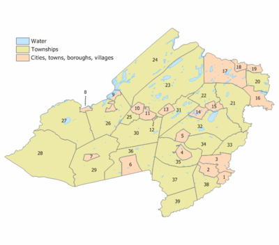
Municipalities in Morris County (with 2010 Census data for population, housing units and area) are:[107]
| Municipality (with map key) |
Municipal type |
Population | Housing Units |
Total Area |
Water Area |
Land Area |
Pop. Density |
Housing Density |
Communities[108] |
|---|---|---|---|---|---|---|---|---|---|
| Boonton (15) | town | 8,347 | 3,398 | 2.51 | 0.17 | 2.34 | 3,574.6 | 1,455.2 | |
| Boonton Township (22) | township | 4,263 | 1,647 | 8.63 | 0.39 | 8.24 | 517.2 | 199.8 | |
| Butler (18) | borough | 7,539 | 3,169 | 2.09 | 0.05 | 2.04 | 3,703.2 | 1,556.6 | |
| Chatham Borough (1) | borough | 8,962 | 3,210 | 2.42 | 0.05 | 2.37 | 3,776.1 | 1,352.5 | |
| Chatham Township (38) | township | 10,452 | 4,128 | 9.36 | 0.38 | 8.98 | 1,164.2 | 459.8 | Green Village |
| Chester Borough (7) | borough | 1,649 | 647 | 1.60 | 0.00 | 1.59 | 1,034.8 | 406.0 | |
| Chester Township (29) | township | 7,838 | 2,697 | 29.46 | 0.09 | 29.38 | 266.8 | 91.8 | |
| Denville Township (31) | township | 16,635 | 6,734 | 12.64 | 0.77 | 11.87 | 1,401.8 | 567.4 | Cedar Lake Estling Lake Indian Lake Lake Arrowhead Shongum Union Hill |
| Dover (11) | town | 18,157 | 5,783 | 2.73 | 0.05 | 2.68 | 6,765.5 | 2,154.8 | |
| East Hanover Township (33) | township | 11,157 | 3,976 | 8.14 | 0.24 | 7.89 | 1,413.7 | 503.8 | |
| Florham Park (3) | borough | 11,696 | 4,201 | 7.54 | 0.25 | 7.29 | 1,604.9 | 576.4 | |
| Hanover Township (34) | township | 13,712 | 5,526 | 10.73 | 0.20 | 10.52 | 1,302.8 | 525.0 | Cedar Knolls Whippany |
| Harding Township (37) | township | 3,838 | 1,610 | 20.44 | 0.53 | 19.92 | 192.7 | 80.8 | Green Village New Vernon |
| Jefferson Township (24) | township | 21,314 | 8,597 | 43.11 | 3.98 | 39.13 | 544.7 | 219.7 | Picatinny Arsenal Russia |
| Kinnelon (17) | borough | 10,248 | 3,600 | 19.19 | 1.20 | 17.99 | 569.7 | 200.1 | Smoke Rise |
| Lincoln Park (16) | borough | 10,521 | 4,145 | 6.91 | 0.53 | 6.38 | 1,649.0 | 649.7 | |
| Long Hill Township (39) | township | 8,702 | 3,226 | 12.14 | 0.29 | 11.85 | 734.3 | 272.2 | Gillette Millington Stirling |
| Madison (2) | borough | 15,845 | 5,775 | 4.22 | 0.01 | 4.21 | 3,767.9 | 1,373.3 | |
| Mendham Borough (6) | borough | 4,981 | 1,798 | 6.00 | 0.05 | 5.95 | 837.1 | 302.2 | |
| Mendham Township (36) | township | 5,869 | 2,062 | 18.10 | 0.23 | 17.87 | 328.4 | 115.4 | Brookside |
| Mine Hill Township (25) | township | 3,651 | 1,380 | 3.03 | 0.09 | 2.94 | 1,241.6 | 469.3 | |
| Montville (21) | township | 21,528 | 7,823 | 19.06 | 0.58 | 18.48 | 1,165.0 | 423.3 | Pine Brook Towaco |
| Morris Plains (5) | borough | 5,532 | 2,197 | 2.59 | 0.04 | 2.56 | 2,163.5 | 859.2 | |
| Morris Township (35) | township | 22,306 | 8,502 | 15.76 | 0.14 | 15.62 | 1,428.3 | 544.4 | Convent Station Washington Valley |
| Morristown (4) | town | 18,411 | 8,172 | 3.03 | 0.10 | 2.93 | 6,284.9 | 2,789.6 | |
| Mount Arlington (9) | borough | 5,050 | 2,545 | 2.92 | 0.75 | 2.17 | 2,325.2 | 1,171.8 | |
| Mount Olive Township (27) | township | 28,117 | 11,244 | 31.08 | 1.67 | 29.41 | 956.1 | 382.4 | Budd Lake CDP (8,968) Flanders |
| Mountain Lakes (14) | borough | 4,160 | 1,363 | 2.89 | 0.27 | 2.62 | 1,590.3 | 521.1 | |
| Netcong (8) | borough | 3,232 | 1,449 | 0.92 | 0.07 | 0.84 | 3,828.4 | 1,716.4 | |
| Parsippany-Troy Hills Township (32) | township | 53,238 | 21,274 | 25.39 | 1.83 | 23.56 | 2,259.3 | 902.8 | Greystone Park Lake Hiawatha |
| Pequannock Township (20) | township | 15,540 | 6,794 | 7.17 | 0.42 | 6.75 | 2,302.7 | 1,006.7 | Pompton Plains |
| Randolph (30) | township | 25,734 | 9,343 | 21.07 | 0.25 | 20.82 | 1,235.9 | 448.7 | Ironia Mount Freedom Shongum |
| Riverdale (19) | borough | 3,559 | 1,657 | 2.09 | 0.07 | 2.01 | 1,766.5 | 822.5 | |
| Rockaway Borough (13) | borough | 6,438 | 2,521 | 2.12 | 0.05 | 2.07 | 3,106.7 | 1,216.5 | |
| Rockaway Township (23) | township | 24,156 | 9,587 | 45.55 | 4.14 | 41.40 | 583.4 | 231.6 | Green Pond Hibernia Lake Telemark CDP (1,255) Picatinny Arsenal White Meadow Lake CDP (8,836) |
| Roxbury Township (26) | township | 23,324 | 8,582 | 21.89 | 1.06 | 20.83 | 1,119.9 | 412.1 | Flanders Kenvil CDP (3,009) Landing Ledgewood Port Morris Succasunna CDP (9,152) |
| Victory Gardens (12) | borough | 1,520 | 566 | 0.15 | 0.00 | 0.15 | 10,419.2 | 3,879.8 | |
| Washington Township (28) | township | 18,533 | 6,488 | 44.77 | 0.38 | 44.39 | 417.5 | 146.2 | Long Valley CDP (1,879) Pottersville Schooley's Mountain Scrappy Corner |
| Wharton (10) | borough | 6,522 | 2,426 | 2.22 | 0.07 | 2.15 | 3,039.0 | 1,130.4 | |
| Morris | county | 492,276 | 189,842 | 481.62 | 21.45 | 460.18 | 1,069.8 | 412.5 |
Transportation
Roads and highways
As of 2010, the county had a total of 2,527.39 miles (4,067.44 km) of roadways, of which 2,070.57 miles (3,332.26 km) are maintained by the local municipality, 295.54 miles (475.63 km) by Morris County and 161.28 miles (259.56 km) by the New Jersey Department of Transportation.[109]
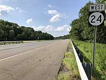
Morris County is served by several major roadways including:
Public transportation
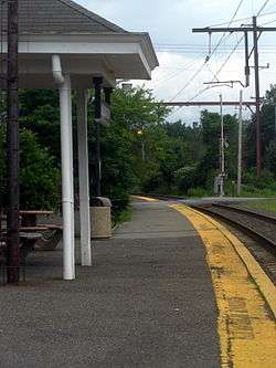
NJ Transit also provides rail service with Morris County via its Morris & Essex Lines and Montclair-Boonton Line to Hoboken Terminal and to New York City via its Midtown Direct service. Rail stations are located in the county providing electrified train service seven days a week from: Chatham, Madison, Convent Station, Morristown, Morris Plains, Denville, and Dover on NJ Transit's Morris & Essex Lines; electrified train service seven days a week from Gillette, Millington and Stirling on the Gladstone Branch; and diesel train service (weekdays only) from Mount Arlington, Lake Hopatcong, Netcong, Mount Olive, Mountain Lakes, Boonton, Towaco (Montville) and Lincoln Park.[110][111][112]
Bus transportation is also offered by several carriers including Lakeland Bus Company and NJ Transit.[113]
Air
Morristown Municipal Airport is a general aviation reliever airport located 3 miles (4.8 km) east of downtown Morristown. Operated by DM Airports, Ltd, it is in the Whippany section of Hanover Township.[114]
Local media
- WMTR is an AM radio station at 1250 kHz is licensed to Morristown and features an oldies format.[115]
- WDHA is a FM radio station (105.5 FM) broadcasting from Dover with their main studios in Cedar Knolls, featuring a rock format.[116]
- WJSV radio and television (90.5 FM) is also in Morristown,[117] the non-profit radio station of Morristown High School, which also has a television show which is shown on cable television, Colonial Corner.
- The Morristown Daily Record and The Star-Ledger and New Jersey Hills Media are published locally.
- Hometown Tales, a Public-access television cable TV show and podcast chronicling stories and urban legends from around the world, is loosely based in Morristown.
Climate and weather
| Morristown, New Jersey | ||||||||||||||||||||||||||||||||||||||||||||||||||||||||||||
|---|---|---|---|---|---|---|---|---|---|---|---|---|---|---|---|---|---|---|---|---|---|---|---|---|---|---|---|---|---|---|---|---|---|---|---|---|---|---|---|---|---|---|---|---|---|---|---|---|---|---|---|---|---|---|---|---|---|---|---|---|
| Climate chart (explanation) | ||||||||||||||||||||||||||||||||||||||||||||||||||||||||||||
| ||||||||||||||||||||||||||||||||||||||||||||||||||||||||||||
| ||||||||||||||||||||||||||||||||||||||||||||||||||||||||||||
In recent years, average temperatures in the county seat of Morristown have ranged from a low of 18 to 23 °F (−8 to −5 °C) in January to a high of 83 to 85 °F (28 to 29 °C) in July, although a record low of −26 °F (−32 °C) was recorded in February 1934 and a record high of 104 °F (40 °C) was recorded in August 2001. Average monthly precipitation ranged from 3.12 inches (79 mm) in February to 5.33 inches (135 mm) in September.[118]
See also
References
- Snyder, John P. The Story of New Jersey's Civil Boundaries: 1606–1968, Bureau of Geology and Topography; Trenton, New Jersey; 1969. p. 191. Accessed January 21, 2013.
- DP1 – Profile of General Population and Housing Characteristics: 2010 Demographic Profile Data for Morris County, New Jersey, United States Census Bureau. Accessed January 22, 2013.
- DP-1 – Profile of General Demographic Characteristics: 2000; Census 2000 Summary File 1 (SF 1) 100-Percent Data for Morris County, New Jersey, United States Census Bureau. Accessed January 22, 2013.
- NJ Labor Market Views Archived September 20, 2013, at the Wayback Machine, New Jersey Department of Labor and Workforce Development, March 15, 2011. Accessed October 6, 2013.
- New Jersey: 2010 – Population and Housing Unit Counts; 2010 Census of Population and Housing, p. 6, CPH-2-32. United States Census Bureau, August 2012. Accessed August 29, 2016.
- QuickFacts – Morris County, New Jersey; New Jersey; United States, United States Census Bureau. Accessed March 25, 2018.
- Annual Estimates of the Resident Population: April 1, 2010 to July 1, 2017 – 2017 Population Estimates Archived February 13, 2020, at Archive.today, United States Census Bureau. Accessed March 24, 2018.
- GCT-PEPANNCHG: Estimates of Resident Population Change and Rankings: July 1, 2016 to July 1, 2017 – State – County / County Equivalent from the 2017 Population Estimates for New Jersey Archived February 13, 2020, at Archive.today, United States Census Bureau. Accessed March 24, 2018.
- New Jersey County Map, New Jersey Department of State. Accessed July 10, 2017.
- 250 Highest Per Capita Personal Incomes available for 3113 counties in the United States: 2015 Archived 2017-10-26 at the Wayback Machine, New Jersey Department of Labor and Workforce Development. Accessed October 24, 2017.
- Local Area Personal Income: 2015 Archived 2017-10-15 at the Wayback Machine, Bureau of Economic Analysis. Accessed October 24, 2017.
- "Census 2000 Data Rankings; A data rankings document focused on the Roanoke Valley and Alleghany Highlands region" Archived October 23, 2013, at the Wayback Machine, Roanoke Valley-Alleghany Regional Commission, p. 22. Accessed October 6, 2013.
- 250 Highest Per Capita Personal Incomes of the 3113 Counties in the United States, 2009 Archived December 12, 2011, at the Wayback Machine, Bureau of Economic Analysis. Accessed April 9, 2012.
- "Complete List: America's Richest Counties", Forbes, January 2, 2008. Accessed May 2, 2008.
- "Rankings". County Health Rankings & Roadmaps. Retrieved 2018-02-01.
- "Morris County Web Site – History – The Land Past and Present". Co.morris.nj.us. Archived from the original on August 22, 2009. Retrieved August 9, 2011.
- "Third Anglo-Dutch War, 1672–1674". www.historyofwar.org. Retrieved 2019-03-23.
- Morris County profile, Choose: New Jersey. Accessed October 6, 2013.
- The Land Past and Present Archived 2009-08-22 at the Wayback Machine, Retrieved on March 22, 2007.
- Adams, III, Charles J. "Jockey Hollow Was Refuge For Continental Army", Reading Eagle, July 20, 2006. Accessed October 6, 2013.
- "The Murder Of A Cornish Girl By Her Lover In The United States". The Cornishman (209). 13 July 1882. p. 7.
- Census 2010 U.S. Gazetteer Files: New Jersey Counties, United States Census Bureau, Backed up by the Internet Archive as of June 11, 2012. Accessed October 6, 2013.
- New Jersey County High Points, Peakbagger.com. Accessed October 5, 2013.
- Average Weather for Morristown, New Jersey – Temperature and Precipitation Archived October 23, 2012, at the Wayback Machine, Weather.com. Accessed March 28, 2008.
- USGS
- Barron, James. "A Third Quake Causes Talk, but Little Else", The New York Times, February 18, 2009. Accessed October 6, 2013. "The earthquake on Feb. 2 and the aftershock on Wednesday were just south of the area he said had been rattled by a strong-for-New-Jersey tremor in 1783. In geologic time, that is almost recent. 'Probably a 5,' he said, explaining how seismologists had sifted through newspaper accounts to estimate the strength of that quake and another in 1884. 'A lot of articles about that one,' he said. 'That was a 5.3.'"
- "Significant Habitats and Habitat Complexes of the New York Bight Watershed Passaic Meadows Complex #24", United States Fish and Wildlife Service. Accessed October 6, 2013.
- "Population and Housing Unit Estimates". Retrieved March 26, 2020.
- Forstall, Richard L. Population of states and counties of the United States: 1790 to 1990 from the Twenty-one Decennial Censuses, pp. 108–109. United States Census Bureau, March 1996. ISBN 9780934213486. Accessed October 6, 2013.
- U.S. Census Bureau Delivers New Jersey's 2010 Census Population Totals, United States Census Bureau, February 3, 2011. Accessed February 5, 2011.
- Forbes.com, retrieved March 21, 2009
- U.S. Census website , United States Census Bureau. Accessed September 4, 2014.
- Tables DP-1 to DP-4 from Census 2000 for Morris County, New Jersey, United States Census Bureau, backed up by the Internet Archive as of May 18, 2011. Accessed October 1, 2013.
- DP-3 – Profile of Selected Economic Characteristics: 2000 from Census 2000 Summary File 3 (SF 3) – Sample Data for Morris County, New Jersey, United States Census Bureau. Accessed September 30, 2013.
- https://morriscountynj.gov/wp-content/uploads/2020/01/2020-Demograhics-and-Trends.pdf
- Brennan, Morgan. "America's Most Expensive Zip Codes 2012", Forbes, October 16, 2012. Accessed September 17, 2013.
- "Most expensive ZIP codes 2006: New Jersey", Forbes, April 24, 2006. Accessed September 17, 2013.
- About County Government, Morris County, New Jersey. Accessed October 24, 2017.
- Contact Us, Morris County, New Jersey. Accessed October 24, 2017.
- Gallo Jr., Bill. "Which N.J. county freeholders are paid the most?", NJ.com, March 11, 2016. Accessed October 25, 2017. "Freeholder director: $25,350; Other freeholders: $24,375"
- Freeholders, Morris County, New Jersey. Accessed April 14, 2017.
- "Deborah Smith". Morris County, NJ. County of Morris, NJ. Retrieved 3 February 2019.
- "Stephen H. Shaw". Morris County, NJ. County of Morris, NJ. Retrieved 3 February 2019.
- Douglas R. Cabana, Morris County, New Jersey. Accessed February 3, 2019.
- "Kathryn A. DeFillippo". Morris County, NJ. County of Morris, NJ. Retrieved 3 February 2019.
- "John Krickus". Morris County, NJ. County of Morris, NJ. Retrieved 3 February 2019.
- "Thomas Mastrangelo". Morris County, NJ. County of Morris, NJ. Retrieved 3 February 2019.
- Morris County Freeholders History Archived 2017-04-15 at the Wayback Machine, Morris County Department of Planning and Public Works. Accessed April 17, 2017.
- New Jersey State Constitution (1947), Article VII, Section II, Paragraph 2, New Jersey Department of State. Accessed October 26, 2017.
- Morris County Manual 2017, Morris County Clerk. Accessed April 14, 2017.
- Ann F. Grossi, Esq., Office of the Morris County Clerk. Accessed October 24, 2017.
- Members List: Clerks, Constitutional Officers Association of New Jersey. Accessed October 22, 2017.
- Sheriff James M. Gannon, Morris County, New Jersey. Accessed October 24, 2017.
- Members List: Sheriffs, Constitutional Officers Association of New Jersey. Accessed October 22, 2017.
- What is a Surrogate?, Morris County Surrogate Court. Accessed February 2, 2020.
- Members List: Surrogates, Constitutional Officers Association of New Jersey. Accessed February 2, 2020.
- Prosecutor Fredric M. Knapp, Morris County, New Jersey. Accessed October 24, 2017. "Fredric M. Knapp was appointed Morris County Prosecutor by Governor Chris Christie on June 27, 2014 following confirmation by the New Jersey Senate. Immediately prior to confirmation as Prosecutor, he was serving as Acting Morris County Prosecutor and Assistant Attorney General since December 14, 2012."
- "Governor Chris Christie Files Nominations" Archived 2017-02-24 at the Wayback Machine, Governor of New Jersey Chris Christie, press release dated June 7, 2012. Accessed October 25, 2017. "MORRIS COUNTY PROSECUTOR – Nominate for appointment Frederic M. Knapp (Randolph, Morris)"
- "Governor Chris Christie Files Nominations", Governor of New Jersey Chris Christie, press release dated June 3, 2014. Accessed October 26, 2017. "Prosecutorial Nominations – Nominate for appointment Fredric M. Knapp (Randolph, Morris)"
- The Library's Integrity, editorial, Star-Ledger, September 11, 2004.
- "Morris County Board of Taxation". Mcweb1.co.morris.nj.us. Archived from the original on August 20, 2011. Retrieved August 9, 2011.
- Ragonese, Lawrence. "Morris Tax Board Never Gets Bored of Traveling; Members Visited Alaska, Orlando, Other Spots on Public Money", The Star-Ledger, October 27, 2006.
- Morris/Sussex, New Jersey Courts|. Accessed October 24, 2017
- 2012 Congressional Districts by County, New Jersey Department of State Division of Elections. Accessed October 6, 2013.
- Plan Components Report, New Jersey Department of State Division of Elections, December 23, 2011. Accessed October 6, 2013.
- Directory of Representatives: New Jersey, United States House of Representatives. Accessed June 1, 2020.
- Directory of Representatives: New Jersey, United States House of Representatives. Accessed January 3, 2019.
- 2011 Legislative Districts by County, New Jersey Department of State Division of Elections. Accessed October 6, 2013.
- Legislative Roster 2018-2019 Session, New Jersey Legislature. Accessed January 22, 2018.
- District 21 Legislators, New Jersey Legislature. Accessed January 22, 2018.
- Legislative Roster 2018-2019 Session, New Jersey Legislature. Accessed January 22, 2018.
- District 24 Legislators, New Jersey Legislature. Accessed January 22, 2018.
- Legislative Roster 2020-2021 Session, New Jersey Legislature. Accessed February 28, 2020.
- District 25 Legislators, New Jersey Legislature. Accessed February 28, 2020.
- Pizarro, Max. "Dunn Sworn into the Assembly", Insider NJ, November 25, 2019. Accessed November 25, 2019. "Speaker Craig Coughlin (D-19) this afternoon administered the office to Assemblywoman Aura Dunn (R-25), who last week at a special convention formally landed the seat left behind by Senator Tony Bucco (R-25)."
- Legislative Roster 2018-2019 Session, New Jersey Legislature. Accessed January 22, 2018.
- District 26 Legislators, New Jersey Legislature. Accessed January 22, 2018.
- Legislative Roster 2018-2019 Session, New Jersey Legislature. Accessed January 22, 2018.
- District 27 Legislators, New Jersey Legislature. Accessed January 22, 2018.
- Legislative Roster 2018-2019 Session, New Jersey Legislature. Accessed January 22, 2018.
- District 40 Legislators, New Jersey Legislature. Accessed January 22, 2018.
- Statewide Voter Registration Summary Archived 2014-12-22 at the Wayback Machine, New Jersey Department of State Division of Elections, October 31, 2014. Accessed March 19, 2015.
- 2008 Presidential General Election Results: Morris County, New Jersey Department of State Division of Elections, December 23, 2008. Accessed December 17, 2012.
- 2004 Presidential Election: Morris County, New Jersey Department of State Division of Elections, December 13, 2004. Accessed December 17, 2012.
- Leip, David. "Dave Leip's Atlas of U.S. Presidential Elections". uselectionatlas.org. Retrieved 2018-06-10.
- 2009 Governor: Morris County Archived 2012-10-17 at the Wayback Machine, New Jersey Department of State Division of Elections, December 31, 2009. Accessed December 17, 2012.
- Biggest Income Tax Burdens: Top 10 Places, CNN Money. Accessed April 28, 2007.
- https://www.nj.com/politics/2019/04/these-are-the-towns-with-the-highest-property-taxes-in-each-of-njs-21-counties.html
- "American FactFinder". Factfinder.census.gov. Archived from the original on 2011-08-10. Retrieved August 9, 2011.
- Local Area Gross Domestic Product, 2018, Bureau of Economic Analysis, released December 12, 2019. Accessed December 12, 2019.
- "Buying a home in Morris Township". Homes101.net. March 1, 2006. Archived from the original on August 7, 2011. Retrieved August 9, 2011.
- History of CCM Archived 2012-09-18 at the Wayback Machine, County College of Morris. Accessed October 1, 2103.
- About Us Archived 2013-10-01 at Archive.today, Assumption College for Sisters. Accessed October 1, 2013.
- College at Florham, Madison, New Jersey, Fairleigh Dickinson University. Accessed October 1, 2013.
- "College of Saint Elizabeth to Become Fully Coeducational for Fall 2016" Archived 2016-03-28 at the Wayback Machine, College of Saint Elizabeth, June 12, 2015. Accessed February 1, 2017. "The College of Saint Elizabeth, which has provided undergraduate education for young women since 1899, will become fully coeducational for fall 2016."
- Theatre History, Mayo Performing Arts Center. Accessed July 25, 2016.
- Mission and History, Morris Museum. Accessed July 25, 2016.
- History, Morris County Historical Society. Accessed January 4, 2018. "Mary Crane Hone presented the Society with Acorn Hall and five acres of surrounding property in 1971. Built in 1853, Acorn Hall was the home of several generations of the Crane-Hone family."
- Historic Speedwell, Morris County Tourism Bureau. Accessed April 1, 2019. "This eight-acre National Historic Landmark has established its place in world history several times over. It was here in 1838, at the start of the Industrial Revolution, that Samuel F.B. Morse and Alfred Vail demonstrated a perfected electromagnetic telegraph to the public."
- Mission & History, Shakespeare Theatre of New Jersey. Accessed November 28, 2017.
- Historic Madison, Shakespeare Theatre of New Jersey. Accessed November 10, 2019. "The Shakespeare Theatre of New Jersey is located in the charming town of Madison.... The vibrant downtown is comprised of unique shops, tree-lined streets, art galleries and more than 40 restaurants and eateries-all within a ten-minute walk from the Theatre's Main Stage."
- Home Page, Indoor Cricket USA.
- https://www.morrisparks.net/index.php/commission/about/
- https://www.morriscountyedc.org/life-in-morris-county/
- "Expansion of the National Park Service in the 1930s". Administrative History. National Park Service. March 14, 2000. Retrieved 2013-12-24.
- Property Highlights for Rockaway Townsquare, Simon Property Group. Accessed December 21, 2011. "Property Facts: Regional Mall - 100% Simon Owned - 1,248,000 sf - Macy's, Lord & Taylor, JCPenney, Sears"
- GCT-PH1: Population, Housing Units, Area, and Density: 2010 – County – County Subdivision and Place from the 2010 Census Summary File 1 for Morris County, New Jersey, United States Census Bureau. Accessed July 17, 201.
- Locality Search, State of New Jersey. Accessed May 11, 2015.
- Morris County Mileage by Municipality and Jurisdiction, New Jersey Department of Transportation, May 2010. Accessed July 24, 2014.
- Montclair-Boonton Line, NJ Transit. Accessed October 6, 2013.
- Gladstone Branch, NJ Transit. Accessed October 6, 2013.
- Morristown Line, NJ Transit. Accessed October 6, 2013.
- Morris County Bus / Rail Connections, NJ Transit, backed up by the Internet Archive as of May 22, 2009. Accessed October 6, 2013.
- About MMU, Morristown Municipal Airport. Accessed May 22, 2017.
- WMTR(AM), FCCInfo.com. Accessed October 6, 2013.
- WDHA-FM, FCCInfo.com. Accessed October 6, 2013.
- WJSV(FM), FCCInfo.com. Accessed October 6, 2013.
- "Monthly Averages for Morristown, New Jersey". The Weather Channel. Retrieved April 15, 2017.
External links
| Wikimedia Commons has media related to Morris County, New Jersey. |
| Wikivoyage has a travel guide for Morris County. |
- Morris County Home Page
- Morris County Economic Development Corporation
- Morris County Visitors Center
- History of Morris County, New Jersey
- Morris County Library
- Morris County Economic Development Corporation (MCEDC)
Places adjacent to Morris County, New Jersey | ||||||||||
|---|---|---|---|---|---|---|---|---|---|---|
| ||||||||||
Municipalities and communities of Morris County, New Jersey, United States | ||
|---|---|---|
| Boroughs | Map of New Jersey highlighting Morris County | |
| Towns | ||
| Townships | ||
| CDPs | ||
| Other unincorporated communities |
| |
| Authority control |
|
|---|