Rockland County, New York
Rockland County is the southernmost county on the west side of the Hudson River in the U.S. state of New York, part of the New York City Metropolitan Statistical Area. The county's population, as of the 2010 United States Census, was 311,687, increasing to a 2019 Census estimate of 325,789,[1] making it the third-most densely populated county outside New York City within New York State (after Nassau and neighboring Westchester counties, respectively). The county seat is New City.[2] Rockland County is a suburb of New York City that borders the boroughs about 9 miles northwest of the city at their closest points, and is accessible via the New York State Thruway, after 10 exits. The name derives from "rocky land", as the area has been aptly described.
Rockland County | |
|---|---|
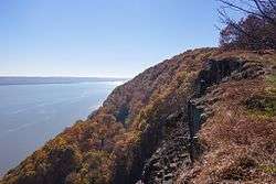 View of the Hudson River looking southward from Hook Mountain State Park. | |
 Flag  Seal | |
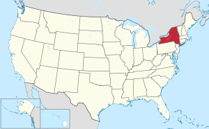
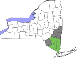
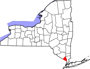 Location within the U.S. state of New York | |
 New York's location within the U.S. | |
| Coordinates: 41°09′N 74°02′W | |
| Country | |
| State | |
| Founded | 1798 |
| Named for | its rocky terrain |
| Seat | New City |
| Largest CDP | New City |
| Government | |
| • County Executive | Ed Day (R) |
| Area | |
| • Total | 199.34 sq mi (516.3 km2) |
| • Land | 173.55 sq mi (449.5 km2) |
| • Water | 25.79 sq mi (66.8 km2) 13% |
| Population | |
| • Estimate (2019) | 325,789[1] |
| • Density | 1,877.21/sq mi (724.79/km2) |
| Time zone | UTC−5 (Eastern) |
| • Summer (DST) | UTC−4 (EDT) |
| Area code | 845 |
| Congressional district | 17th |
| Website | www |
Rockland County is the smallest county by area in New York State outside New York City. It comprises five towns and nineteen incorporated villages, with numerous unincorporated villages (sixteen) and hamlets. Rockland County is designated as a Preserve America Community, and nearly a third of the county's area is parkland. The county has the largest Jewish population per capita of any U.S. county, with 31.4%, or 90,000 residents, being Jewish.[3] Rockland also ranked 31st on the list of highest-income counties by median household income in the United States, with a median household income of $82,534 according to the 2010 census.
History
The area that would become Rockland County was originally inhabited by Algonquian-speaking Aboriginals, including Munsees, or Lenni Lenape.
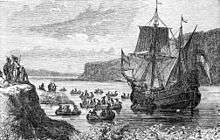
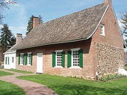
In 1609, Henry Hudson, thinking he had found the legendary "Northwest Passage", sailed on the Half Moon up the river that would one day bear his name and anchored near the area that is now Haverstraw before continuing to disillusionment north of Albany. The Dutch were the first Europeans to settle in the area, around 1675.[4] These settlers, eager to escape "city life", moved from Manhattan to Rockland. A number of unique Dutch-style red sandstone houses still stand, and many place names in the county reveal their Dutch origin. When the Duke of York (who became King James II of England) established the first twelve counties of New York in 1683, present-day Rockland County was part of Orange County, known then as "Orange County South of the Mountains". Orangetown was created at the same time under a royal grant, originally encompassing all of modern Rockland County. Around this time, as the English began to colonize Nyack and Tappan, the Native Americans began to leave Rockland in search of undisturbed land further north.[4]
The natural barrier of the Ramapo Mountains and the size of the county made it difficult to carry out governmental activities. At one point there were twin governments, one on each side of the Ramapo Mountains. For this reason, Rockland split off from Orange in 1798 to form its own county. That same year the county seat was transferred from Tappan to New City, where a new courthouse was built.
Haverstraw was separated from Orangetown in 1719 and became a town in 1788; it included the present-day Clarkstown, Ramapo and Stony Point. Clarkstown and Ramapo became towns in 1791, followed by Stony Point in 1865.
During the American Revolution, when control of the Hudson River was viewed by the British as strategic to dominating the American territories, Rockland saw skirmishes at Haverstraw, Nyack and Piermont, and significant military engagements at the Battle of Stony Point, where General "Mad" Anthony Wayne earned his nickname. George Washington had headquarters for a time at John Suffern's tavern, the later site of the village of Suffern. British Major John André met with American traitor Benedict Arnold near Stony Point to buy the plans for the fortifications at West Point. André was captured with the plans in Tarrytown on his way back to the British lines; he was brought to Tappan for trial in the Tappan church, found guilty, hanged and buried nearby. Still another important chapter in the story of the Revolution was written on May 5, 1783, when General Washington received Sir Guy Carleton at the DeWint House, where they discussed terms of a peace treaty. Two days later Washington visited Sir Guy aboard a British war vessel. On this day the King's Navy fired its first salute to the flag of the United States of America.
In the decades following the Revolution, Rockland became popular for its stone and bricks. These products, however, required quarrying in land that many later believed should be set aside as a preserve. Many unsuccessful efforts were made to turn much of the Hudson Highlands on the northern tip of the county into a forest preserve. However, Union Pacific Railroad president E. H. Harriman donated land as well as large sums of money for the purchase of properties in the area of Bear Mountain. Bear Mountain/Harriman State Park became a reality in 1910 when Harriman's widow donated his lands to the state, and by 1914 it was estimated that more than a million people a year were coming to the park. After World War I, Rockland County became the most important sausage making hub in the state of New York.[5][6][7]
Rockland remained semi-rural until the 1950s when the Palisades Interstate Parkway, Tappan Zee Bridge, and other major arteries were built. The idea of suburbia also helped transform the county. The county's population flourished, from 89,276 in 1950 to 265,475 in 1990.
Geography
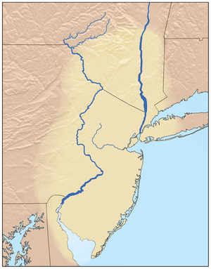
Rockland County lies just north of the New Jersey-New York border, west of Westchester County (across the Hudson River), and south of Orange County. Its east border is formed by the Tappan Zee portion of the Hudson River.[8] The county's terrain ranges from 1,283' (391m) ASL on Rockhouse Mountain (northwest of Lake Welch)[9] to approaching sea level along the Hudson River. According to the US Census Bureau, the county has a total area of 199.34 sqmi (516 km²), of which 173.55 sqmi (449.49 km²) is land and 25.79 sqmi (66.80 km²) (13%) is water.[10] It is the state's smallest county outside the five boroughs of New York City.
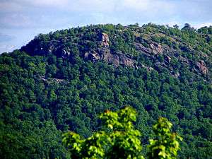
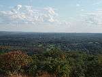
Approximately 30% of Rockland County is devoted to parkland, belonging to either the five towns, incorporated villages, the state, or the county. These parks provide walking and hiking trails, ballfields, dog runs, historic sites, ponds, streams, salt marshes, and equestrian trails. Some popular state parks include Bear Mountain State Park on the northernmost tip of the county, Harriman State Park also along the county's northern boundary, and Nyack Beach State Park along the Hudson River, with trails connecting to Rockland Lake State Park. The county hosts numerous public and private golf courses, with the towns of Orangetown, Ramapo, Stony Point, and Haverstraw all operating public golf courses within their towns. The Palisades Interstate Park Commission operates two golf courses in Rockland Lake State Park. Notable private courses in the county include Paramount Country Club, Manhattan Woods Golf Course (designed by PGA great Gary Player), and Rockland Country Club (Sparkill).
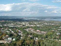
 Overlooking Rockland County with NYC skyline in far background
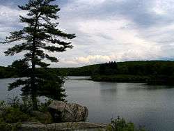
 Haverstraw along the Hudson River
Adjacent counties
- Orange County - northwest
- Putnam County - northeast
- Westchester County - east
- Passaic County, New Jersey - west
- Bergen County, New Jersey - south
Lakes[8]
- Breakneck Pond
- Congers Lake
- Cranberry Pond
- Lake DeForest
- Lake Sebago
- Lake Tappan (part)
- Lake Wanoksink
- Pine Meadow Lake
- Potake Lake (part)
- Rockland Lake
- Second Reservoir
- Lake Welch
- Tappan Zee (along east border)
- Third Reservoir
Demographics
| Historical population | |||
|---|---|---|---|
| Census | Pop. | %± | |
| 1800 | 6,353 | — | |
| 1810 | 7,758 | 22.1% | |
| 1820 | 8,837 | 13.9% | |
| 1830 | 9,388 | 6.2% | |
| 1840 | 11,975 | 27.6% | |
| 1850 | 16,962 | 41.6% | |
| 1860 | 22,492 | 32.6% | |
| 1870 | 25,213 | 12.1% | |
| 1880 | 27,690 | 9.8% | |
| 1890 | 35,162 | 27.0% | |
| 1900 | 38,298 | 8.9% | |
| 1910 | 46,873 | 22.4% | |
| 1920 | 45,548 | −2.8% | |
| 1930 | 59,599 | 30.8% | |
| 1940 | 74,261 | 24.6% | |
| 1950 | 89,276 | 20.2% | |
| 1960 | 136,803 | 53.2% | |
| 1970 | 229,903 | 68.1% | |
| 1980 | 259,530 | 12.9% | |
| 1990 | 265,475 | 2.3% | |
| 2000 | 286,753 | 8.0% | |
| 2010 | 311,687 | 8.7% | |
| Est. 2019 | 325,789 | 4.5% | |
| US Decennial Census[11] 1790-1960[12] 1900-1990[13] 1990-2000[14] 2010, 2019[1] | |||
2000 census
As of the 2000 United States Census.[15] there were 286,753 people, 92,675 households, and 70,989 families in the county. The population density was 1,652/sqmi (638/km²). There were 94,973 housing units at an average density of 547/sqmi (211/km²). However, residents live closer together than the census numbers indicate, as 30% of the county is reserved as parkland. 9% of residents reported speaking Spanish at home, 5% Yiddish, 3% French-based creole, 1.5% Italian, 1.3% Tagalog, 1.3% Hebrew, 1.2% French, and 1% Russian. Other languages spoken at home by at least 1000 people include Malayalam, Korean, Chinese, German, and Polish.
| Rockland County Demographics | |
|---|---|
| Racial demographics of Rockland according to 2016 US Census Bureau data:[16] | |
| Race | Percentage |
| White (Whites of non-Hispanic origin: 63.0%) | 77.5% |
| Hispanics and Latinos (of any race) | 17.6% |
| Black | 13.3% |
| Asian | 6.5% |
| Multiracial | 2.0% |
| American Indian and Alaska Native persons | 0.5% |
| Native Hawaiian and Other Pacific Islander persons | 0.1% |
There were 92,675 households out of which 38% had children under the age of 18 living with them, 63% were married couples living together, 10% had a female householder with no husband present, and 23% were non-families. 19% of households were made up of individuals and 8% had someone living alone who was 65 years of age or older. The average household size was 3 and the average family size was 3.5.
The county population contained 28% under the age of 18, 8% from 18 to 24, 28% from 25 to 44, 24.30% from 45 to 64, and 12% who were 65 years of age or older. The median age was 36 years. For every 100 women there were 95 men. For every 100 women age 18 and over, there were 91 men.
The median income for a household in the county was $68,000 and the median income for a family was $80,000. Males had a median income of $58,000 versus $39,000 for females. The per capita income for the county was $28,000. The mean, or average, income for a family in Rockland County is $73,500 according to the 2004 census. About 6% of families and 10% of the population were below the poverty line, including 14% of those under age 18 and 8% of those age 65 or over.
Education
The county is home to several Blue Ribbon School of Excellence Award winners, awarded by the U.S. Department of Education:
- In 2000–2001, Liberty Elementary School in Valley Cottage (semi-finalists in 2004)
- In 2007, Strawtown Elementary School in West Nyack
- In 2008 & 2014, Franklin Avenue Elementary School in Pearl River
- In 2009, George W. Miller Elementary School in Nanuet
- In 2011, Pearl River Middle School in Pearl River
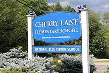
- In 2013, Cherry Lane Elementary School in Suffern
- In 2016, Nanuet Senior High School In Nanuet
- In 2018, Clarkstown High School South
Colleges and universities
The county is home to several colleges and universities. For more information please visit List of colleges and universities in New York (state)
- SUNY:
- Rockland Community College - Suffern, NY
- Private University:
- Dominican College (Dominican College of Blauvelt) - Orangeburg, NY
- Long Island University extension site at Rockland Community College - Suffern, NY
- Columbia University's Lamont–Doherty Earth Observatory
- Nyack College - Nyack, NY
- Rabbinical College Beth Shraga - Monsey, NY
- St. Thomas Aquinas College - Sparkill, NY
- Yeshiva D'Monsey Rabbinical College - Monsey, NY
- Yeshivath Viznitz - Kaser, NY (Monsey, NY}
High schools
School districts
- Clarkstown Central School District
- In 2015 U.S. News & World Report ranked Clarkstown North Senior High School with a Silver award as 135th Best High School in New York State and at 1,329 nationally.[17]
- In 2017 U.S. News & World Report ranked Clarkstown South Senior High School with a Silver award as 116th Best High School in New York State and at 1,219 nationally.
- In 2017 U.S. News & World Report ranked Clarkstown North Senior High School with a Silver award as 117th Best High School in New York State and at 1,224 nationally.
- In 2018, ranked 78 Best School Districts in Clarkstown by Niche's.
- East Ramapo Central School District
- In 2019, U.S. News & World Report ranked Ramapo High School 765th in New York State and 10,493th in the US.
- In 2019, U.S. News & World Report ranked Spring Valley High School 820th in New York State and 11,474th in the US.
- Nanuet Union Free School District
- In 2018, ranked 89 Best School Districts in Nanuet by Niche.
- In 2018, National School Boards Association 2018 Magna Award was awarded to the Nanuet Public Schools in recognition of the Outdoor Education Center.[18]
- North Rockland Central School District
- In 2017 U.S. News & World Report ranked North Rockland Senior High School with a Bronze award as New York's 219th Best High School.
- In 2018, ranked 179 2018 Best School Districts in North Rockland by Niche.
- Nyack Public Schools
- In 2018, ranked 68 Best School Districts in Nyack by Niche.
- Pearl River School District
- In 2017 U.S. News & World Report ranked Pearl River High School with a Silver award as 76th Best High School in New York State and at 727 nationally.
- In 2018, ranked 214 Best School Districts in Pearl River by Niche.
- Suffern Central School District
- Suffern Senior High School was ranked #53 (out of 938 public high schools) on Niche's 2016 Best Public High Schools in New York, and #343 (out of 16,464 public high schools) in the country.
- In 2017 U.S. News & World Report ranked Suffern Senior High School with a Silver award as 111th Best High School in New York State and #1179 nationally.
- In 2018, ranked 26 Best School Districts in Suffern by Niche
- South Orangetown Central School District
- In 2017 U.S. News & World Report ranked Tappan Zee High School with a Silver award as 66th Best High School in New York State and #643 nationally.
- In 2018, ranked 71 Best School Districts in Orangetown by Niche.
Transportation

The Tappan Zee Bridge connects South Nyack in Rockland County and Tarrytown in Westchester County across the Hudson River in the Lower Hudson Valley of New York State. The old bridge was replaced with a new span in 2017.[19]
Major highways
The county is served by several major highways, including Interstate 87/287 (the New York Thruway), opening from Suffern to Yonkers in 1955. The Tappan Zee Bridge opened the same year, connecting Rockland and Westchester, allowing Rockland County's population to grow rapidly. The Palisades Interstate Parkway, a project of master planner Robert Moses and built between 1947 and 1958, connects the county directly to the George Washington Bridge due south. The Garden State Parkway opened in 1955, connecting New Jersey to I-87/287.
For further information
- List of county routes in Rockland County, New York
- List of county routes in Rockland County, New York (1–38)
- List of county routes in Rockland County, New York (41–75)
- List of county routes in Rockland County, New York (76–118A)
Bus
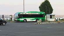
The Transport of Rockland operates several local bus routes throughout the county, as well as the express bus Hudson Link routes to city centers and train stations in Tarrytown and White Plains in Westchester County. TOR provides connections to other neighborhood bus operations – Minitrans[20] and connections to private commuter lines, Rockland Coaches and Short Line providing service to northern New Jersey and New York City.
Railroad
NJ Transit/Metro-North Railroad operates the Port Jervis Line, which stops at the Suffern Railroad Station and Sloatsburg Station, and the Pascack Valley Line, whose stops include Pearl River, Nanuet, and Spring Valley. in their respective hamlets and village of the same name. Connections on this line are available at Secaucus for service to Penn Station in Midtown Manhattan and service to the Meadowlands Sports Complex in East Rutherford, New Jersey. The southern terminus of both lines is Hoboken Terminal in New Jersey, where connections can be made to several NJ Transit bus lines, ferries, and PATH trains to New York City.
Until 1958, Rockland County's eastern side was served by the New York Central Railroad's passenger service on the West Shore Railroad from Weehawken, New Jersey, opposite Midtown Manhattan up through Tappan, west Nyack, Congers, Haverstraw, on to the West Hudson shore cities of Newburgh, Kingston and Albany. The service ran to West Haverstraw, in the north of the until 1959.[21][22] The Erie Railroad ran train service on the Northern Branch through the southeastern corner of the county to Nyack up to 1966.[23]
Ferry
NY Waterway operates a ferry service between Haverstraw and Ossining in Westchester County for the Metropolitan Transportation Authority. Commuters take the Transport of Rockland's Ferry Express route to the Haverstraw ferry terminal for service to Metro-North's Hudson Line service to Grand Central Terminal. Ferry service is typically suspended in the colder months when the Hudson River freezes over, and commuters must take shuttle buses across the Tappan Zee Bridge.
Airports
Nearby airports include:
Law, government and politics
United States House of Representatives
All of Rockland County falls within the 17th Congressional District, along with central and western Westchester County. The district is represented by Congresswoman Nita M. Lowey, a Democrat (as of 2019).
New York State politicians
The county of Rockland is represented in the New York State Senate by David Carlucci (D) of the 38th district and James Skoufis (D) of the 39th district (as of 2019).[24][25]
| Rockland County Assembly Members | ||
|---|---|---|
| Kenneth Zebrowski, Jr. | ||
| Ellen C. Jaffee | ||
County politicians
Rockland County government is led by County Executive. Republican Ed Day was first elected in 2013 and re-elected in 2017. The previous county executive was Republican C. Scott Vanderhoef, who was re-elected in 2009 to his fifth four-year term. Day is the third county executive in Rockland history, with Vanderhoef having defeated the incumbent, John T. Grant (D), in 1993. Prior to 1985, Rockland County did not have a county executive. County Executive Day was sworn in for his second term on January 1, 2018.
Rockland County has a county legislature made up of 17 members, elected from single-member districts.[26] The Chairman of the Legislature is Democrat Alden H. Wolfe. In the November 2019 election Republicans gained one seat, reducing the Democratic majority from 10–7 to 9–8. As of January 2020, the legislators are: Legislative District Maps
| Rockland County Legislators | |||
|---|---|---|---|
| District | Legislator | Party | Area Represented |
| Douglas J. Jobson | Republican | Stony Point | |
| Michael M. Grant | Democrat | West Haverstraw | |
| Jay Hood Jr. Majority Leader | Democrat | Haverstraw | |
| Itamar Yeger | Democrat | Wesley Hills | |
| Lon M. Hofstein Minority Leader | Republican | New City | |
| Alden H. Wolfe Chair | Democrat | Suffern | |
| Philip Soskin Deputy Majority Leader | Democrat | Monsey | |
| Toney L. Earl | Democrat | Hillcrest | |
| Christopher J. Carey | Republican | Bardonia | |
| Harriet D. Cornell | Democrat | West Nyack | |
| Laurie A. Santulli | Republican | Congers | |
| Charles J. Falciglia | Republican | Airmont | |
| Aron B. Wieder | Democrat | Monsey | |
| Aney Paul Vice Chair | Democrat | Nanuet | |
| John W. McGowan | Republican | Pearl River | |
| Vince D. Tyer Deputy Minority Leader | Republican | Pearl River | |
| James Foley | Republican | Sparkill | |
Town governments
The five towns of Rockland County are led by Town Supervisors and Town Boards. The villages encompassed in the towns are led by Mayors and Village Trustees.
As of the November 2019 elections, the town supervisors are:
| Rockland County Town Supervisors | ||
|---|---|---|
| Clarkstown | ||
| Haverstraw | ||
| Orangetown | ||
| Ramapo | ||
| Stony Point | ||
County courts
There are three types of general trial courts in Rockland County: the New York Supreme Court, the County Court and the Justice Courts. The Supreme Court is the trial level court of the New York State Unified Court System, which presents some confusion as the Supreme Court is the highest court of appeals in the federal system as well as in most states (the Court of Appeals is the highest court in New York State). The Supreme Court has broad authority over all categories of cases, both civil and criminal. Generally the Supreme Court in Rockland County hears civil cases involving claims in excess of $25,000. While the Supreme Court has jurisdiction over criminal cases in most counties this is handled by the County Courts. In Rockland however, the Supreme Court does exercise jurisdiction over some criminal cases.
The County Court is inferior to the Supreme Court and is authorized to hear criminal cases that have occurred in the county as well as limited jurisdiction over civil cases. The County Court handles felony cases exclusively and shares jurisdiction with the town and village justice courts on misdemeanor cases and other minor offenses and violations. The County Court's jurisdiction on civil cases is limited to those involving less than $25,000.
Each of the towns and fifteen of the villages have Justice Courts, which mostly hear routine traffic ticket cases, especially from the New York State Thruway and the Palisades Interstate Parkway. They also handle drunk driving charges, lower-level criminal misdemeanor matters, and occasionally perform arraignment on felonies (most felony proceedings are heard in County Court). These courts generally handle the highest volume of cases.
National politics
Like most of the Hudson Valley, Rockland County historically voted Republican. Between 1892 and 1992, Rockland County only voted Democratic three times–Lyndon B. Johnson's landslide victory of 1964, Franklin Delano Roosevelt's landslide victory in 1936 (in which it was the only New York City suburb to vote Democratic), and Woodrow Wilson's first campaign in 1912. Rockland shifted Democratic in 1992, and has since only voted Republican once, in 2004 for George W. Bush. Despite this shift, national elections have remained close in Rockland County as compared to neighboring Westchester County, which has witnessed dependable double-digit Democratic victories since the 1990s.
| Year | Republican | Democratic | Third parties |
|---|---|---|---|
| 2016 | 45.1% 60,911 | 51.3% 69,342 | 3.6% 4,834 |
| 2012 | 46.1% 57,428 | 52.8% 65,793 | 1.1% 1,424 |
| 2008 | 46.7% 61,752 | 52.6% 69,543 | 0.7% 898 |
| 2004 | 49.6% 65,130 | 48.9% 64,191 | 1.5% 1,910 |
| 2000 | 39.5% 48,441 | 56.7% 69,530 | 3.8% 4,619 |
| 1996 | 36.0% 40,395 | 56.2% 63,127 | 7.8% 8,719 |
| 1992 | 40.7% 49,608 | 46.6% 56,759 | 12.7% 15,464 |
| 1988 | 56.8% 63,825 | 42.4% 47,634 | 0.8% 842 |
| 1984 | 60.9% 70,020 | 38.9% 44,687 | 0.3% 311 |
| 1980 | 56.3% 59,068 | 33.6% 35,277 | 10.1% 10,648 |
| 1976 | 51.3% 52,087 | 47.9% 48,673 | 0.8% 780 |
| 1972 | 64.3% 64,753 | 35.5% 35,771 | 0.2% 196 |
| 1968 | 49.1% 40,880 | 44.4% 36,948 | 6.6% 5,479 |
| 1964 | 36.2% 26,187 | 63.7% 46,173 | 0.1% 82 |
| 1960 | 54.8% 33,107 | 45.0% 27,178 | 0.2% 113 |
| 1956 | 71.0% 34,049 | 29.0% 13,881 | |
| 1952 | 64.4% 27,657 | 35.1% 15,084 | 0.5% 212 |
| 1948 | 57.8% 20,661 | 36.6% 13,066 | 5.6% 2,001 |
| 1944 | 59.0% 19,471 | 40.7% 13,437 | 0.3% 91 |
| 1940 | 56.8% 20,040 | 42.2% 14,897 | 1.0% 362 |
| 1936 | 48.6% 15,583 | 49.5% 15,876 | 2.0% 631 |
| 1932 | 49.9% 13,963 | 47.7% 13,347 | 2.4% 672 |
| 1928 | 60.3% 15,732 | 37.5% 9,769 | 2.2% 571 |
| 1924 | 60.9% 11,915 | 28.8% 5,640 | 10.3% 2,004 |
| 1920 | 66.1% 11,169 | 29.9% 5,057 | 4.0% 671 |
| 1916 | 52.2% 5,041 | 46.3% 4,469 | 1.5% 149 |
| 1912 | 24.6% 2,221 | 46.9% 4,241 | 28.6% 2,586 |
| 1908 | 52.6% 4,857 | 42.7% 3,937 | 4.7% 433 |
| 1904 | 49.0% 4,283 | 48.6% 4,246 | 2.4% 213 |
| 1900 | 50.2% 4,187 | 48.2% 4,021 | 1.7% 139 |
| 1896 | 57.0% 4,336 | 39.4% 3,002 | 3.6% 276 |
| 1892 | 41.0% 2,909 | 53.4% 3,789 | 5.6% 395 |
| 1888 | 41.8% 3,013 | 54.7% 3,939 | 3.5% 251 |
| 1884 | 40.3% 2,593 | 57.4% 3,697 | 2.3% 151 |
Sports
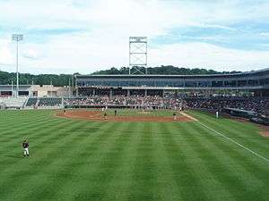
- The New York Boulders (formerly Rockland), a member of the Frontier League was founded in 2011 by former Yankee catcher John Flaherty of Pearl River, Clarkstown resident Michael Aglialoro (president of Clarkstown Education Foundation) and Stephen Mulvey (former part-owner of the Brooklyn-Los Angeles Dodgers). The team, owned by Bottom 9 Baseball, play their home games at the 4,350-seat, 16-suite Palisades Credit Union Park.
- Rockland Country Club is located in Sparkill, New York and features an 18-hole golf course.
- The New York Raiders, an American semi-professional rugby league football team based in Congers, New York, currently play in the American National Rugby League (AMNRL) competition. Their home games are at Rockland Lake State Park; they partner with the Canberra Raiders of Australia's National Rugby League (NRL).
Media
- The Journal News
- Our Town
- WRKL AM 910
- WRCR AM 1700
- Left of the Hudson
- Rockland World Radio
- Nyack News and Views
- Rockland County Times
- Rockland Review
- The Hook
- Rockland County's Best Magazine
- Clipper
- The 2017 CW series, Riverdale - Rockland County mentioned in pilot as site.
Health
Air quality
According to Scorecard.org, which integrates data from different sources including the U.S. Environmental Protection Agency (EPA), in 2002, Rockland County ranked among the worst 10% in the United States in terms of air releases.[28] Recent EPA statistics show that a total of 66 presently active Rockland County facilities are currently regulated.[29] In Scorecard's list of Top 10 polluters from 2002, the Lovett generating station in Tompkins Cove is the top polluter, releasing 1,523,339 pounds of toxic emissions.[30] Studies were released in 2000 and in 2004 by the Clean Air Task Force to study the impacts of power plant emissions in the United States. This data for Rockland County shows that a total of $2,150,800 was paid in compensation for numerous illnesses caused by power plant pollution, including asthma attacks, heart attacks and death.[31] The Lovett generating station was closed and dismantled prior to 2014. From 2015 to 2018, the Haverstraw Quarry owned and managed by CRH Tilcon and Oldcastle Materials was heavily fined for air and water pollution, including over-blasting, over-excavating, non-viable use of its NESCO unhealthy dust suppression systems and lethal dust & water runoffs into protected waterways. In the period from 2017 to 2020, Suez experienced instances of discolored water and odor complaints. [32] [33] Higher cancer rates in Rockland County as compared to Manhattan associate towards drinking water quality, aging drink water infra strucuture/storm drain runoff concerns.</ref>[34][35][36]
2020 coronavirus pandemic
In March 2020, the COVID-19 pandemic was first discovered in the county. This pandemic caused some confusion in the Rockland County Government. For several weeks after the New York State Governor enacted P.A.U.S.E., the Rockland Conty Government misinterpreted as to who was to enforce the executive order. http://rocklandgov.com/departments/county-executive/press-releases/2020-press-releases/statement-re-enforcement-of-governor-cuomo-s-executive-orders/ this was finally resolved after the State Government enlightened the Rockland County Government, that the health code gave law enforcement the legal authority to enforce the executive order. After the areas of Spring Valley and Monsey were identified as having the highest infection rates, County Executive Ed Day requested that state emergency management declare those areas a closed containment zone.[37] As of July 23, 2020, there are a total of 13,812 COVID-19 cases and 673 deaths. At 4,241 cases per 100,000, Rockland had the greatest density of COVID-19 cases of any New York county.[38]
Solar field
In 2014, Clarkstown created a first-of-its-kind in New York State 2.3-megawatt solar system consisting of about 4,300 panels on top of a closed, highly regulated, flat shadeless 13-acre section of the former garbage landfill in West Nyack. The unit is sized to generate 3 million kilowatt-hours annually – enough power to supply about 200 homes, that provides one-third of the electric needs of the Town of Clarkstown government. The Clarkstown solar field project is at the maximum size that is currently allowed by New York State. The installation was projected to save taxpayers as much as $4 million over 30 years by reducing the amount of the town's annual electric bill – which is about $2 million and produce 10 percent of all the electricity that O&R gets through solar power. The project was installed in summer 2014, coming online in October.[39][40][41]
Municipalities
Paul W. Adler, the chairperson of the Rockland County's Jewish Community Relations Council, said in a 1997 New York Times article that "There are two reasons villages get formed in Rockland. One is to keep the Hasidim out and the other is to keep the Hasidim in."[42]
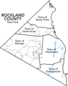
There are five towns in Rockland County. The most populous is Ramapo at 126,595, while the least populous is Stony Point, at 15,059, according to the 2010 US Census.
There are nineteen incorporated villages in Rockland County, twelve of which are located at least partially in the town of Ramapo, and none of which are in Stony Point. There are seventeen Census-designated places and seven Hamlets within the five towns of Rockland County.
Towns
Villages
Census-designated places
Hamlets
- Central Nyack
- Garnerville
- Jones Point
- Palisades
- Rockland Lake
- Sparkill Previously known as Tappan Sloat
- Tallman
- Tomkins Cove
Defunct communities
Points of interest
Educational and cultural
- Major John Andre Monument - Tappan, New York. Represents British army officer John André, put to death for assisting Benedict Arnold in his attempted surrender in West Point during the American Revolutionary War.
- Camp Shanks - Orangetown, New York. A museum in a former military camp, named for Major General David Carey Shanks (1861–1940).
- Edward Hopper Birthplace and Boyhood Home- Nyack, New York. The home of American realism painter Edward Hopper, now an art center.
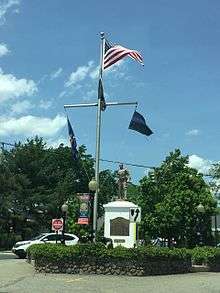
- Washington Avenue Soldier's Monument and Triangle - Suffern, New York. Honors George Washington and Rochambeau, where they encamped during the American Revolutionary War.
- The Old 76 House- Tappan, New York. One of the oldest bars in America, a meeting place for Patriots during the Revolutionary War, headquarters of Nathaniel Greene.
Commercial and entertainment
- Palisades Center - West Nyack, New York. Opened in 1998, one of America's largest shopping malls.
- The Shops at Nanuet - Nanuet, New York. Opened in 1969 as Nanuet Mall. It was the site of the notorious 1981 Brinks Robbery.
- Palisades Credit Union Park - Ramapo, New York. A baseball stadium home to the New York Boulders and the St. Thomas Aquinas College baseball team.
- Lafayette Theatre - A movie palace in downtown Suffern, New York.
- Blue Hill Plaza - Pearl River, New York. 21-story office tower and an eight-story office building on 90-acres of landscaped and wooded property.
- Rockland Bakery - Nanuet, New York. Opened in 1986, Rockland's biggest bakery, delivering bread and other baked products as far as New Jersey, Pennsylvania, and Connecticut.[43]
Parks
- Bear Mountain State Park - Stony Point, New York
- Blauvelt State Park - Blauvelt, New York
- Harriman State Park (bordered between Rockland and Orange County, New York)
- High Tor State Park - Clarkstown, New York
- Hook Mountain State Park - Clarkstown, New York
- Nyack Beach State Park - Upper Nyack, New York
- Rockland Lake State Park - Congers, New York
- Tallman Mountain State Park - Orangetown, New York
See also
References
- "QuickFacts Rockland County, New York". United States Census Bureau. Retrieved March 31, 2018.
- "Find a County". National Association of Counties. Retrieved June 7, 2011.
- "Rockland County". New York State. Retrieved January 4, 2019.
- "County of Rockland, New York :: Home". Co.rockland.ny.us. Archived from the original on March 11, 2012. Retrieved February 3, 2013.
- Italian Food Center (accessed 18 July 2019)
- Italian Fest Returns to Blauvelt (accessed 18 July 2019)
- 9th Annual Blauvelt Sons of Italy Festival (accessed 18 July 2019)
- Rockland County NY - Google Maps (accessed 10 July 2019)
- Rockhouse Mountain, New York (PeakBagger.com) Accessed 10 July 2019
- "2010 Census Gazetteer Files". US Census Bureau. August 22, 2012. Archived from the original on May 19, 2014. Retrieved January 7, 2015.
- "US Decennial Census". US Census Bureau. Retrieved July 10, 2019.
- "Historical Census Browser". University of Virginia Library. Retrieved January 7, 2015.
- "Population of Counties by Decennial Census: 1900 to 1990". US Census Bureau. Retrieved January 7, 2015.
- "Census 2000 PHC-T-4. Ranking Tables for Counties: 1990 and 2000" (PDF). US Census Bureau. Retrieved January 7, 2015.
- "U.S. Census website". US Census Bureau. Retrieved January 31, 2008.
- "Rockland County QuickFacts from the US Census Bureau". Quickfacts.census.gov. Retrieved February 17, 2018.
- 2015 Academic Indicators
- "Outdoor Education Center - National School Boards Association". www.nsba.org.
- Khurram Saeed and Theresa Juva-Brown (December 17, 2012). "It's official: State picks builder for new Tappan Zee Bridge". Copyright © 2012 www.lohud.com. All rights reserved. Retrieved January 9, 2013.
- "Minitrans". Town.clarkstown.ny.us. Archived from the original on May 15, 2016. Retrieved February 3, 2013.
- "Comments On The West Shore from James Knecht". Nyc.railfan.net. Retrieved January 19, 2018.
- "New York Central Railroad, Table 50". Official Guide of the Railways. National Railway Publication Company. 92 (7). December 1959.
- "COMMUTERS LOSE BID TO KEEP ERIE TRAINS", The New York Times, p. 58, October 3, 1966, retrieved June 7, 2010
- 38th District (accessed 10 July 2019)
- 39th District (accessed 10 July 2019)
- Elected Officials
- Leip, David. "Atlas of US Presidential Elections". uselectionatlas.org. Retrieved October 24, 2018.
- "Rockland County's general pollution report card". Scorecard.goodguide.com. October 28, 2003. Retrieved February 3, 2013.
- "Envirofacts Rockland county data sheet". Oaspub.epa.gov. December 22, 2008. Retrieved February 3, 2013.
- "Scorecard's Top ten polluters". Scorecard.goodguide.com. Retrieved February 3, 2013.
- "Clean Air Task Force interactive map". Catf.us. January 1, 1979. Archived from the original on March 3, 2012. Retrieved February 3, 2013.
- http://westchester.news12.com/story/41316609/nys-dept-of-health-visits-rockland-following-suez-water-complaints
- https://www.lohud.com/story/tech/science/environment/2015/11/27/dec-cites-tilcon-violations-haverstraw-quarry/76393854/
- https://www.lohud.com/story/news/local/rockland/haverstraw/2016/10/13/tilcon-haverstraw-noise-dust/91911218/
- https://dailyvoice.com/new-york/northrockland/news/state-dec-issues-violation-against-haverstraw-quarry/607237/
- https://www.dec.ny.gov/about/34315.html
- https://www.lohud.com/story/news/coronavirus/2020/04/02/ed-day-coronavirus-containment-zone-temporary-hospital/5110736002/
- "JHU COVID-19 Dashboard". Johns Hopkins University. Retrieved April 18, 2020.
- "Clarkstown Turns Old Landfill Into Solar Energy Field". Rockland Times. July 8, 2014. Retrieved July 10, 2019.
- Supervisor Hoehmann to Discuss Clarkston's Solar Field. Rockland Times (17 March 2017). Accessed 10 July 2019
- Supervisor Bio: George Hoehmann (accessed 10 July 2019)
- Berger, Joseph. "Growing Pains for a Rural Hasidic Enclave." The New York Times. January 13, 1997.
- Rockland Bakery. (n.d.). Our History. Retrieved March 30, 2020, from https://www.rocklandbakery.com/history
External links
- Rockland County official website
- The Historical Society of Rockland County
- Journal-News Rockland
- Rockland Review weekly newspaper
Places adjacent to Rockland County, New York | ||||||||||
|---|---|---|---|---|---|---|---|---|---|---|
| ||||||||||
Municipalities and communities of Rockland County, New York, United States | ||
|---|---|---|
| Towns | | |
| Villages | ||
| CDPs | ||
| Other hamlets | ||
| |||||||||
| |||||||||
| Authority control |
|
|---|