Mézières-sur-Couesnon
Mézières-sur-Couesnon (Breton: Magoerioù-ar-C'houenon, Gallo: Maézierr) is a commune in the Ille-et-Vilaine department in Brittany in northwestern France.
Mézières-sur-Couesnon Magoerioù-ar-C'houenon | |
|---|---|
_Mairie.jpg) The town hall and library of Mézières-sur-Couesnon | |
Location of Mézières-sur-Couesnon 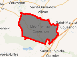
| |
 Mézières-sur-Couesnon 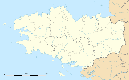 Mézières-sur-Couesnon | |
| Coordinates: 48°17′47″N 1°25′54″W | |
| Country | France |
| Region | Brittany |
| Department | Ille-et-Vilaine |
| Arrondissement | Rennes |
| Canton | Fougères-1 |
| Intercommunality | Pays de Saint-Aubin-du-Cormier |
| Government | |
| • Mayor (2014–2020) | Olivier Barbette |
| Area 1 | 24.74 km2 (9.55 sq mi) |
| Population (2017-01-01)[1] | 1,752 |
| • Density | 71/km2 (180/sq mi) |
| Time zone | UTC+01:00 (CET) |
| • Summer (DST) | UTC+02:00 (CEST) |
| INSEE/Postal code | 35178 /35140 |
| Elevation | 35–121 m (115–397 ft) (avg. 90 m or 300 ft) |
| 1 French Land Register data, which excludes lakes, ponds, glaciers > 1 km2 (0.386 sq mi or 247 acres) and river estuaries. | |
Geography
Mézières-sur-Couesnon is located 30 km (19 mi) northeast of Rennes and 42 km (26 mi) south of Mont Saint-Michel. As its name indicates, it is situated on the Couesnon River.
The bordering communes are Saint-Ouen-des-Alleux, Saint-Marc-sur-Couesnon, Saint-Jean-sur-Couesnon, Saint-Aubin-du-Cormier, Gahard, and Vieux-Vy-sur-Couesnon.
Population
Inhabitants of Mézières-sur-Couesnon are called Mézièrais in French.
| Year | Pop. | ±% |
|---|---|---|
| 1962 | 1,007 | — |
| 1968 | 962 | −4.5% |
| 1975 | 881 | −8.4% |
| 1982 | 816 | −7.4% |
| 1990 | 807 | −1.1% |
| 1999 | 822 | +1.9% |
| 2008 | 1,297 | +57.8% |
References
- "Populations légales 2017". INSEE. Retrieved 6 January 2020.
External links
| Wikimedia Commons has media related to Mézières-sur-Couesnon. |
- Geography of Brittany(in French)
- The page of the commune on infobretagne.com(in French)
- The data base Mérimée - the French architectural heritage(in French)
| Authority control |
|
|---|
This article is issued from Wikipedia. The text is licensed under Creative Commons - Attribution - Sharealike. Additional terms may apply for the media files.