Chauvigné
Chauvigné (Breton: Kelvinieg, Gallo: Chauveinyaé) is a commune in the Ille-et-Vilaine department in Brittany in northwestern France.
Chauvigné Kelvinieg | |
|---|---|
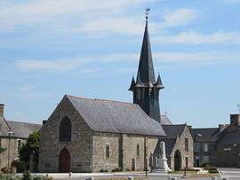 The church of Chauvigné | |
 Coat of arms | |
Location of Chauvigné 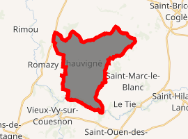
| |
 Chauvigné 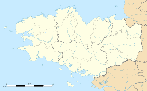 Chauvigné | |
| Coordinates: 48°22′36″N 1°27′32″W | |
| Country | France |
| Region | Brittany |
| Department | Ille-et-Vilaine |
| Arrondissement | Fougères-Vitré |
| Canton | Antrain |
| Intercommunality | Antrain |
| Government | |
| • Mayor (2014–2020) | Henri Rault |
| Area 1 | 17.71 km2 (6.84 sq mi) |
| Population (2017-01-01)[1] | 845 |
| • Density | 48/km2 (120/sq mi) |
| Time zone | UTC+01:00 (CET) |
| • Summer (DST) | UTC+02:00 (CEST) |
| INSEE/Postal code | 35075 /35490 |
| Elevation | 30–107 m (98–351 ft) |
| 1 French Land Register data, which excludes lakes, ponds, glaciers > 1 km2 (0.386 sq mi or 247 acres) and river estuaries. | |
Geography
Chauvigné is located at 38 km (24 mi) northeast of Rennes and 30 km (19 mi) south of the Mont Saint-Michel.
The communes bordering are Tremblay, Saint-Marc-le-Blanc, Le Tiercent, Saint-Christophe-de-Valains, Vieux-Vy-sur-Couesnon and Romazy.
Population
Inhabitants of Chauvigné are called Chauvignéens in French.
| Year | Pop. | ±% |
|---|---|---|
| 1793 | 972 | — |
| 1800 | 934 | −3.9% |
| 1806 | 946 | +1.3% |
| 1821 | 937 | −1.0% |
| 1831 | 971 | +3.6% |
| 1836 | 976 | +0.5% |
| 1841 | 938 | −3.9% |
| 1846 | 1,047 | +11.6% |
| 1851 | 1,156 | +10.4% |
| 1856 | 1,165 | +0.8% |
| 1861 | 1,204 | +3.3% |
| 1866 | 1,229 | +2.1% |
| 1872 | 1,292 | +5.1% |
| 1876 | 1,267 | −1.9% |
| 1881 | 1,208 | −4.7% |
| 1886 | 1,204 | −0.3% |
| 1891 | 1,200 | −0.3% |
| 1896 | 1,180 | −1.7% |
| 1901 | 1,129 | −4.3% |
| 1906 | 1,194 | +5.8% |
| 1911 | 1,172 | −1.8% |
| 1921 | 1,057 | −9.8% |
| 1926 | 964 | −8.8% |
| 1931 | 987 | +2.4% |
| 1936 | 959 | −2.8% |
| 1946 | 887 | −7.5% |
| 1954 | 840 | −5.3% |
| 1962 | 789 | −6.1% |
| 1968 | 741 | −6.1% |
| 1975 | 704 | −5.0% |
| 1982 | 617 | −12.4% |
| 1990 | 566 | −8.3% |
| 1999 | 575 | +1.6% |
| 2008 | 770 | +33.9% |
References
- "Populations légales 2017". INSEE. Retrieved 6 January 2020.
External links
| Wikimedia Commons has media related to Chauvigné. |
- Geography of Brittany
- The page of the commune on infobretagne.com
- The data base Mérimée - the French architectural heritage
| Authority control |
|
|---|
This article is issued from Wikipedia. The text is licensed under Creative Commons - Attribution - Sharealike. Additional terms may apply for the media files.