Libertytown, Maryland
Libertytown is an unincorporated community and census-designated place (CDP) in Frederick County, in the U.S. state of Maryland.[2] As of the 2010 census it had a population of 950.[3] The Abraham Jones House was listed on the National Register of Historic Places in 1973.[4]
Libertytown, Maryland | |
|---|---|
_between_Maryland_State_Route_550_(Woodsboro_Road)_and_Trammels_Alley_in_Libertytown%2C_Frederick_County%2C_Maryland.jpg) MD 26 through Libertytown | |
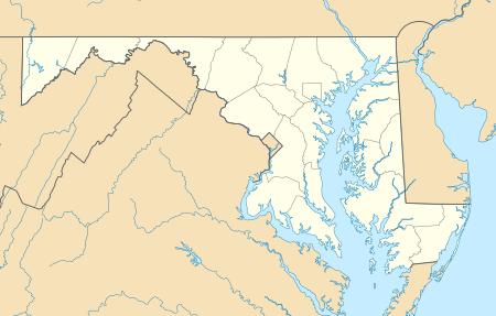 Libertytown Location in Maryland  Libertytown Libertytown (the United States) | |
| Coordinates: 39°29′5″N 77°14′31″W | |
| Country | |
| State | |
| County | |
| Area | |
| • Total | 2.42 sq mi (6.26 km2) |
| • Land | 2.41 sq mi (6.24 km2) |
| • Water | 0.004 sq mi (0.01 km2) |
| Elevation | 490 ft (150 m) |
| Population (2010) | |
| • Total | 950 |
| • Density | 394/sq mi (152.2/km2) |
| Time zone | UTC−5 (Eastern (EST)) |
| • Summer (DST) | UTC−4 (EDT) |
| ZIP code | 21762 Post Office, 21791 and 21701, RFD |
| Area code(s) | 301 and 240, Walkersville and Frederick Exchanges, Telephone exchange names |
| FIPS code | 24-46800 |
| GNIS feature ID | 0590664[1] |
Geography
The community is in eastern Frederick County, along Maryland Route 26 (Liberty Road), which leads east 34 miles (55 km) to Baltimore and southwest 11 miles (18 km) to Frederick. Maryland Route 75 crosses MD 26 in the center of town, leading northeast 8 miles (13 km) to Union Bridge and south 7 miles (11 km) to New Market. Maryland Route 31 intersects MD 26 on the east edge of town and leads northeast 17 miles (27 km) to Westminster. Maryland Route 550 leaves MD 26 in the western part of town and leads northwest 5 miles (8 km) to Woodsboro.
According to the U.S. Census Bureau, the Libertytown CDP has a total area of 2.4 square miles (6.3 km2), of which 0.006 square miles (0.015 km2), or 0.23%, is water.[3]
Education
Libertytown is the location of Liberty Elementary School. Liberty opened its doors in 1927, teaching grades 1 through 12. In 1945, Liberty graduated its final senior class and continued teaching junior high until 1962.
Notre Dame Academy is a Catholic elementary school in Libertytown.
Recreation
Libertytown Park contains picnic gazebos and a county maintained rain garden. This regional park also has two baseball fields: one for Little League and another regulation-sized baseball field. Additional facilities include a basketball court, three tennis courts, and a large field space for football or soccer. A wildlife trail of 2.4 miles (3.9 km) along the perimeter of the park not only is accessible from within the park, but also is accessible off Dollyhide Road with additional parking. The trails runs through a native Bobwhite quail protection area maintained by Quail Forever.
References
- U.S. Geological Survey Geographic Names Information System: Libertytown, Maryland
- "Geographic Names Information System". Libertytown (Populated Place). U.S. Geological Survey. 2009-01-29.
- "Geographic Identifiers: 2010 Census Summary File 1 (G001), Libertytown CDP, Maryland". American FactFinder. U.S. Census Bureau. Archived from the original on February 13, 2020. Retrieved June 1, 2016.
- "National Register Information System". National Register of Historic Places. National Park Service. April 15, 2008.
.svg.png)
Municipalities and communities of Frederick County, Maryland, United States | ||
|---|---|---|
| Cities | 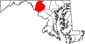 | |
| Towns | ||
| Village | ||
| CDPs | ||
| Other communities |
| |
| Footnotes | ‡This populated place also has portions in an adjacent county or counties | |