Zerega Avenue station
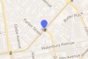
Zerega Avenue is a local station on the IRT Pelham Line of the New York City Subway. Located at Zerega Avenue and Westchester Avenue in the Westchester Square section of the Bronx, it is served by the 6 train at all times except weekdays in the peak direction, when the <6> train takes over.
Zerega Avenue | |||||||||
|---|---|---|---|---|---|---|---|---|---|
 Platforms | |||||||||
| Station statistics | |||||||||
| Address | Zerega Avenue & Westchester Avenue Bronx, NY 10461 | ||||||||
| Borough | The Bronx | ||||||||
| Locale | Westchester Square | ||||||||
| Coordinates | 40.836769°N 73.846793°W | ||||||||
| Division | A (IRT) | ||||||||
| Line | IRT Pelham Line | ||||||||
| Services | 6 | ||||||||
| Transit connections | |||||||||
| Structure | Elevated | ||||||||
| Platforms | 2 side platforms | ||||||||
| Tracks | 3 (2 in regular service) | ||||||||
| Other information | |||||||||
| Opened | October 24, 1920 | ||||||||
| Rebuilt | July 5, 2014 to April 27, 2015[1] | ||||||||
| Station code | 364[2] | ||||||||
| Opposite-direction transfer available | Yes | ||||||||
| Traffic | |||||||||
| Passengers (2019) | 795,756[3] | ||||||||
| Rank | 382 out of 424[3] | ||||||||
| Station succession | |||||||||
| Next north | Westchester Square–East Tremont Avenue: 6 | ||||||||
| Next south | Castle Hill Avenue: 6 | ||||||||
| |||||||||
| |||||||||
| |||||||||
History

This station was built as part of the Pelham Line, which was part of the Dual Contracts, signed on March 19, 1913 and also known as the Dual Subway System.[4] The Pelham Line was proposed to be a branch of the Lexington Avenue Line running northeast via 138th Street, Southern Boulevard and Westchester Avenue to Pelham Bay Park.[5] This station opened on October 24, 1920, with the line's extension from East 177th Street to Westchester Square.[6][7][8]:2389 Service was initially served by a mix of through and shuttle trains during the 1920s.[9]:73–74
From July 5, 2014 to April 27, 2015, as part of a $109 million rebuilding project at five Pelham Line stations,[1] this station, along with Buhre Avenue, was closed for station rehabilitation work.[10][11]
Station layout
| P Platform level |
Side platform | |
| Southbound local | ← | |
| Peak-direction express | No regular service | |
| Northbound local | | |
| Side platform | ||
| M | Mezzanine | Fare control, station agent, MetroCard machines |
| G | Street level | Exit/entrance |
_by_David_Shankbone.jpg)
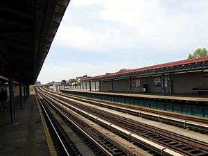
This elevated station has three tracks and two side platforms. The center track is not used in regular service.
It resembles other elevated stations along the line: it has wood mezzanines and no windscreens along the platform edges.
Exits
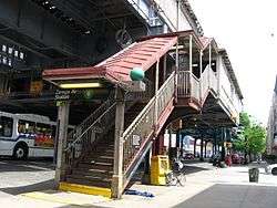
The station's only exit is a mezzanine beneath the tracks. Outside fare control, stairs lead to the northeast and southwest corners of Westchester Avenue and Zerega Avenue.[12]
References
- "Zerega Av and Buhre Av 6 Stations To Reopen After Renewal Project". mta.info (Press release). Metropolitan Transportation Authority. April 24, 2015. Retrieved April 26, 2015.
- "Station Developers' Information". Metropolitan Transportation Authority. Retrieved June 13, 2017.
- "Facts and Figures: Annual Subway Ridership 2014–2019". Metropolitan Transportation Authority. 2020. Retrieved May 26, 2020.
- nycsubway.org—The Dual Contracts
- "The Dual System of Rapid Transit (1912)". www.nycsubway.org. Retrieved March 25, 2014.
- "Subway Extension Opens Sunday". The New York Times. October 22, 1920. ISSN 0362-4331. Retrieved December 14, 2016.
- Brooklyn Daily Eagle Almanac. Brooklyn Daily Eagle. 1922. p. 372.
- Moodys Manual of Railroads and Corporation Securities. Moody Manual Company. 1922.
- Annual Report. J.B. Lyon Company. 1922.
- "Zerega Avenue and Buhre Avenue 6 Line Stations to Close for Seven Months for Renewal". Retrieved April 11, 2016.
- "Service Notice". mta.info. Metropolitan Transportation Authority. Retrieved April 11, 2016.
- "MTA Neighborhood Maps: Pelham Bay" (PDF). mta.info. Metropolitan Transportation Authority. 2015. Retrieved July 20, 2016.
External links
| Wikimedia Commons has media related to Zerega Avenue (IRT Pelham Line). |
- nycsubway.org – IRT Pelham Line: Zerega Avenue
- Station Reporter — 6 Train
- The Subway Nut — Zerega Avenue Pictures
- Zerega Avenue entrance from Google Maps Street View
- Platforms from Google Maps Street View


