Weldon, California
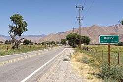
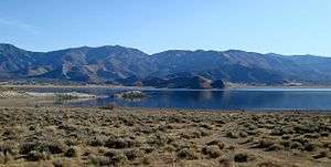
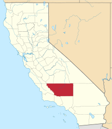
Weldon is a census-designated place (CDP) in Kern County, California, United States. It sits at the southeast tip of Lake Isabella. Weldon is located 9 miles (14 km) east-southeast of Wofford Heights,[5] at an elevation of 2,654 feet (809 m).[4] The population was 2,642 at the 2010 census, up from 2,387 at the 2000 census.
Weldon | |
|---|---|
 | |
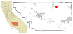
 Location in Kern County and the state of California | |
 Weldon Location in the United States | |
| Coordinates: 35°39′57″N 118°17′25″W | |
| Country | |
| State | |
| County | Kern |
| Government | |
| • State senator | Shannon Grove (R)[1] |
| • Assemblymember | Devon Mathis (R)[1] |
| • U. S. rep. | Kevin McCarthy (R)[2] |
| Area | |
| • Total | 26.793 sq mi (69.394 km2) |
| • Land | 26.642 sq mi (69.002 km2) |
| • Water | 0.151 sq mi (0.392 km2) 0.56% |
| Elevation | 2,654 ft (809 m) |
| Population (2010) | |
| • Total | 2,645 |
| • Density | 99/sq mi (38/km2) |
| Time zone | UTC-8 (PST) |
| • Summer (DST) | UTC-7 (PDT) |
| ZIP code | 93283 |
| Area codes | 442/760 |
| FIPS code | 06-83948 |
| GNIS feature ID | 0255860 |

Geography
Weldon is located at 35°39′57″N 118°17′25″W.[4]
According to the United States Census Bureau, the CDP has a total area of 26.8 square miles (69 km2), over 99% of it land.
History
The Weldon post office opened in 1871.[5] The name honors William B. Weldon, a cattle rancher.[5] Camp Leonard, a temporary army camp, was established at Weldon in 1863.[5] [6]
The 1941 western film Doomed Caravan was partially filmed in Weldon.[7] Other movies filmed here include Borderland (1937), In Old Mexico (1938) and Hidden Gold (1940).[8]
Demographics
2010
At the 2010 census Weldon had a population of 2,642. The population density was 98.6 people per square mile (38.1/km2). The racial makeup of Weldon was 2,375 (89.9%) White, 5 (0.2%) African American, 82 (3.1%) Native American, 11 (0.4%) Asian, 1 (0.0%) Pacific Islander, 53 (2.0%) from other races, and 115 (4.4%) from two or more races. Hispanic or Latino of any race were 217 people (8.2%).[9]
The census reported that 2,636 people (99.8% of the population) lived in households, no one lived in non-institutionalized group quarters and 6 (0.2%) were institutionalized.
There were 1,167 households, 254 (21.8%) had children under the age of 18 living in them, 541 (46.4%) were opposite-sex married couples living together, 117 (10.0%) had a female householder with no husband present, 78 (6.7%) had a male householder with no wife present. There were 78 (6.7%) unmarried opposite-sex partnerships, and 18 (1.5%) same-sex married couples or partnerships. 351 households (30.1%) were one person and 179 (15.3%) had someone living alone who was 65 or older. The average household size was 2.26. There were 736 families (63.1% of households); the average family size was 2.74.
The age distribution was 484 people (18.3%) under the age of 18, 178 people (6.7%) aged 18 to 24, 443 people (16.8%) aged 25 to 44, 856 people (32.4%) aged 45 to 64, and 681 people (25.8%) who were 65 or older. The median age was 50.7 years. For every 100 females, there were 98.3 males. For every 100 females age 18 and over, there were 100.0 males.
There were 1,583 housing units at an average density of 59.1 per square mile, of the occupied units 901 (77.2%) were owner-occupied and 266 (22.8%) were rented. The homeowner vacancy rate was 4.2%; the rental vacancy rate was 7.8%. 1,923 people (72.8% of the population) lived in owner-occupied housing units and 713 people (27.0%) lived in rental housing units.
2000
At the 2000 census there were 2,387 people, 1,087 households, and 703 families living in the CDP. The population density was 89.5 people per square mile (34.6/km2). There were 1,441 housing units at an average density of 54.0 per square mile (20.9/km2). The racial makeup of the CDP was 91.33% White, 0.42% Black or African American, 3.94% Native American, 0.46% Asian, 0.13% Pacific Islander, 0.88% from other races, and 2.85% from two or more races. 6.24% of the population were Hispanic or Latino of any race.[10] Of the 1,087 households 19.2% had children under the age of 18 living with them, 51.2% were married couples living together, 9.8% had a female householder with no husband present, and 35.3% were non-families. 30.6% of households were one person and 18.6% were one person aged 65 or older. The average household size was 2.20 and the average family size was 2.73.
The age distribution was 20.3% under the age of 18, 2.8% from 18 to 24, 17.6% from 25 to 44, 28.3% from 45 to 64, and 31.0% 65 or older. The median age was 52 years. For every 100 females, there were 97.3 males. For every 100 females age 18 and over, there were 93.4 males.
The median household income was $22,857 and the median family income was $26,500. Males had a median income of $35,573 versus $20,208 for females. The per capita income for the CDP was $15,243. About 14.9% of families and 18.7% of the population were below the poverty line, including 23.7% of those under age 18 and 13.6% of those age 65 or over.
References
- "Statewide Database". Regents of the University of California. Retrieved April 6, 2015.
- "California's 23rd Congressional District - Representatives & District Map". Civic Impulse, LLC.
- U.S. Census
- U.S. Geological Survey Geographic Names Information System: Weldon, California
- Durham, David L. (1998). California's Geographic Names: A Gazetteer of Historic and Modern Names of the State. Clovis, Calif.: Word Dancer Press. p. 1125. ISBN 1-884995-14-4.
- Historic California Posts: Camp Leonard, from The California State Military Museum website, accessed September 15, 2011
- Schneider, Jerry L. (2016). Western Filming Locations California Book 6. CP Entertainment Books. Page 73. ISBN 9780692722947.
- Schneider, Jerry L. (2016). Western Filming Locations California Book 6. CP Entertainment Books. Page 70. ISBN 9780692722947.
- "2010 Census Interactive Population Search: CA - Weldon CDP". U.S. Census Bureau. Archived from the original on July 15, 2014. Retrieved July 12, 2014.
- "U.S. Census website". United States Census Bureau. Retrieved 2008-01-31.
