Tri-Valley
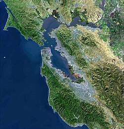
The Tri-Valley area is a triangle-shaped region of the eastern San Francisco Bay Area, 18 miles southeast of Oakland and 33 miles from San Francisco. It encompasses the cities of Dublin, Livermore, Pleasanton and San Ramon, the town of Danville and the CDPs of Alamo, Blackhawk and Diablo.
Tri-Valley | |
|---|---|
Region | |
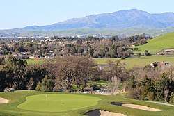
 Tri-Valley Landscape | |
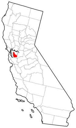
 Tri-Valley location in California | |
 Tri-Valley Location in the United States | |
| Coordinates: 37°39′45″N 121°52′29″W | |
| Population | |
| • Total | 361,000 |
| Time zone | Pacific Time Zone |
The three valleys from which it takes its name are Amador Valley, Livermore Valley and San Ramon Valley. The region is well known for its Mediterranean climate, wineries, historic downtown areas, high cost of living and fine dining. It is a primarily affluent suburban area with a population of about 361,000.[1] It offers more affordable living accommodations than the cities of San Francisco and San Jose.[2][3]
History
The Ohlone tribe settled the area circa 2000 BCE, particularly in the northern part of Pleasanton. In 1772 CE, however, Spanish settlers involved with the nearby mission work at Mission San Jose restructured the Ohlone way of life. https://www.nps.gov/goga/learn/historyculture/upload/Chapter-9.pdf [4]
The area began to be developed when the Gold Rush ended. During this period, the area went from being marshland to agricultural.[5]
Climate
The climate of the Tri-Valley is mild. Most rain falls in the winter. Snow almost never occurs, although it sometimes falls on the tops of surrounding mountains, especially Mt. Diablo. Summer days are in the 80s to over 100 °F, but nights are often cool. In winter, daytime temperatures reach the 50s and 60s, while nights are in the 30s and 40s, dipping on rare occasions into the 20s. Mean annual rainfall ranges from about 14 inches in Livermore to 23 inches in Alamo.[6]
Transportation
The Tri-Valley is serviced by WHEELS, operated by LAVTA, formerly called Tri-Valley Transit, a bus agency that operates local bus service in addition to feeder service to Hacienda Business Park, Lawrence Livermore National Laboratory, Las Positas College, Stoneridge Mall, and Dublin/Pleasanton BART station.
Two major highways, Interstates 580 and 680 cross the Tri-Valley area. Interstate 580 runs east-west, connecting the area to the Central Valley to the east and the North Bay area to the west. Interstate 680 runs north-south, connecting the area to the South Bay area in the south, and the Concord-Walnut Creek area in the north. The two interstates cross on the border of Dublin and Pleasanton.
The Tri-Valley area is also serviced by BART, offering service to the rest of the San Francisco Bay Area via two stops: West Dublin/Pleasanton and the Dublin/Pleasanton terminus station.[7] The West Dublin/Pleasanton Station opened in 2011, and was the first infill station on an existing line. In 2018, BART cancelled plans[8] to extend the line to Livermore. However, the Tri-Valley San Joaquin Valley Regional Rail Authority is in the planning process[9] for a rail connection between BART, ACE, and the San Joaquin Valley.
Economy
The Tri-Valley is home to the corporate headquarters of many companies, including 24 Hour Fitness, Architectural Glass and Aluminum, Bay Area News Group, Blackhawk Network Holdings, CallidusCloud, Chevron, The Cooper Companies, Discovery Toys, Ellie Mae, GE Digital, Gillig Corporation, Patelco Credit Union, Prosoft Engineering, Ross Stores, SafeAmerica Credit Union, Safeway, Shaklee, Veeva Systems, Visioneer, WANdisco, The Wine Group and Workday.
Major employment centers include Bishop Ranch and Hacienda Business Park.
Lawrence Livermore National Laboratory and Sandia National Laboratories are also major employers in the region.
Recreation
The Tri-Valley features access to many recreational options, including Alviso Adobe Community Park, Blackhawk Museum, Brushy Peak Regional Preserve, Del Valle Regional Park, Dublin Hills Regional Park, Eugene O'Neill National Historic Site, Forest Home Farms, Iron Horse Regional Trail, Las Trampas Regional Wilderness, Little Hills Picnic Ranch, Livermore Valley Wine Country, Morgan Territory Regional Preserve, Mount Diablo State Park, Pleasanton Ridge Regional Park, Shadow Cliffs Regional Recreation Area and The Wave Waterpark.
See also
- East Bay (San Francisco Bay Area)
- Tri-Valley Community Television
- Livermore Valley AVA
- Visit Tri-Valley
- Innovation Tri-Valley
- The Mirador View: Perspectives on the Tri-Valley: The Intersection of Talent & Technology
- i-GATE Innovation Hub & The Switch
- Bishop Ranch Intelligence Innovation Accelerator (BRIIA)
References
- http://www.diablomag.com/February-2019/Tri-Valley-Boomtowns/
- CBS (2017). "10 Most Expensive Cities in America". CBS.
- CBS (2017). "10 Most Expensive Cities in America". CBS.
- "History of Pleasanton". pleasanton.com. Archived from the original on November 8, 2017. Retrieved 2018-01-01.
- "History of Pleasanton". Museum on Main. Retrieved 2018-01-01.
- "Cooperative Climatological Data Summaries". Western Regional Climate Center. Retrieved 2018-11-24.
- "Station List | bart.gov". www.bart.gov. Retrieved 2018-01-01.
- "Livermore Extension | bart.gov". www.bart.gov. Retrieved 2019-06-13.
- "ValleyLink". www.acetobart.org. Retrieved 2019-06-13.

