Tongibari Upazila
Tongibari (Bengali: টঙ্গিবাড়ী) is an Upazila of Munshiganj District[1] in the Division of Dhaka, Bangladesh.
Tongibari টংগিবাড়ী | |
|---|---|
Upazila | |
 Tongibari Location in Bangladesh | |
| Coordinates: 23°30′N 90°27.5′E | |
| Country | |
| Division | Dhaka Division |
| District | Munshiganj District |
| Area | |
| • Total | 149.96 km2 (57.90 sq mi) |
| Population (1991) | |
| • Total | 176,881 |
| • Density | 1,200/km2 (3,100/sq mi) |
| Time zone | UTC+6 (BST) |
| Website | tongibari |
Geography
Tongibari is located at {{#|23°30′N 90°27.5′E|}} . It has 31346 households and total area 149.96 km2.
Demographics
As of the 1991 Bangladesh census, Tongibari has a population of 176881. Males constitute 52.46% of the population, and females 47.54%. This Upazila's eighteen up population is 83593. Tongibari has an average literacy rate of 35.6% (7+ years), and the national average of 32.4% literate.[2]
Administration
Tongibari Upazila is divided into 12 union parishads: Abdullapur, Arial Baligaon, Autasahi, Betka, Dhipur, Dighirpar, Hasaila Banari, Joslong, Kamarkhara, Kathadia Shimolia, Panchgaon, and Sonarong Tongibari. The union parishads are subdivided into 113 mauzas and 156 villages.
Primary schools
Here is a list of all the primary schools in this Upazila.
- Tongibary Model Govt. Primary School
Secondary schools
Here is a list of all the secondary schools in this Upazila.
- Sonarong Pilot High School
Colleges
Here is a list of all the colleges in this Upazila.
- Bikrampur Tongibari College
See also
- Upazilas of Bangladesh
- Districts of Bangladesh
- Divisions of Bangladesh
References
- Masuma Sultana Champa (2012), "Tongibari Upazila", in Sirajul Islam and Ahmed A. Jamal (ed.), Banglapedia: National Encyclopedia of Bangladesh (Second ed.), Asiatic Society of BangladeshCS1 maint: uses authors parameter (link)
- "Population Census Wing, BBS". Archived from the original on 2005-03-27. Retrieved November 10, 2006.
| Upazila/Thana: |
| |
|---|---|---|
Headquarters: Dhaka | ||
| Dhaka District | 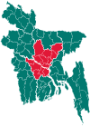 | |
| Faridpur District | ||
| Gazipur District | ||
| Gopalganj District | ||
| Kishoreganj District | ||
| Madaripur District |
| |
| Manikganj District | ||
| Munshiganj District |
| |
| Narayanganj District | ||
| Narsingdi District | ||
| Rajbari District |
| |
| Shariatpur District |
| |
| Tangail District | ||