Itna Upazila
Itna (Bengali: ইটনা) is an Upazila of Kishoreganj District in the Division of Dhaka, Bangladesh.[1]
Itna ইটনা | |
|---|---|
Upazila | |
 Itna Location in Bangladesh | |
| Coordinates: 24°32′N 91°5′E | |
| Country | |
| Division | Dhaka Division |
| District | Kishoreganj District |
| Area | |
| • Total | 401.94 km2 (155.19 sq mi) |
| Population (1991) | |
| • Total | 132,948 |
| • Density | 330/km2 (860/sq mi) |
| Time zone | UTC+6 (BST) |
| Website | Official Map of Itna |
Geography
Itna is located at 24.5333°N 91.0833°E . It has 23943 households and total area 401.94 km².
Demographics
As of the 1991 Bangladesh census, Itna has a population of 132948. Males constitute 52.14% of the population, and females 47.86%. This Upazila's eighteen up population is 63852. Itna has an average literacy rate of 16% (7+ years), and the national average of 32.4% literate.[2]
Administration
Itna has 8 Unions/Wards, 85 Mauzas/Mahallas, and 117 villages.
gollark: A beesolang, if you will.
gollark: What about an actor-model esolang with bees?
gollark: Feature idea for some random esolang: using diacritics to modify behavior of operators in some way?
gollark: Yes, although the unprintable lang never went anywhere.
gollark: Meh, out of scope.
See also
- Upazilas of Bangladesh
- Districts of Bangladesh
- Divisions of Bangladesh
References
- Saurav Jahangir (2012), "Itna Upazila", in Sirajul Islam and Ahmed A. Jamal (ed.), Banglapedia: National Encyclopedia of Bangladesh (Second ed.), Asiatic Society of Bangladesh
- "Population Census Wing, BBS". Archived from the original on 2005-03-27. Retrieved November 10, 2006.
| Upazila/Thana: | ||
|---|---|---|
Headquarters: Dhaka | ||
| Dhaka District | 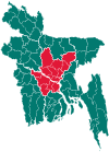 | |
| Faridpur District | ||
| Gazipur District | ||
| Gopalganj District | ||
| Kishoreganj District | ||
| Madaripur District |
| |
| Manikganj District | ||
| Munshiganj District |
| |
| Narayanganj District | ||
| Narsingdi District | ||
| Rajbari District |
| |
| Shariatpur District |
| |
| Tangail District | ||
This article is issued from Wikipedia. The text is licensed under Creative Commons - Attribution - Sharealike. Additional terms may apply for the media files.