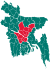
Nawabganj Upazila, Dhaka
Nawabganj (Bengali: নবাবগঞ্জ) is an Upazila of Dhaka District in the Division of Dhaka, Bangladesh.[1]
Nawabganj নবাবগঞ্জ | |
|---|---|
Upazila | |
 Nawabganj Location in Bangladesh | |
| Coordinates: 23°40′N 90°10′E | |
| Country | |
| Division | Dhaka Division |
| District | Dhaka District |
| Area | |
| • Total | 244.81 km2 (94.52 sq mi) |
| Population (1991) | |
| • Total | 269,189 |
| • Density | 1,100/km2 (2,800/sq mi) |
| Time zone | UTC+6 (BST) |
| Website | Official Map of Nawabganj |
Geography
Nawabganj is located at 23.6667°N 90.1667°E. It has 47,411 households and total area 244.81 km2.
Demographics
As of the 1991 Bangladesh census, Nawabganj had a population of 269,189. Males constituted 49.31% of the population, and females 50.69%. 134,813 residents were over eighteen. Nawabganj had an average literacy rate of 34.5% (7+ years). For reference, the national average is 32.4%.[2]
Nawabganj is surrounded by Singair upazila on the north, Dohar upazila on the south, Keraniganj, sirajdikhan and Sreenagar upazilas on the east, Harirampur and Manikganj Sadar upazilas on the west. Nawabganj thana, now an upazila, was established in 1974.
gollark: What's vlang **actually** able to do now, anyway?
gollark: > 0.0000000000001 msec/$So if I donate it compiles *slower*?
gollark: Like all my ideas, yes.
gollark: Each two shirts look basically the same, but they'll look different as you go through them.
gollark: Fun idea: buy 360 shirts and put slightly different colors on each (using HSL or something) and wear one every day for a year.
See also
- Upazilas of Bangladesh
- Districts of Bangladesh
- Divisions of Bangladesh
References
- Md. Abu Hasan Farooque (2012). "Nawabganj Upazila (Dhaka District)". In Sirajul Islam and Ahmed A. Jamal (ed.). Banglapedia: National Encyclopedia of Bangladesh (Second ed.). Asiatic Society of Bangladesh.
- "Population Census Wing, BBS". Archived from the original on 2005-03-27. Retrieved November 10, 2006.
This article is issued from Wikipedia. The text is licensed under Creative Commons - Attribution - Sharealike. Additional terms may apply for the media files.
