Mithamain Upazila
Mithamain (Bengali: মিটামইন) is an Upazila of Kishoreganj District in the Division of Dhaka, Bangladesh.[1]
Mithamain মিটামইন | |
|---|---|
Upazila | |
 Mithamain Location in Bangladesh | |
| Coordinates: 24°25.5′N 91°2.7′E | |
| Country | |
| Division | Dhaka Division |
| District | Kishoreganj District |
| Area | |
| • Total | 222.92 km2 (86.07 sq mi) |
| Population (1991) | |
| • Total | 108,204 |
| • Density | 490/km2 (1,300/sq mi) |
| Time zone | UTC+6 (BST) |
| Website | Official Map of Mithamain |
Geography
Mithamain is located at 24.4250°N 91.0458°E. Mithamain has 17,183 households and a total land area of 222.92 km².
Demographics
As of the 1991 Bangladesh census, Mithamain's population is 108,204. The population's male to female ratio is 51.79% to 48.21%. 49,034 of Upazila's population is aged 18 or above. Mithamain has an average literacy rate of 15.6% (7+ years). The literary rate nationally is 32.4%.[2]
Administration
Mithamain has 6 Unions/Wards, 59 Mauzas/Mahallas and 129 villages.
gollark: If it uses a sensible SSH program, yes.
gollark: You can put all the configuration in there and just type `ssh loki`, it's very convenient.
gollark: You know you can do this in `~/.ssh/config`, right?```Host loki HostName osmarks.tk User osmarks IdentityFile ~/.ssh/id_ed25519_loki Port 1022```?
gollark: Mostly I just copypaste them.
gollark: It barely holds together through a pile of horrible hacks.
See also
- Upazilas of Bangladesh
- Districts of Bangladesh
- Divisions of Bangladesh
References
- Shokorana, Mokarram Hussain (2012). "Mithamain Upazila". In Islam, Sirajul; Jamal, Ahmed A. (eds.). Banglapedia: National Encyclopedia of Bangladesh (Second ed.). Asiatic Society of Bangladesh.
- "Population Census Wing, BBS". Archived from the original on 2005-03-27. Retrieved November 10, 2006.
| Upazila/Thana: | ||
|---|---|---|
Headquarters: Dhaka | ||
| Dhaka District | 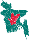 | |
| Faridpur District | ||
| Gazipur District | ||
| Gopalganj District | ||
| Kishoreganj District | ||
| Madaripur District |
| |
| Manikganj District | ||
| Munshiganj District |
| |
| Narayanganj District | ||
| Narsingdi District | ||
| Rajbari District |
| |
| Shariatpur District |
| |
| Tangail District | ||
This article is issued from Wikipedia. The text is licensed under Creative Commons - Attribution - Sharealike. Additional terms may apply for the media files.