Baliakandi Upazila
Baliakandi (Bengali: বালিয়াকান্দি) is an Upazila of Rajbari District in the Division of Dhaka, Bangladesh.
Baliakandi বালিয়াকান্দি | |
|---|---|
Upazila | |
 Baliakandi Location in Bangladesh | |
| Coordinates: 23°38.1′N 89°33′E | |
| Country | |
| Division | Dhaka Division |
| District | Rajbari District |
| Area | |
| • Total | 242.53 km2 (93.64 sq mi) |
| Population (1991) | |
| • Total | 163,191 |
| • Density | 670/km2 (1,700/sq mi) |
| Time zone | UTC+6 (BST) |
| Postal code | 7730 |
| Website | Upazila Portal |
Geography
Baliakandi is located at 23.6352457°N 89.5495388°E . It has 28668 households and total area 242.53 km².
Demographics
As of the 1991 Bangladesh census, Baliakandi has a population of 163191. Males constitute 51.45% of the population, and females 48.55%. This Upazila's eighteen up population is 80752. Baliakandi has an average literacy rate of 26.4% (7+ years), and the national average of 32.4% literate.[1]
Administration
Baliakandi has 7 Unions, 150 Mauzas/Mahallas, and 257 villages including Rajdharpur.
gollark: Why not just use an osmarks.tk collaboration space™ on my raspberry pi™?
gollark: yes.
gollark: Maybe try and get rootaccess™ using hackerization™ and run haskell properly?
gollark: To some extent, the internet's culture of free expression is going away, and being replaced with "please pick from this list of acceptable political views to use [any large platform]".
gollark: "Remember the internet before Facebook bought TCP/IP?"
See also
- Upazilas of Bangladesh
- Districts of Bangladesh
- Divisions of Bangladesh
- Rajdharpur
- Baliakandi (Town)
References
- "Population Census Wing, BBS". Archived from the original on 2005-03-27. Retrieved November 10, 2006.
| Upazila/Thana: |
| |
|---|---|---|
Headquarters: Dhaka | ||
| Dhaka District | 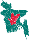 | |
| Faridpur District | ||
| Gazipur District | ||
| Gopalganj District | ||
| Kishoreganj District | ||
| Madaripur District |
| |
| Manikganj District | ||
| Munshiganj District |
| |
| Narayanganj District | ||
| Narsingdi District | ||
| Rajbari District |
| |
| Shariatpur District |
| |
| Tangail District | ||
This article is issued from Wikipedia. The text is licensed under Creative Commons - Attribution - Sharealike. Additional terms may apply for the media files.