Belabo Upazila
Belabo (Bengali: বেলাবো) is an Upazila of Narsingdi District[1] in the Division of Dhaka, Bangladesh. Here the 2,500-year-old civilisation of Wari Bateshwari has been discovered. It is believed that it was a port city with foreign trade with Rome, Southeast Asia and other regions. It is the oldest city so far discovered after Indus valley civilisation.
Belabo বেলাবো | |
|---|---|
Upazila | |
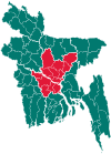
 Belabo Location in Bangladesh | |
| Coordinates: 24°5.5′N 90°51′E | |
| Country | |
| Division | Dhaka Division |
| District | Narsingdi District |
| Area | |
| • Total | 117.66 km2 (45.43 sq mi) |
| Population (1991) | |
| • Total | 145,708 |
| • Density | 1,238/km2 (3,210/sq mi) |
| Time zone | UTC+6 (BST) |
| Website | Official Map of Belabo |
Geography
Belabo is located at 24.0917°N 90.8500°E. It has 27802 households and total area 117.66 km².
Demographics
As of the 1991 Bangladesh census, Belabo has a population of 145708. Males constitute 51.05% of the population, and females 48.95%. This Upazila's eighteen up population is 73046. Belabo has an average literacy rate of 29.9% (7+ years), and the national average of 32.4% literate.[2]
Administration
Belabo has 8 Unions/72 Wards, 52 Mauzas/Mahallas, and 97 villages. Elected Member of Parliament – Adv. Nurul Majid Mahmud Humayun (Elected – 1986 and also the Present MP elected in the 9th parliamentary election 2008 )Sarder Sakhawat Hossain Bakul (1991 and 2001) and L. G. Nuruddin khan (1996)Adv.Mohammad Shahidullah Bhuyain (1954 M.N.A,1962 M.N.A,1979 M.P,1988 M.P)First Up-Zilla chairman-Abu Tarek Al Hussain Bhuyain.
See also
- Upazilas of Bangladesh
- Districts of Bangladesh
- Divisions of Bangladesh
References
- Md. Ifftekhar Uddin Bhuiyan (2012). "Belabo Upazila". In Sirajul Islam and Ahmed A. Jamal (ed.). Banglapedia: National Encyclopedia of Bangladesh (Second ed.). Asiatic Society of Bangladesh.
- "Population Census Wing, BBS". Archived from the original on 27 March 2005. Retrieved 10 November 2006.
