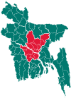
Gopalpur Upazila
Gopalpur (Bengali: গোপালপুর) is an Upazila of Tangail District[2] in the Division of Dhaka, Bangladesh.
Gopalpur Upazila গোপালপুর | |
|---|---|
Upazila | |
 Gopalpur Upazila Location in Tangail, Bangladesh | |
| Coordinates: 24°33.5′N 89°55′E | |
| Country | |
| Division | Dhaka Division |
| District | Tangail District |
| Area | |
| • Total | 193.37 km2 (74.66 sq mi) |
| Population (2011) | |
| • Total | 252,331[1] |
| Time zone | UTC+6 (BST) |
| Website | gopalpur |
Geography
Gopalpur is located at 24.5583°N 89.9167°E . It has 49976 households and total area of 193.37 km2.
Demographics
As of the 1991 Bangladesh census, Gopalpur has a population of 252747. Males constitute 50.98% of the population, and females 49.02%. Population over the age of 18 is 130298. Gopalpur has an average literacy rate of 63%, and the national average of 73.4% literate.[3]
Administration
Gopalpur Upazila has 1 Municipality(Gopalpur), 7 Unions, 162 Mauzas/Mahallas, and 146 villages.
The Union Parishads are-
- Alamnagar Union
- Dhopakandi Union
- Hadira Union
- Hemnagar Union
- Jhawail Union
- Mirzapur Union
- Nagda Simla Union
gollark: Perhaps Fish is actually a highly advanced AI, far more advanced than any other previous human invention, designed to click eggs on DragCave very fast.
gollark: You would probably have been beaten by fish-y people, who can seek and click golds in 0.001 seconds.
gollark: I should start scraping those or something. Drop analytics could be really interesting.
gollark: Alpine.
gollark: It was probably fish who caught it.
See also
- Gopalpur
- Upazilas of Bangladesh
- Districts of Bangladesh
- Divisions of Bangladesh
References
- http://www.citypopulation.de/php/bangladesh-admin.php?adm2id=9338
- Samaresh Devnath (2012), "Gopalpur Upazila", in Sirajul Islam and Ahmed A. Jamal (ed.), Banglapedia: National Encyclopedia of Bangladesh (Second ed.), Asiatic Society of BangladeshCS1 maint: uses authors parameter (link)
- "Population Census Wing, BBS". Archived from the original on 2005-03-27. Retrieved November 10, 2006.
This article is issued from Wikipedia. The text is licensed under Creative Commons - Attribution - Sharealike. Additional terms may apply for the media files.
