Kaliakair Upazila
Kaliakair (Bengali: কালিয়াকৈর) is an Upazila of Gazipur District in the Division of Dhaka, Bangladesh.[1]
Kaliakair কালিয়াকৈর | |
|---|---|
Upazila | |
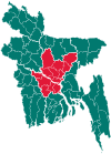
 Kaliakair Location in Bangladesh | |
| Coordinates: 24°4.5′N 90°13′E | |
| Country | |
| Division | Dhaka Division |
| District | Gazipur District |
| Area | |
| • Total | 314.14 km2 (121.29 sq mi) |
| Population (1991) | |
| • Total | 232,915 |
| • Density | 740/km2 (1,900/sq mi) |
| Time zone | UTC+6 (BST) |
| Postal code | 1750 |
| Website | Official Website of Kaliakair Upazila |
Geography
Kaliakair is located at 24.0750°N 90.2167°E . It has 45565 households and total area 314.14 km².It is bounded by mirzapur and sakhipur upazilas on the north, savar and dhamrai upazilas on the south, gazipur sadar and sreepur upazilas on the east, Mirzapur upazila on the west.
Population Total'267003; male 138240, female 128763; Muslim 231672, Hindu 34306, Buddhist 910, Christian 30 and others 85. Indigenous communities such as Koch and Badey belong to this upazila.
Water bodies Main rivers: turag, bangshi, Salda; Boali, Hawla, Ujan and Markaj beels and Goala and Betjuri canals are notable.
Administration Kaliakair Thana was formed in 1923 and it was turned into an upazila' on 2 July 1983.'
Demographics
As of the 1991 Bangladesh census, Kaliakair has a population of 232915. Males constitute 51.21% of the population, and females 48.79%. This Upazila's eighteen up population is 126799. Kaliakair has an average literacy rate of 58.3% (7+ years), and the national average of 32.4% literate.[2]
Administration
Kaliakair has 9 Unions/Wards, 181 Mauzas/Mahallas, and 283 villages.
Also has 1 Municipality with 9 wards.
Economy
There are 1000 + Garments factory in Kaliakair. Many Garemnts Worker living here.
See also
- Upazilas of Bangladesh
- Districts of Bangladesh
- Divisions of Bangladesh
References
- Rana, Ayub (2012). "Kaliakair Upazila". In Islam, Sirajul; Jamal, Ahmed A. (eds.). Banglapedia: National Encyclopedia of Bangladesh (Second ed.). Asiatic Society of Bangladesh.
- "Population Census Wing, BBS". Archived from the original on 2005-03-27. Retrieved November 10, 2006.
3. Al Mamun Vai (2018)
