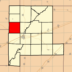
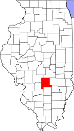
Shafter Township, Fayette County, Illinois
Shafter Township is one of twenty townships in Fayette County, Illinois, USA. As of the 2010 census, its population was 485 and it contained 201 housing units.[2] Shafter Township was formed out of Sharon Township in December, 1920.
Shafter Township | |
|---|---|
 Location in Fayette County | |
 Fayette County's location in Illinois | |
| Coordinates: 39°02′38″N 89°11′09″W | |
| Country | United States |
| State | Illinois |
| County | Fayette |
| Established | December, 1920 |
| Area | |
| • Total | 36.28 sq mi (94.0 km2) |
| • Land | 35.61 sq mi (92.2 km2) |
| • Water | 0.67 sq mi (1.7 km2) 1.85% |
| Elevation | 574 ft (175 m) |
| Population (2010) | |
| • Estimate (2016)[1] | 479 |
| • Density | 13.6/sq mi (5.3/km2) |
| Time zone | UTC-6 (CST) |
| • Summer (DST) | UTC-5 (CDT) |
| ZIP codes | 62011, 62080, 62262, 62471 |
| FIPS code | 17-051-68926 |
Geography
According to the 2010 census, the township has a total area of 36.28 square miles (94.0 km2), of which 35.61 square miles (92.2 km2) (or 98.15%) is land and 0.67 square miles (1.7 km2) (or 1.85%) is water.[2]
Extinct towns
Cemeteries
The township contains these seven cemeteries: Brackenbush, Browning, Cook, Hoffman, Holy Cross Lutheran, Lawler and Rush.
Major highways
School districts
- Ramsey Community Unit School District 204
- Vandalia Community Unit School District 203
Political districts
- Illinois' 19th congressional district
- State House District 102
- State Senate District 51
gollark: As Macron is purely functional and deterministic, when an error occurs it simply rewrites the code and time-travel-debuggings it back to the same state, until it stops erroring.
gollark: I think they can be basically equal in convenience if you can do anyhow-style error casting stuff and have try.
gollark: And bad workarounds like the errWriter thing from that blog post.
gollark: I love how they keep trying to come up with ridiculous justifications for the awful error handling.
gollark: I agree.
References
- "Shafter Township, Fayette County, Illinois". Geographic Names Information System. United States Geological Survey. Retrieved 2010-01-16.
- United States Census Bureau 2007 TIGER/Line Shapefiles
- United States National Atlas
- "Population and Housing Unit Estimates". Retrieved June 9, 2017.
- "Population, Housing Units, Area, and Density: 2010 - County -- County Subdivision and Place -- 2010 Census Summary File 1". United States Census. Archived from the original on 2020-02-12. Retrieved 2013-05-28.
- "Census of Population and Housing". Census.gov. Retrieved June 4, 2016.
External links
This article is issued from Wikipedia. The text is licensed under Creative Commons - Attribution - Sharealike. Additional terms may apply for the media files.