Mulberry Grove Township, Bond County, Illinois
Mulberry Grove Township is one of nine townships in Bond County, Illinois, USA. As of the 2010 census, its population was 1,361 and it contained 610 housing units.[2]
Mulberry Grove Township | |
|---|---|
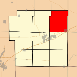 Location in Bond County | |
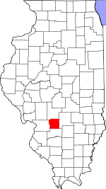 Bond County's location in Illinois | |
| Coordinates: 38°58′05″N 89°18′46″W | |
| Country | United States |
| State | Illinois |
| County | Bond |
| Settlement | November 6, 1888 |
| Area | |
| • Total | 47.43 sq mi (122.8 km2) |
| • Land | 47.03 sq mi (121.8 km2) |
| • Water | 0.4 sq mi (1 km2) 0.84% |
| Elevation | 571 ft (174 m) |
| Population (2010) | |
| • Estimate (2016)[1] | 1,269 |
| • Density | 28.9/sq mi (11.2/km2) |
| Time zone | UTC-6 (CST) |
| • Summer (DST) | UTC-5 (CDT) |
| ZIP codes | 62017, 62246, 62262, 62284 |
| FIPS code | 17-005-51297 |
Geography
According to the 2010 census, the township has a total area of 47.43 square miles (122.8 km2), of which 47.03 square miles (121.8 km2) (or 99.16%) is land and 0.4 square miles (1.0 km2) (or 0.84%) is water.[2]
Cities
Cemeteries
The township contains these seven cemeteries: Dunkard, Durr, Etcheson, Hastings, Liberty, Neathery and Snow.
Major highways


Lakes
- Governor Bond Lake
School districts
- Bond County Community Unit School District 2
- Mulberry Grove Community Unit School District 1
Political districts
- Illinois' 19th congressional district
- State House District 102
- State Senate District 51
gollark: You might have to prompt it with bits of good personal statements or something.
gollark: https://studio.ai21.com/playground apparently needs you to create an account now, sad.
gollark: 178B parameters.
gollark: J1-Jumbo is about the same scale.
gollark: GPT-3 is closed beta, EleutherAI have a nice frontend here (https://6b.eleuther.ai/) for their smaller model, I am looking for where to use the Jurassic-1 models.
References
- "Mulberry Grove Township, Bond County, Illinois". Geographic Names Information System. United States Geological Survey. Retrieved 2010-01-04.
- United States Census Bureau 2007 TIGER/Line Shapefiles
- United States National Atlas
- "Population and Housing Unit Estimates". Retrieved June 9, 2017.
- "Population, Housing Units, Area, and Density: 2010 - County -- County Subdivision and Place -- 2010 Census Summary File 1". United States Census. Archived from the original on 2020-02-12. Retrieved 2013-05-28.
- "Census of Population and Housing". Census.gov. Retrieved June 4, 2016.
External links
Places adjacent to Mulberry Grove Township, Bond County, Illinois | |
|---|---|
Municipalities and communities of Bond County, Illinois, United States | ||
|---|---|---|
| City | Map of Illinois highlighting Bond County | |
| Villages | ||
| Townships | ||
| Unincorporated communities | ||
| Ghost town | ||
| Footnotes | ‡This populated place also has portions in an adjacent county or counties | |
This article is issued from Wikipedia. The text is licensed under Creative Commons - Attribution - Sharealike. Additional terms may apply for the media files.