Avena Township, Fayette County, Illinois
Avena Township is one of twenty townships in Fayette County, Illinois, USA. As of the 2010 census, its population was 2,010 and it contained 855 housing units.[2]
Avena Township | |
|---|---|
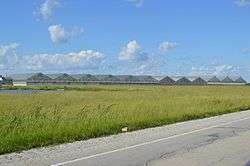
 Greenhouses on U.S. Route 40, west of St. Elmo | |
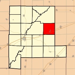
 Location in Fayette County | |
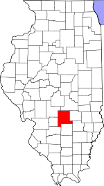
 Fayette County's location in Illinois | |
| Coordinates: 39°02′35″N 88°51′44″W | |
| Country | United States |
| State | Illinois |
| County | Fayette |
| Established | November 9, 1859 |
| Area | |
| • Total | 36.47 sq mi (94.5 km2) |
| • Land | 36.32 sq mi (94.1 km2) |
| • Water | 0.15 sq mi (0.4 km2) 0.41% |
| Elevation | 597 ft (182 m) |
| Population (2010) | |
| • Estimate (2016)[1] | 1,956 |
| • Density | 55.3/sq mi (21.4/km2) |
| Time zone | UTC-6 (CST) |
| • Summer (DST) | UTC-5 (CDT) |
| ZIP codes | 62418, 62458 |
| FIPS code | 17-051-03155 |
Geography
According to the 2010 census, the township has a total area of 36.47 square miles (94.5 km2), of which 36.32 square miles (94.1 km2) (or 99.59%) is land and 0.15 square miles (0.39 km2) (or 0.41%) is water.[2]
Cities, towns, villages
Extinct towns
- Howards Point
- Pruett
Cemeteries
The township contains these five cemeteries: Crums Chapel, Guy, Maplewood, Seidner, Saint Bonaventure and Yolton.
Major highways


School districts
- Brownstown Community Unit School District 201
- St Elmo Community Unit School District 202
Political districts
- Illinois's 19th congressional district
- State House District 102
- State Senate District 51
gollark: The counterargument is that nonworker management might be good in terms of profit maximization but bad in other ways.
gollark: It could be argued that workers could just make their own company if they think they'd run it better.
gollark: i.e. are you required to provide people food and whatever, or just not steal it from them etc.
gollark: The difference is probably positive vs negative rights.
gollark: Anarchocapitalistic people would probably agree with that too.
References
- "Avena Township, Fayette County, Illinois". Geographic Names Information System. United States Geological Survey. Retrieved 2010-01-16.
- United States Census Bureau 2007 TIGER/Line Shapefiles
- United States National Atlas
- "Population and Housing Unit Estimates". Retrieved June 9, 2017.
- "Population, Housing Units, Area, and Density: 2010 - County -- County Subdivision and Place -- 2010 Census Summary File 1". United States Census. Archived from the original on 2020-02-12. Retrieved 2013-05-28.
- "Census of Population and Housing". Census.gov. Retrieved June 4, 2016.
External links
This article is issued from Wikipedia. The text is licensed under Creative Commons - Attribution - Sharealike. Additional terms may apply for the media files.