Kaskaskia Township, Fayette County, Illinois
Kaskaskia Township is one of twenty townships in Fayette County, Illinois, USA. As of the 2010 census, its population was 650 and it contained 289 housing units.[2]
Kaskaskia Township | |
|---|---|
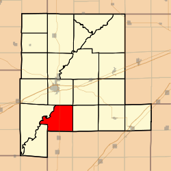 Location in Fayette County | |
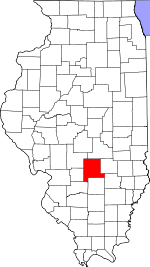 Fayette County's location in Illinois | |
| Coordinates: 38°51′57″N 89°05′13″W | |
| Country | United States |
| State | Illinois |
| County | Fayette |
| Established | November 9, 1859 |
| Area | |
| • Total | 34.34 sq mi (88.9 km2) |
| • Land | 34.3 sq mi (89 km2) |
| • Water | 0.04 sq mi (0.1 km2) 0.12% |
| Elevation | 515 ft (157 m) |
| Population (2010) | |
| • Estimate (2016)[1] | 631 |
| • Density | 19/sq mi (7/km2) |
| Time zone | UTC-6 (CST) |
| • Summer (DST) | UTC-5 (CDT) |
| ZIP codes | 62471, 62885, 62892 |
| FIPS code | 17-051-39116 |
Geography
According to the 2010 census, the township has a total area of 34.34 square miles (88.9 km2), of which 34.3 square miles (89 km2) (or 99.88%) is land and 0.04 square miles (0.10 km2) (or 0.12%) is water.[2]
Unincorporated towns
Cemeteries
The township contains these five cemeteries: Britton, Farmer, Heckethorn, Lee and McConnell.
Major highways

School districts
- Patoka Community Unit School District 100
- Vandalia Community Unit School District 203
Political districts
- Illinois' 19th congressional district
- State House District 102
- State Senate District 51
gollark: For a function to be run, it must be called.
gollark: It's not magically run just because it exists.
gollark: What is the problem you're facing?
gollark: Well, your abstract existence doesn't have sandwiches.
gollark: Yes, I'm sure you mathematicians love existing abstractly outside of spacetime.
References
- "Kaskaskia Township, Fayette County, Illinois". Geographic Names Information System. United States Geological Survey. Retrieved 2010-01-16.
- United States Census Bureau 2007 TIGER/Line Shapefiles
- United States National Atlas
- "Population and Housing Unit Estimates". Retrieved June 9, 2017.
- "Population, Housing Units, Area, and Density: 2010 - County -- County Subdivision and Place -- 2010 Census Summary File 1". United States Census. Archived from the original on 2020-02-12. Retrieved 2013-05-28.
- "Census of Population and Housing". Census.gov. Retrieved June 4, 2016.
External links
Places adjacent to Kaskaskia Township, Fayette County, Illinois | |
|---|---|
Municipalities and communities of Fayette County, Illinois, United States | ||
|---|---|---|
| Cities | Map of Illinois highlighting Fayette County | |
| Villages | ||
| Townships | ||
| Unincorporated communities | ||
This article is issued from Wikipedia. The text is licensed under Creative Commons - Attribution - Sharealike. Additional terms may apply for the media files.