Royalton, Indiana
Royalton is an unincorporated community in Eagle Township, Boone County, in the U.S. state of Indiana.[3]
Royalton, Indiana | |
|---|---|
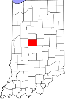
 Boone County's location in Indiana | |
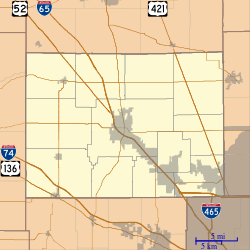
 Royalton Location in Boone County | |
| Coordinates: 39°55′37″N 86°20′18″W | |
| Country | United States |
| State | Indiana |
| County | Boone |
| Township | Eagle |
| Elevation | 919 ft (280 m) |
| Time zone | UTC-5 (Eastern (EST)) |
| • Summer (DST) | UTC-4 (EDT) |
| ZIP code | 46077 |
| FIPS code | 18-66258[2] |
| GNIS feature ID | 442375 |
History
A post office was established at Royalton (but was called Rodmans until 1838[4]) in 1832, and remained in operation until it was discontinued in 1903.[5]
Geography and Location
Royalton is located at 39°55′37″N 86°20′18″W. Royalton is located along Indianapolis Rd approximately 0.7 miles northwest of Marion County. The town is made up of three main streets - Royal Avenue, Circle Drive, and Harmon Avenue.
gollark: <@151391317740486657> Redesign bad.
gollark: My server does generally manage decent uptime.
gollark: I wonder if osmarks.tk is actually more reliable than Discord.
gollark: Mine is the text editor in OS.js.
gollark: I want to edit configuration files and whatnot sometimes and not learn vimsanity.
References
- "US Board on Geographic Names". United States Geological Survey. 2007-10-25. Retrieved 2008-01-31.
- "U.S. Census website". United States Census Bureau. Retrieved 2008-01-31.
- "Royalton, Indiana". Geographic Names Information System. United States Geological Survey. Retrieved March 6, 2020.
- Baker, Ronald L. (October 1995). From Needmore to Prosperity: Hoosier Place Names in Folklore and History. Indiana University Press. p. 287. ISBN 978-0-253-32866-3.
A post office called Rodmans...
- "Boone County". Jim Forte Postal History. Retrieved 26 August 2014.
This article is issued from Wikipedia. The text is licensed under Creative Commons - Attribution - Sharealike. Additional terms may apply for the media files.