Herr, Indiana
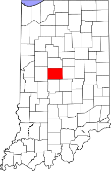
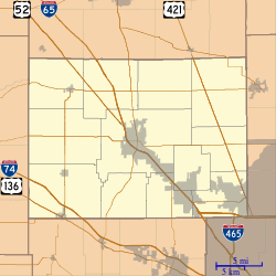
Herr is an unincorporated community in Perry Township, Boone County, in the U.S. state of Indiana.[3]
Herr, Indiana | |
|---|---|
 Boone County's location in Indiana | |
 Herr Location in Boone County | |
| Coordinates: 39°57′20″N 86°25′54″W | |
| Country | United States |
| State | Indiana |
| County | Boone |
| Township | Perry |
| Elevation | 965 ft (294 m) |
| Time zone | UTC-5 (Eastern (EST)) |
| • Summer (DST) | UTC-4 (EDT) |
| ZIP code | 46052 |
| Area code(s) | 765 |
| FIPS code | 18-33196[2] |
| GNIS feature ID | 436061 |
Geography
Herr is located at 39°57′20″N 86°25′54″W.
gollark: I can just not use Discord. Problem solved!
gollark: Anyway, the battery life will be *great* if I can cut down basically every pointless background service and have a GNU/Linux-running phone which basically just runs a browser and basic phone-network functionality.
gollark: Well, that's interesting, thanks.
gollark: Hmm, interesting.
gollark: Yes.
References
- "US Board on Geographic Names". United States Geological Survey. 2007-10-25. Retrieved 2008-01-31.
- "U.S. Census website". United States Census Bureau. Retrieved 2008-01-31.
- "Herr, Indiana". Geographic Names Information System. United States Geological Survey. Retrieved March 1, 2020.
This article is issued from Wikipedia. The text is licensed under Creative Commons - Attribution - Sharealike. Additional terms may apply for the media files.