Clinton Township, Boone County, Indiana
Clinton Township is one of twelve townships in Boone County, Indiana. As of the 2010 census, its population was 886 and it contained 351 housing units.[3]
Clinton Township | |
|---|---|
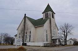 Elizaville Baptist Church | |
 Location of Clinton Township in Boone County | |
| Coordinates: 40°08′01″N 86°24′22″W | |
| Country | United States |
| State | Indiana |
| County | Boone |
| Government | |
| • Type | Indiana township |
| Area | |
| • Total | 32.44 sq mi (84.0 km2) |
| • Land | 32.44 sq mi (84.0 km2) |
| • Water | 0 sq mi (0 km2) |
| Elevation | 938 ft (286 m) |
| Population (2010) | |
| • Total | 886 |
| • Density | 27.3/sq mi (10.5/km2) |
| FIPS code | 18-13672[2] |
| GNIS feature ID | 453228 |
History
Scotland Bridge was listed on the National Register of Historic Places in 1994.[4]
Geography
According to the 2010 census, the township has a total area of 32.44 square miles (84.0 km2), all land.[3]
Unincorporated towns
Adjacent townships
- Center (southwest)
- Marion (east)
- Washington (west)
- Jackson Township, Clinton County (northwest)
- Kirklin Township, Clinton County (northeast)
Major highways
Cemeteries
The township contains one cemetery, Garrett.
gollark: > That is the problem, nobody can fucking decide if it is 1000 or 1024There's a standard: kB/KB (kilobyte) is 1000, KiB (kibibyte) is 1024. But that's not really stuck with consistently and different platforms will randomly label it the wrong way and it's all quite bad.
gollark: 🦀 yay this will somewhat reduce annoyance 🦀
gollark: Oh, neat.
gollark: That makes as much as sense as saying that people who don't believe in free will shouldn't have human rights, i.e. not much, and slowmode is annoying.
gollark: Well, you could measure your height in decimeters, then.
References
- "Clinton Township, Boone County, Indiana". Geographic Names Information System. United States Geological Survey. Retrieved 2009-09-24.
- United States Census Bureau cartographic boundary files
- "US Board on Geographic Names". United States Geological Survey. 2007-10-25. Retrieved 2008-01-31.
- "U.S. Census website". United States Census Bureau. Retrieved 2008-01-31.
- "Population, Housing Units, Area, and Density: 2010 - County -- County Subdivision and Place -- 2010 Census Summary File 1". United States Census. Archived from the original on 2020-02-12. Retrieved 2013-05-10.
- "National Register Information System". National Register of Historic Places. National Park Service. July 9, 2010.
External links
Municipalities and communities of Boone County, Indiana, United States | ||
|---|---|---|
| City | Map of Indiana highlighting Boone County | |
| Towns | ||
| Townships | ||
| Unincorporated communities | ||
| Footnotes | ‡This populated place also has portions in an adjacent county or counties | |
This article is issued from Wikipedia. The text is licensed under Creative Commons - Attribution - Sharealike. Additional terms may apply for the media files.