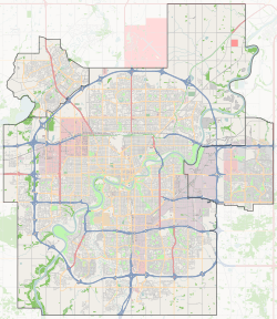
Richfield, Edmonton
Richfield is a residential neighbourhood in the Millbourne area of Mill Woods, part of south east Edmonton, Alberta, Canada.
Richfield | |
|---|---|
Neighbourhood | |
 Richfield Location of Richfield in Edmonton | |
| Coordinates: 53.469°N 113.458°W | |
| Country | |
| Province | |
| City | Edmonton |
| Quadrant[1] | NW |
| Ward[1] | 11 |
| Sector[2] | Southeast |
| Area[3][4] Community | Mill Woods Millbourne |
| Government | |
| • Mayor | Don Iveson |
| • Administrative body | Edmonton City Council |
| • Councillor | Mike Nickel |
| Area | |
| • Total | 0.94 km2 (0.36 sq mi) |
| Elevation | 687 m (2,254 ft) |
| Population (2012)[7] | |
| • Total | 3,299 |
| • Density | 3,509.6/km2 (9,090/sq mi) |
| • Change (2009–12) | |
| • Dwellings | 1,164 |
Demographics
In the City of Edmonton's 2012 municipal census, Richfield had a population of 3,299 living in 1,164 dwellings,[7] a -1.4% change from its 2009 population of 3,346.[8] With a land area of 0.94 km2 (0.36 sq mi), it had a population density of 3,509.6 people/km2 in 2012.[6][7]
Residential development
According to the 2001 federal census, the bulk of residential construction in the neighbourhood occurred during the 1970s when roughly three out of four (75.8%) of residences were constructed. Another one in ten (10.8%) were constructed during the 1960s, and one in ten (10.0%) were constructed during the 1980s.[9]
The most common type of residence in the neighbourhood, according to the 2005 municipal census, is the row house. Row houses account for almost half (45%) of all the residences in Richfield. Single-family dwellings account for roughly four in ten (41%) of residences. The remaining residences are split almost equally between rented apartments (7%) and duplexes[10] (7%). Just over half the residences (51%) are owner-occupied, with the remainder (49%) being rented.[11]
The population of the neighbourhood is somewhat stable with four out of ten (41%) or residents having lived at the same address for more than five years according to the 2005 municipal census. At the same time, one in five (19.3%) residents had moved within the previous 12 months and another one in five (21.9%) had moved within the preceding one to three years.[12]
There are two elementary schools in the neighbourhood. The Edmonton Public School System operates the Grace Martin Elementary School while the Edmonton Catholic School System operates the St Elizabeth Catholic Elementary School.
The neighbourhood is bounded on the west by 91 Street, on south by 34 Avenue, and on the remaining sides by Mill Woods Road.
Surrounding neighbourhoods
References
- "City of Edmonton Wards & Standard Neighbourhoods" (PDF). City of Edmonton. Archived from the original (PDF) on May 3, 2014. Retrieved February 13, 2013.
- "Edmonton Developing and Planned Neighbourhoods, 2011" (PDF). City of Edmonton. Archived from the original (PDF) on September 4, 2013. Retrieved February 13, 2013.
- "The Way We Grow: Municipal Development Plan Bylaw 15100" (PDF). City of Edmonton. 2010-05-26. Archived from the original (PDF) on May 2, 2015. Retrieved February 13, 2013.
- "City of Edmonton Plans in Effect" (PDF). City of Edmonton. November 2011. Archived from the original (PDF) on October 17, 2013. Retrieved February 13, 2013.
- "City Councillors". City of Edmonton. Retrieved February 16, 2014.
- "Neighbourhoods (data plus kml file)". City of Edmonton. Retrieved February 13, 2013.
- "Municipal Census Results – Edmonton 2012 Census". City of Edmonton. Retrieved February 22, 2013.
- "2009 Municipal Census Results". City of Edmonton. Retrieved February 22, 2013.
- http://censusdocs.edmonton.ca/DD23/FEDERAL%202001/Neighbourhood/RICHFIELD.pdf
- Duplexes include triplexes and quadruplexes.
- http://censusdocs.edmonton.ca/C05002/MUNICIPAL%202005/Neighbourhood/RICHFIELD.pdf
- http://censusdocs.edmonton.ca/C05022B/MUNICIPAL%202005/Neighbourhood/RICHFIELD.pdf