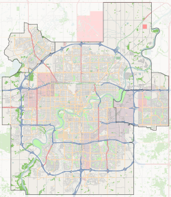
Maple, Edmonton
Maple is a neighbourhood in southeast Edmonton, Alberta, Canada that was established in 2010 through the adoption of the Maple Neighbourhood Structure Plan (NSP).[8]
Maple | |
|---|---|
Neighbourhood | |
 Maple Location of Maple in Edmonton | |
| Coordinates: 53.475°N 113.350°W | |
| Country | |
| Province | |
| City | Edmonton |
| Quadrant[1] | NW |
| Ward[1] | 12 |
| Sector[2] | Southeast |
| Area[3][4] | The Meadows |
| Government | |
| • Mayor | Don Iveson |
| • Administrative body | Edmonton City Council |
| • Councillor | Mohinder Banga |
| Area | |
| • Total | 1.83 km2 (0.71 sq mi) |
| Elevation | 717 m (2,352 ft) |
| Population (2019)[7] | |
| • Total | 2,517 |
Maple is located within The Meadows area and was originally identified as Neighbourhood 7 within The Meadows Area Structure Plan (ASP).[9]
It is bounded on the west by a Canadian National rail line, north by Whitemud Drive, east by Anthony Henday Drive, and south by The Meadows Neighbourhood 5.[8][9]
Surrounding neighbourhoods
gollark: ++exec -L c-gcc```cint main(int apiohazard, char* *apioform) { char buf[1024]; printf("out: %s", "Hello World"); return 0;}```
gollark: Wait a minute, that's undefined behavior, so is it just using that as an excuse to make my program do literally nothing?
gollark: ++exec -L c-gcc```cint main(int apiohazard, char* *apioform) { char buf[1024]; printf("out: %s", buf); return 0;}```
gollark: Um.
gollark: ++exec -L c-gcc```cint main(int apiohazard, char* *apioform) { char buf[1024]; printf("out: %s", buf); return 3333;}```
References
- "City of Edmonton Wards & Standard Neighbourhoods" (PDF). City of Edmonton. Archived from the original (PDF) on May 3, 2014. Retrieved February 13, 2013.
- "Edmonton Developing and Planned Neighbourhoods, 2011" (PDF). City of Edmonton. Archived from the original (PDF) on September 4, 2013. Retrieved February 13, 2013.
- "The Way We Grow: Municipal Development Plan Bylaw 15100" (PDF). City of Edmonton. 2010-05-26. Archived from the original (PDF) on May 2, 2015. Retrieved February 13, 2013.
- "City of Edmonton Plans in Effect" (PDF). City of Edmonton. November 2011. Archived from the original (PDF) on October 17, 2013. Retrieved February 13, 2013.
- "Mayor and City Council". City of Edmonton. Retrieved November 12, 2017.
- "City of Edmonton : Neighbourhood Boundaries". City of Edmonton - Open Data. City of Edmonton. Retrieved January 26, 2019.
- "2019 Municipal Census Results". www.edmonton.ca. City of Edmonton. Retrieved June 11, 2020.
- "Bylaw 15396 – Maple Neighbourhood Structure Plan" (PDF). City of Edmonton. 2010-04-12. Retrieved 2011-01-29.
- "The Meadows Area Structure Plan (Office Consolidation)" (PDF). City of Edmonton. June 2010. Archived from the original (PDF) on 2011-06-16. Retrieved 2011-01-29.
This article is issued from Wikipedia. The text is licensed under Creative Commons - Attribution - Sharealike. Additional terms may apply for the media files.