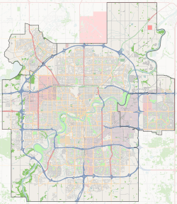
Lorelei, Edmonton
Lorelei is a residential neighbourhood located in the Castledowns area of north Edmonton, Alberta, Canada.
Lorelei | |
|---|---|
Neighbourhood | |
 Lorelei Location of Lorelei in Edmonton | |
| Coordinates: 53.625°N 113.498°W | |
| Country | |
| Province | |
| City | Edmonton |
| Quadrant[1] | NW |
| Ward[1] | 3 |
| Sector[2] | North |
| Area[3][4] | Castle Downs |
| Government | |
| • Administrative body | Edmonton City Council |
| • Councillor | Jon Dziadyk |
| Area | |
| • Total | 1.22 km2 (0.47 sq mi) |
| Elevation | 682 m (2,238 ft) |
| Population (2012)[7] | |
| • Total | 4,027 |
| • Density | 3,300.8/km2 (8,549/sq mi) |
| • Change (2009–12) | |
| • Dwellings | 1,475 |
It is bounded on the north and west by Castledowns Road, on the east by 97 Street, and on the south by Beaumaris Road and 160 Avenue. Travel north along 97 Street takes residents past CFB Edmonton located just north of the city, while travel south along 97 Street takes residents past the Northern Alberta Institute of Technology and into the downtown core.
Most of the residences in the neighbourhood were built in the 1970s and 1980s, with residences being a mixture of single-family dwellings (57%), row houses (25%), walk-up apartments in buildings with five or fewer stories (10%) and duplexes (8%). Roughly three out of four residences are owner-occupied.
The community is represented by the Lorelei-Beaumaris Community League, established in 1978, which maintains a community hall and outdoor rink located at 103 Street and 162 Avenue.[8][9]
Demographics
In the City of Edmonton's 2012 municipal census, Lorelei had a population of 4,027 living in 1,475 dwellings,[7] a -3.4% change from its 2009 population of 4,170.[10] With a land area of 1.22 km2 (0.47 sq mi), it had a population density of 3,300.8 people/km2 in 2012.[6][7]
Surrounding neighbourhoods
References
- "City of Edmonton Wards & Standard Neighbourhoods" (PDF). City of Edmonton. Archived from the original (PDF) on May 3, 2014. Retrieved February 13, 2013.
- "Edmonton Developing and Planned Neighbourhoods, 2011" (PDF). City of Edmonton. Archived from the original (PDF) on September 4, 2013. Retrieved February 13, 2013.
- "The Way We Grow: Municipal Development Plan Bylaw 15100" (PDF). City of Edmonton. 2010-05-26. Archived from the original (PDF) on May 2, 2015. Retrieved February 13, 2013.
- "City of Edmonton Plans in Effect" (PDF). City of Edmonton. November 2011. Archived from the original (PDF) on October 17, 2013. Retrieved February 13, 2013.
- "City Councillors". City of Edmonton. Retrieved February 13, 2013.
- "Neighbourhoods (data plus kml file)". City of Edmonton. Retrieved February 13, 2013.
- "Municipal Census Results – Edmonton 2012 Census". City of Edmonton. Retrieved February 22, 2013.
- "Allendale Community League". Allendale Community League. Retrieved October 10, 2017.
- Kuban, Ron (2005). Edmonton's Urban Villages: The Community League Movement. University of Alberta Press. ISBN 9781459303249.
- "2009 Municipal Census Results". City of Edmonton. Retrieved February 22, 2013.