Prince Rupert, Edmonton
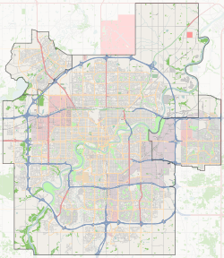
Prince Rupert is a triangle-shaped residential neighbourhood in north west Edmonton, Alberta, Canada. Prince Rupert is located within the old Hudson's Bay Reserve and was developed after the end of World War II.[6] The neighbourhood is bounded on the south by 111 Avenue, on the west by 121 Street, and on the northeast by Kingsway Avenue.
Prince Rupert | |
|---|---|
Neighbourhood | |
 Prince Rupert Location of Prince Rupert in Edmonton | |
| Coordinates: 53.561°N 113.523°W | |
| Country | |
| Province | |
| City | Edmonton |
| Quadrant[1] | NW |
| Ward[1] | 2 |
| Sector[2] | Mature area |
| Government | |
| • Administrative body | Edmonton City Council |
| • Councillor | Bev Esslinger |
| Area | |
| • Total | 1.14 km2 (0.44 sq mi) |
| Elevation | 668 m (2,192 ft) |
| Population (2012)[5] | |
| • Total | 1,339 |
| • Density | 1,174.6/km2 (3,042/sq mi) |
| • Change (2009–12) | |
| • Dwellings | 725 |
The community is represented by the Prince Rupert Community League, established in 1962.[7][8]
Demographics
In the City of Edmonton's 2012 municipal census, Prince Rupert had a population of 1,339 living in 725 dwellings,[5] a 6.2% change from its 2009 population of 1,261.[9] With a land area of 1.14 km2 (0.44 sq mi),[4] it had a population density of 1,174.6 people/km2 in 2012.[4][5]
Residential development
According to the 2001 federal census, seven out of every ten (71.2%) of the residences were constructed between the end of World War II and 1960. Another one in twelve (8.5%) were constructed during the 1960s. There is also some more recent construction, with one out of twelve (8.5%) of residences being constructed in the second half of the 1990s. The majority of these recently constructed homes are in a new development bounded by 119 Street to the West, 114 Avenue to the South, and the Kingsway shopping district to the Northeast.[10]
The most common type of residence in the neighbourhood, according to the 2005 municipal census, is the single-family dwelling. These account for six out of every ten (60%) of all residences. Approximately one in three residences (34%) are apartments in low-rise buildings with fewer than five stories. The remaining 6% of residences are duplexes.[11] Just over half (53%) or residences are owner-occupied, with the remainder being rented.[12]
The neighbourhood profile is highly mobile with roughly one in five (20.8%) residents having moved within the previous twelve months according to the 2005 municipal census. Another one in five (19.5%) or residents had moved within the previous one to three years. Less than half (44.5%) had lived at the same address for longer than five years.[13]
There was a single school in the neighbourhood, Prince Rupert Elementary School, operated by the Edmonton Public School System, however, since it closed after the 1994-1995 school year, there has not been a single school in the neighbourhood.
Kingsway Mall is located near the south east corner of the neighbourhood.
Surrounding neighbourhoods
References
- "City of Edmonton Wards & Standard Neighbourhoods" (PDF). City of Edmonton. Archived from the original (PDF) on May 3, 2014. Retrieved February 13, 2013.
- "Edmonton Developing and Planned Neighbourhoods, 2011" (PDF). City of Edmonton. Archived from the original (PDF) on September 4, 2013. Retrieved February 13, 2013.
- "City Councillors". City of Edmonton. Retrieved February 13, 2013.
- "Neighbourhoods (data plus kml file)". City of Edmonton. Retrieved February 13, 2013.
- "Municipal Census Results – Edmonton 2012 Census". City of Edmonton. Retrieved February 22, 2013.
- From the neighbourhood description in the City of Edmonton Map Utility
- "Prince Rupert Community League". Prince Rupert Community League. Retrieved October 13, 2017.
- Kuban, Ron (2005). Edmonton's Urban Villages: The Community League Movement. University of Alberta Press. ISBN 9781459303249.
- "2009 Municipal Census Results". City of Edmonton. Retrieved February 22, 2013.
- http://censusdocs.edmonton.ca/DD23/FEDERAL%202001/Neighbourhood/PRINCE%20RUPERT.pdf
- Duplexes include triplexes and quadruplexes.
- http://censusdocs.edmonton.ca/C05002/MUNICIPAL%202005/Neighbourhood/PRINCE%20RUPERT.pdf
- http://censusdocs.edmonton.ca/C05022B/MUNICIPAL%202005/Neighbourhood/PRINCE%20RUPERT.pdf