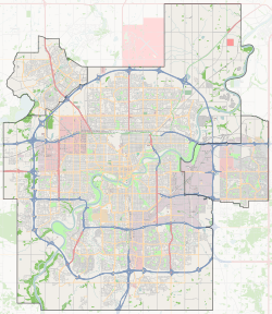
West Jasper Place, Edmonton (area)
West Jasper Place is a residential area in the west portion of the City of Edmonton in Alberta, Canada. It was established in 1972 through Edmonton City Council's adoption of West Jasper Place Outline Plan, which guides the overall development of the area.[3]
West Jasper Place | |
|---|---|
Area | |
 West Jasper Place Location of West Jasper Place in Edmonton | |
| Coordinates: 53.512°N 113.630°W | |
| Country | |
| Province | |
| City | Edmonton |
| Quadrant[1] | NW |
| Ward[1] | 1 & 5 |
| Government | |
| • Administrative body | Edmonton City Council |
| Elevation | 680 m (2,230 ft) |
Neighbourhoods
The West Jasper Place Outline Plan originally planned for 14 separate neighbourhoods.[3] Today, the West Jasper Place area includes the following 17 neighbourhoods:[4]
- Aldergrove;
- Belmead;
- Callingwood North, originally known as Callingwood Campus;[3]
- Callingwood South, originally known as Callingwood Town Centre;[3]
- Dechene;
- Donsdale;
- Gariepy;
- Jamieson Place;
- La Perle;
- Lymburn;
- Oleskiw;
- Ormsby Place;
- Summerlea;
- Terra Losa;
- Thorncliff;
- Wedgewood Heights; and
- Westridge.
Land use plans
In addition to the West Jasper Place Outline Plan, the following neighbourhood area structure plans and area structure plans were adopted to further guide development of certain portions of the West Jasper Place area:
- the Summerlea Neighbourhood Area Structure Plan (NASP) in 1983,[5] which applies to the Summerlea neighbourhood;[4]
- the Terra Losa NASP in 1982,[6] which applies to the Terra Losa neighbourhood;[4]
- the West Jasper Place North Area Structure Plan (ASP) in 1979,[7] which applies to the western portions of the Aldergrove, Belmead and La Perle neighbourhoods;[4] and
- the West Jasper Place South ASP in 1979,[8] which applies to the Dechene, Donsdale, Jamieson Place and Wedgewood Heights neighbourhoods and the western portions of the Lymburn and Ormsby Place neighbourhoods.[4]
West Jasper Place North
Further to the West Jasper Place North ASP, the following neighbourhood structure plans were adopted to further guide development within this certain portion of the West Jasper Place area:
- the Aldergrove Neighbourhood Structure Plan (NSP) in 1980,[9] which applies to the western portion of the Aldergrove neighbourhood;[4]
- the Belmead NSP in 1981,[10] which applies to the western portion of the Belmead neighbourhood;[4] and
- the La Perle NSP in 19,[11] which applies to the western portion of the La Perle neighbourhood.[4]
West Jasper Place South
Further to the West Jasper Place South ASP, the following neighbourhood structure plans were adopted to further guide development within this certain portion of the West Jasper Place area:
- the Dechene NSP in 1979,[12] which applies to the Dechene neighbourhood;[4]
- the Donsdale NSP in 1995,[13] which applies to the Donsdale neighbourhood;[4]
- the Jamieson Place NSP in 1980,[14] which applies to the Jamieson Place neighbourhood;[4]
- the Lymburn NSP in 1980,[15] which applies to the western portion of the Lymburn neighbourhood;[4]
- the Ormsby Place NSP in 1986,[16] which applies to the western portion of the Ormsby Place neighbourhood;[4] and
- the Wedgewood Heights NSP in 1986,[17] which applies to the Wedgewood Heights neighbourhood.[4]
Surrounding areas
References
- "City of Edmonton Wards & Standard Neighbourhoods" (PDF). City of Edmonton. Retrieved February 13, 2013.
- "City Councillors". City of Edmonton. Retrieved February 13, 2013.
- "West Jasper Place Outline Plan (Office Consolidation)" (PDF). City of Edmonton. June 2006. Retrieved 2012-05-13.
- "Welcome to Edmonton Maps". City of Edmonton. Retrieved 2012-05-26.
- "Summerlea Neighbourhood Area Structure Plan (Office Consolidation)" (PDF). City of Edmonton. January 2006. Retrieved 2012-06-04.
- "Terra Losa Neighbourhood Area Structure Plan (Office Consolidation)" (PDF). City of Edmonton. May 2006. Retrieved 2012-06-04.
- "West Jasper Place North Area Structure Plan (Office Consolidation)" (PDF). City of Edmonton. May 2006. Retrieved 2012-06-04.
- "West Jasper Place South Area Structure Plan (Office Consolidation)" (PDF). City of Edmonton. December 2006. Retrieved 2012-06-04.
- "Aldergrove Neighbourhood Structure Plan (Office Consolidation)" (PDF). City of Edmonton. October 2005. Retrieved 2012-06-04.
- "Belmead Neighbourhood Structure Plan (Office Consolidation)" (PDF). City of Edmonton. November 2005. Retrieved 2012-06-04.
- "La Perle Neighbourhood Structure Plan (Office Consolidation)". City of Edmonton. Missing or empty
|url=(help) - "Dechene Neighbourhood Structure Plan (Office Consolidation)" (PDF). City of Edmonton. December 2006. Retrieved 2012-06-04.
- "Donsdale Neighbourhood Structure Plan (Office Consolidation)" (PDF). City of Edmonton. March 2006. Retrieved 2012-06-04.
- "Jamieson Place Neighbourhood Structure Plan (Office Consolidation)" (PDF). City of Edmonton. August 2008. Retrieved 2012-06-04.
- "Lymburn Neighbourhood Structure Plan (Office Consolidation)" (PDF). City of Edmonton. March 2006. Retrieved 2012-06-04.
- "Ormsby Place Neighbourhood Structure Plan (Office Consolidation)" (PDF). City of Edmonton. May 2006. Retrieved 2012-06-04.
- "Wedgewood Heights Neighbourhood Structure Plan (Office Consolidation)" (PDF). City of Edmonton. January 2006. Retrieved 2012-06-04.