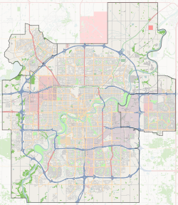
Dickinsfield, Edmonton
Dickinsfield is a residential area in northeast Edmonton, Alberta, Canada that consists of the neighbourhoods of Evansdale and Northmount.[3][4]
Dickinsfield | |
|---|---|
Area | |
 Dickinsfield Location of Dickinsfield in Edmonton | |
| Coordinates: 53.608°N 113.478°W | |
| Country | |
| Province | |
| City | Edmonton |
| Quadrant[1] | NW |
| Ward[1] | 3 & 7 |
| Government | |
| • Administrative body | Edmonton City Council |
| • Councillors | Kim Krushell & Tony Caterina |
| Elevation | 680 m (2,230 ft) |
The area, the Dickinsfield Junior High School, and the Dickinsfield Extended Care Centre are all named after aviator Clennell Haggerston "Punch" Dickins. Dickins was the first pilot inducted into the Canada's Aviation Hall of Fame.[5]
Geography
Located in northeast Edmonton, the Dickinsfield area is bounded by 97 Street (Highway 28) to the west, 137 Avenue to the south, 82 Street to the east, and 153 Avenue to the north.[3] The area is bisected by 144 Avenue.[4] Evansdale comprises the part of the area north of 144 Avenue, while Northmount comprises the balance to the south of 144 Avenue.[3][4] Access to Edmonton's downtown to the south and CFB Edmonton to the north is available by 97 Street.
The Londonderry area is located beyond 82 Street to the east,[3] while the Lake District (Edmonton North) area is beyond 153 Avenue to the north.[6] The Griesbach neighbourhood is located across 97 Street to the west,[7] while the Glengarry neighbourhood is across 137 Avenue to the south.[3][4]
Housing
Housing in both neighbourhoods is predominantly single-family dwellings with just over half (54%) of the homes in Evansdale and seven out of ten (69%) of the homes in Northmount being of this type. Evansdale has a significant portion of residences (24%) in walk-up apartment buildings, while approximately one in five residences (20%) in both neighbourhoods are row houses.
| Housing Type | Evansdale[8] | Northmount[9] | Dickinsfield[10] |
|---|---|---|---|
| Apartments With Five Or More Stories[11] | 0% | 0% | 0% |
| Apartments With Fewer Than Five Stories | 24% | 2% | 16% |
| Duplexes[12] | 3% | 0% | 2% |
| Rooming Houses[13] | 0% | 7% | 3% |
| Row Houses | 19% | 21% | 20% |
| Single Family Dwelling | 54% | 69% | 60% |
| Total | 100% | 100% | 100% |
Schools
There are six schools operated by Edmonton Public Schools and Edmonton Catholic Schools in Dickinsfield, three in Evansdale and three in Northmount. Two are junior high schools and four are elementary schools.[4] In addition, there are two other educational facilities located in Dickinsfield Mall.
- Schools in Evansdale
- Edmonton Public Schools
- Evansdale Elementary School
- Edmonton Catholic Schools
- Cardinal Leger Catholic Junior High School
- St. Philip Catholic Elementary School
- Schools in Northmount
- Edmonton Public Schools
- Dickinsfield Junior High School
- Northmount Elementary School
- Edmonton Catholic Schools
- St. Anne Catholic Elementary School
Shopping
There are two shopping malls in Dickinsfield. One is the Dickinsfield Mall. The other is North Town Centre, located at the southwest corner of Northmount. Immediately across 137 Avenue from the North Town Centre is Northgate Centre. The Edmonton Transit System's Northgate Transit Centre is located next to North Town Mall on the north side of 137 Avenue.
Amenities
Parks within Evansdale include Evansdale Park and St. Olga Park, while Northmount Park is located within Northmount.[4]
Health care services
The Dickinsfield Extended Care Hospital is located in the Northmount neighbourhood.[4]
Surrounding neighbourhoods
References
- "City of Edmonton Wards & Standard Neighbourhoods" (PDF). City of Edmonton. Archived from the original (PDF) on May 3, 2014. Retrieved February 13, 2013.
- "City Councillors". City of Edmonton. Archived from the original on March 28, 2013. Retrieved February 13, 2013.
- "Casselman-Steele Heights District Outline Plan (Office Consolidation)" (PDF). City of Edmonton. August 2006. p. 6 of 47. Archived from the original (PDF) on 2011-06-16. Retrieved 2012-05-27.
- "Welcome to Edmonton Maps". City of Edmonton. Archived from the original on 2009-06-25. Retrieved 2012-05-27.
- "Real Estate Weekly". rewedmonton.ca. Archived from the original on 24 February 2012. Retrieved 24 April 2018.
- "Edmonton North Area Structure Plan (Office Consolidation)" (PDF). City of Edmonton. September 2010. Archived from the original (PDF) on 2011-06-16. Retrieved 2012-05-13.
- "Griesbach Neighbourhood Area Structure Plan (Office Consolidation)" (PDF). City of Edmonton. August 2010. Archived from the original (PDF) on 2012-05-12. Retrieved 2012-06-11.
- "Archived copy" (PDF). Archived (PDF) from the original on 2007-09-27. Retrieved 2007-06-09.CS1 maint: archived copy as title (link)
- "Archived copy" (PDF). Archived (PDF) from the original on 2007-09-30. Retrieved 2007-06-09.CS1 maint: archived copy as title (link)
- Evansdale and Northmount combined.
- Indicates number of rental units, not the number of buildings. For example, one building could have 25 rental units.
- Duplexes include triplexes and quadruplexes.
- Dickinsfield Extended Care Hospital