Piedmont Atlantic Megaregion
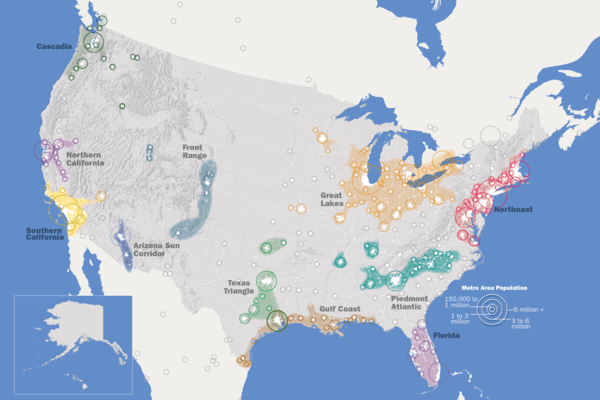
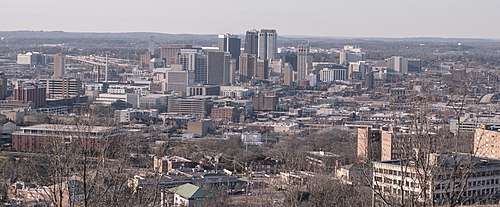
The Piedmont Atlantic Megaregion (PAM) is a neologism created by the Regional Plan Association for an area of the Southeastern United States that includes the Atlanta, Birmingham, Charlotte, Memphis, Nashville, Research Triangle (Raleigh-Durham), and Greensboro-Winston-Salem-High Point metropolitan areas. The megaregion generally follows the Interstate 85/20 corridor. According to Georgia Tech, PAM represents over 12 percent of the total United States population and covers over 243,000 square miles (630,000 km2) of land.
.jpg)
PAM is just one emergent megalopolis (also known as a megaregion) of eight such regions in the continental United States. Half of the nation's population growth and two-thirds of its economic growth are expected to occur within those regions over the next four decades.
Region
Studies by Virginia Tech and Georgia Tech identify the 85/20 corridor in the Southeastern United States area as an "emergent" megalopolis including the primary cities of Atlanta, Birmingham, Greenville, Spartanburg, Charlotte, Winston-Salem, Greensboro, Durham, and Raleigh with Atlanta being the largest metropolitan area and Charlotte being the largest city. Both studies refer to the area as the Piedmont megalopolis.
The Georgia Tech survey defines the region narrowly, focusing on the urban and suburban counties between Birmingham and Raleigh, and the rural counties that explicitly link those urban and suburban counties.
The Virginia Tech study proposes a broader definition, which would also include Columbus, Macon, Huntsville, Augusta, Columbia, Knoxville, Chattanooga, the Tri-Cities, Asheville and a number of smaller cities. The western extent of this definition is deeply disconnected from the remainder of the region by the Appalachian Mountains range, and is economically not well-integrated into the greater region. Other locales mentioned in the Virginia Tech study remain disconnected from the region's core, separated by dozens of miles of deeply rural areas.
Both reports highlight the "emergent" nature of this possible megalopolis, noting comparatively low urban densities, but also noting a pattern in growth (in the individual, component urban areas) towards each other. As of 2005, this region (as defined in the Virginia Tech study) has a population of 19 million.
The Piedmont Atlantic central Metropolitan Areas are located on the southern Piedmont region which gives the Megaregion its name. The Piedmont is located between the Appalachian Mountains and the Atlantic coastal plain. The surface relief of the Piedmont is characterized by relatively low, rolling hills with heights above sea level between 200 feet (50 m) and 800 feet to (rarely) 1,000 feet (250 m to 300 m).
The region has a diverse economy ranging in many different industries. Henry W. Grady of the Atlanta Journal-Constitution coined the term New South to describe the American South, in whole or in part. The term "New South" is used in contrast to the Old South's plantation system of the antebellum period, to a new Industrial region. Since then Atlanta has grown from a small railway town into a major business, convention and transportation hub. Atlanta is now considered an "Alpha-World City" according to GaWC 2010 at Loughborough University by the Globalization and World Cities Study Group & Network. Charlotte in the Piedmont Crescent has grown to become a major U.S. financial center, and the nation's 2nd largest financial center. Birmingham boomed after the Civil War as a major industrial center in the Southern United States, the city's economy has diversified into banking, insurance, medicine, publishing, and biotechnology. The region of Raleigh, Durham, and Chapel Hill is known as the Research Triangle, named for the Research Triangle Park, which is the largest research park in the United States and one of its most prominent high-tech research and development centers. Upstate South Carolina, a region including Greenville, Spartanburg and Anderson has been given foreign investment and has become the fastest growing region in the U.S. state of South Carolina.
Population
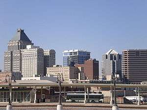
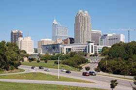
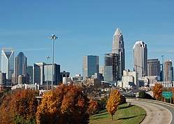
Primary Statistical Areas (PSAs) within the Piedmont Atlantic megalopolis[1]
| Rank | Primary Statistical Area | Anchor City(s) | State(s) | Population (2016) |
|---|---|---|---|---|
| 1 | Atlanta–Athens-Clarke County–Sandy Springs | Atlanta | GA | 6,451,262 |
| 2 | Charlotte–Concord–Gastonia | Charlotte | NC / SC | 2,632,249 |
| 3 | Raleigh–Durham–Chapel Hill | Raleigh | NC | 2,156,253 |
| 4 | Nashville-Davidson–Murfreesboro | Nashville | TN | 1,987,778 |
| 5 | Greensboro–Winston-Salem–High Point | Greensboro and Winston-Salem | NC | 1,650,019 |
| 6 | Greenville–Spartanburg–Anderson | Greenville | SC | 1,442,117 |
| 7 | Memphis–Forrest City | Memphis | TN / MS / AR | 1,369,038 |
| 8 | Birmingham–Hoover–Talladega | Birmingham | AL | 1,361,299 |
| 9 | Knoxville–Morristown–Sevierville | Knoxville | TN | 1,117,758 |
| 10 | Chattanooga–Cleveland–Dalton | Chattanooga | TN / GA / AL | 954,228 |
| 11 | Columbia–Orangeburg–Newberry | Columbia | SC | 943,470 |
| 12 | Charleston-North Charleston | Charleston | SC | 761,155 |
| 13 | Huntsville–Decatur–Albertville | Huntsville | AL | 768,033 |
| 14 | Augusta-Richmond County-Martinez | Augusta | GA | 594,919 |
| 15 | Fayetteville–Lumberton–Laurinburg | Fayetteville | NC | 548,868 |
| 16 | Johnson City–Kingsport–Bristol | Kingsport | TN / VA | 507,995 |
| 17 | Columbus–Auburn–Opelika | Columbus | GA / AL | 501,589 |
| 18 | Asheville–Brevard | Asheville | NC | 485,801 |
| 19 | Hickory-Lenoir-Morganton | Hickory | NC | 409,262 |
| Total | 26,643,093 | |||
Transportation
Interstate I-85 and I-20 are the main corridors, and the major Interstates which are intersected are the I-59, I-95, I-40, I-73, I-74, I-77, I-26, I-75 and I-65. The gateway cities of Savannah, Charleston, and Wilmington all serve as seaports for the Piedmont Atlantic Region. Within the PAM there are six international airports, nine when including those located in the aforementioned gateway cities.
Hartsfield-Jackson Atlanta International Airport is the busiest airport in the region and in the world. Charlotte/Douglas International Airport is the second busiest airport in the region and the 17th busiest airport in the world. In addition to Charlotte and Atlanta, other airports in the region with direct, non-stop airline service outside North America include: Raleigh-Durham International Airport, Charleston International Airport, and Nashville International Airport. Other major airports in the region include: Piedmont Triad International Airport, Asheville Regional Airport, Wilmington International Airport, Birmingham-Shuttlesworth International Airport, Huntsville International Airport, Greenville-Spartanburg International Airport, Myrtle Beach International Airport, Columbia Metropolitan Airport, Hilton Head Airport, McGhee Tyson Airport, and Memphis International Airport, which is the world's busiest airport by most cargo traffic by weight annually.
Megaregion as a unit
The Piedmont Atlantic is the fastest growing mega-region in the United States. The mega-region is facing challenges with its growing population, increased traffic congestion, and inadequate infrastructure. Mayors, businesses, and academic professionals have organized the Piedmont Alliance for Quality Growth to help address these problems with sustainable solutions. With the goal of focusing on the growth of the Megaregion, they have called for less competition between cities and metropolitan areas in the same region, and a stronger and more cohesive ability to work together to compete on the global scale. The major issues that the PAM has to solve include conflicts over shared natural resources such as water and problems transportation infrastructure such as road upkeep and the railways linking cities. Many of the issues cities or metropolitan areas face cannot be solved by action on a local scale. A Megaregion as a unit working together is an advantage in economics and quality of life within the region.
Culture
The culture of the PAM is a subset of the culture of the greater Southern United States. It is mainly a combination of the cultures of Georgia and North Carolina, as these two states have the greatest populations by far of the five states that make up the region, and contain most of the region's major cities.
Sports
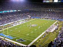
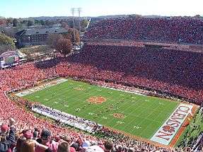
Professional sports teams in the region include:
- Atlanta Braves (Major League Baseball)
- Atlanta Dream (Women's National Basketball Association)
- Atlanta Falcons National Football League)
- Atlanta Hawks (National Basketball Association)
- Atlanta United FC (Major League Soccer)
- Birmingham Barons (Minor League Baseball)
- Carolina Hurricanes (National Hockey League)
- Carolina Panthers (National Football League)
- Charlotte Hornets (National Basketball Association)
- Charlotte Knights (Minor League Baseball)
- Durham Bulls (Minor League Baseball)
- Memphis Grizzlies (National Basketball Association)
- Nashville Predators (National Hockey League)
- North Carolina Courage (National Women's Soccer League)
- Rocket City Trash Pandas (Minor League Baseball)[2]
- Tennessee Titans (National Football League)
College athletics teams in the so-called Power Five conferences include:
- Alabama Crimson Tide (Southeastern Conference)
- Auburn Tigers (Southeastern Conference)
- Clemson Tigers (Atlantic Coast Conference)
- Duke Blue Devils (Atlantic Coast Conference)
- Georgia Bulldogs (Southeastern Conference)
- Georgia Tech Yellow Jackets (Atlantic Coast Conference)
- NC State Wolfpack (Atlantic Coast Conference)
- North Carolina Tar Heels (Atlantic Coast Conference)
- South Carolina Gamecocks (Southeastern Conference)
- Tennessee Volunteers (Southeastern Conference)
- Vanderbilt Commodores (Southeastern Conference)
- Wake Forest Demon Deacons (Atlantic Coast Conference)
Notable sports competitions include:
- 1996 Summer Olympics
- Barbasol Championship
- Masters Tournament
- St. Jude Classic
- The Tradition
- Wells Fargo Championship
- Wyndham Championship
- U.S. National Indoor Tennis Championships
Notable motorsport racetracks include:
Attractions
The geography of the region is diverse and lends itself to a variety of outdoor recreational activities, ranging from hiking along the Appalachian Trail in the mountains to relaxing on the coastal beaches.
Atlanta hosts 37 million tourists every year. Attractions include the Atlanta Motor Speedway, Centennial Olympic Park, CNN Center, Georgia Aquarium, Martin Luther King Jr. National Historic Park, Road Atlanta, Six Flags Over Georgia, Stone Mountain Park, and World of Coca-Cola.
Charlotte hosts the NASCAR Hall of Fame, Charlotte Motor Speedway, Daniel Stowe Botanical Garden, Discovery Place Science, Bechtler Museum of Modern Art, Uptown Mint Museum, Carowinds Amusement Park, Bank of America Headquarters, U.S. National Whitewater Center, and Billy Graham Center. The nearby North Carolina Zoological Park is located in Asheboro in Randolph County, North Carolina in the Uwharrie Mountains and Uwharrie National Forest. At over 500 acres (200 ha), it is the largest walk-through zoo in the world
Other cities in the mega-region also offer tourism opportunities. Birmingham, for example, is home to several museums; the largest is the Birmingham Museum of Art, which is also the largest municipal art museum in the Southeast. The area's history museums includes Birmingham Civil Rights Institute, which houses a detailed and emotionally charged narrative exhibit putting Birmingham's history into the context of the Civil Rights Movement located at the Birmingham Civil Rights National Monument, Birmingham Civil Rights District. The Sloss Furnaces National Historic Landmark and the Vulcan statue and museum that overlooks the city and provides stunning views from atop Red Mountain details the industrial history of the area. Other Birmingham area attractions include Alabama Adventure Amusement Park, McWane Science Center, Red Mountain Park, Birmingham Botanical Gardens, and the Alabama Sports Hall of Fame. The Birmingham area also includes two prominent race tracks, Talladega Superspeedway and Barber Motorsports Park and museum, which features over 1400 motorcycles and race cars and is the largest collection of motorcycles in the world. Greenville, South Carolina, offers Falls Park on the Reedy, a 32-acre (130,000 m2) park adjacent to downtown in the historic West End district.
Education
The area is home to a number of colleges and universities, including:
- Agnes Scott College
- Alabama A & M University
- Alabama State University
- Albany State University
- Anderson University
- Appalachian State University
- Auburn University
- Augusta University
- Austin Peay State University
- Belmont University
- Belmont Abbey College
- Bevill State Community College
- Birmingham Southern College
- Bob Jones University
- Brevard College
- Carson-Newman College
- Catawba College
- Charlotte School of Law
- Christian Brothers University
- Clark Atlanta University
- Clayton State University
- Clemson University
- Converse College
- Cumberland University
- Davidson College
- Duke University
- Elon University
- Emory University
- Fisk University
- Fort Valley State University
- Furman University
- Gardner–Webb University
- Georgia Gwinnett College
- Georgia State University
- Georgia Tech
- Gordon State College
- Greensboro College
- Greenville Technical College
- Guilford College
- High Point University
- Jacksonville State University
- Johnson C. Smith University
- Johnson & Wales University
- Kennesaw State University
- LaGrange College
- Lenoir-Rhyne University
- Limestone College
- Lipscomb University
- Livingstone College
- Louisburg College
- Meharry Medical College
- Meredith College
- Middle Tennessee State University
- Morehouse College
- North Carolina A&T State University
- North Carolina Central University
- North Carolina State University
North Greenville University
- Oakwood University
- Oglethorpe University
- Paine College
- Peace College
- Pfeiffer University
- Presbyterian College
- Piedmont College
- Queens University of Charlotte
- Rhodes College
- Saint Augustine's College
- Salem College
- Samford University
- Savannah College of Art and Design
- Shaw University
- Southcentral Kentucky Community and Technical College
- Southern Polytechnic State University
- Southern Wesleyan University
- Spartanburg Community College
- Spelman College
- Tennessee State University
- Tennessee Technological University
- Trevecca Nazarene University
- Tuskegee University
- University of Alabama
- University of Alabama at Birmingham
- University of Alabama in Huntsville
- University of Georgia
- University of Memphis
- University of Montevallo
- University of North Carolina at Asheville
- University of North Carolina at Chapel Hill
- University of North Carolina at Charlotte
- University of North Carolina at Greensboro
- University of North Carolina at Wilmington
- University of North Carolina School of the Arts
- University of North Georgia
- University of South Carolina Aiken
- University of South Carolina School of Medicine - Greenville
- University of South Carolina Upstate
- University of Tennessee, Knoxville
- University of West Georgia
- Vanderbilt University
- Wake Forest University
- Western Kentucky University
- Wilkes Community College
- Winston-Salem State University
- Wingate University
- Winthrop University
- Wofford College
See also
- I-85 Corridor
- Conurbation
- Megalopolis (city type)
- Megaregions of the United States
- Piedmont Crescent
References
- Excerpted from List of primary statistical areas of the United States
- https://whnt.com/2018/09/05/rocket-city-trash-pandas-chosen-as-new-madison-baseball-teams-name/
Further reading
- Jerry Weitz (2014). "Employment Changes in the Spine of the Carolina Megapolitan Area: Implications for Megaregion Planning". Southeastern Geographer. 54 (3): 215–232. ISSN 1549-6929.


