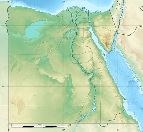
Mount Sinai
Mount Sinai (Hebrew: הר סיניHar Sinai; Greek: Όρος Σινάι), traditionally known as Jabal Musa (Arabic: جَبَل مُوسَىٰ, translation: Mount Moses), is a mountain in the Sinai Peninsula of Egypt that is a possible location of the biblical Mount Sinai, the place where Moses receives the Ten Commandments.
| Mount Sinai | |
|---|---|
| Egyptian Arabic: جَبَل مُوسَىٰ, romanized: Jabal Mūsā Arabic: جَبَل مُوْسَى, romanized: Gabal Mūsā Classical Syriac: ܛܘܪܐ ܕܣܝܢܝ and ܛܘܪܐ ܕܡܘܫܐ Όρος Σινάι Mons Sinai | |
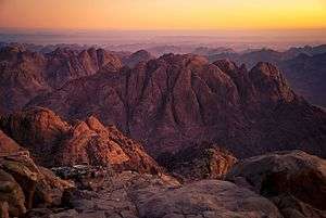 The summit of Mount Sinai | |
| Highest point | |
| Elevation | 2,285 m (7,497 ft) |
| Prominence | 334 m (1,096 ft) |
| Coordinates | 28°32′21.9″N 33°58′31.5″E |
| Naming | |
| Native name | طُوْر سِيْنَاء |
| Geography | |
It is a 2,285-metre (7,497 ft) moderately high mountain near the city of Saint Catherine in the region known in modern times as the Sinai Peninsula. It is next to Mount Catherine (at 2,629 m or 8,625 ft, the highest peak in Egypt).[1] It is surrounded on all sides by higher peaks of the mountain range.
Geology
Mount Sinai's rocks were formed in the late stage of the Arabian-Nubian Shield's (ANS) evolution. Mount Sinai displays a ring complex[2] that consists of alkaline granites intruded into diverse rock types, including volcanics. The granites range in composition from syenogranite to alkali feldspar granite. The volcanic rocks are alkaline to peralkaline and they are represented by subaerial flows and eruptions and subvolcanic porphyry. Generally, the nature of the exposed rocks in Mount Sinai indicates that they originated from differing depths.
Religious significance
Immediately north of the mountain is the 6th century Saint Catherine's Monastery. The summit has a mosque that is still used by Muslims, and a Greek Orthodox chapel, constructed in 1934 on the ruins of a 16th-century church, that is not open to the public. The chapel encloses the rock which is considered to be the source for the biblical Tablets of Stone.[3] At the summit also is "Moses' cave", where Moses was said to have waited to receive the Ten Commandments.
- Saint Catherine's Monastery, looking down from Mount Sinai
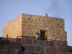 The mosque at the summit
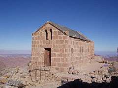 The chapel at the summit
Ascent and summit
There are two principal routes to the summit. The longer and shallower route, Siket El Bashait, takes about 2.5 hours on foot, though camels can be used. The steeper, more direct route (Siket Sayidna Musa) is up the 3,750 "steps of penitence" in the ravine behind the monastery.[4]
- Sunrise
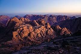 View from the summit
- The last few meters of the climb up the mountain
See also
- Hashem el-Tarif
- Jebel Musa, Morocco, a similarly named mountain in Morocco
References
- "Sinai Geology". AllSinai.info.
- Hanaa M. Salem and A. A. ElFouly, "Minerals Reconnaissance at Saint Catherine Area, Southern Central Sinai, Egypt and their Environmental Impacts on Human Health". ICEHM2000, Cairo University, Egypt, September 2000, pp. 586–98
- "Mount Sinai, Egypt". Places of Peace and Power.
- "Mount Sinai". AllSinai.info.
External links
| Wikimedia Commons has media related to Mount Sinai. |

- Caucasian Albanian Alphabet Discovered and Deciphered, Azerbaijan International, Vol. 11:3 (Autumn 2003). Six articles.
- View OF Mount Sinai (as opposed to the view FROM Mount Sinai)
- Information about the town of St. Katherine and the Sinai mountains
- A Report on Mount Sinai
- Map of Mount Sinai, 18th century. Eran Laor Cartographic Collection, National Library of Israel.
