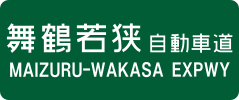
Maizuru-Wakasa Expressway
The Maizuru-Wakasa Expressway (舞鶴若狭自動車道, Maizuru-Wakasa Jidōsha-dō) is a national expressway in Japan. It is owned and operated by West Nippon Expressway Company. It is signed as E27 under the Ministry of Land, Infrastructure, Transport and Tourism's "2016 Proposal for Realization of Expressway Numbering."[1]
| |
|---|---|
| Route information | |
| Length | 161.8 km (100.5 mi) |
| Existed | 1987–present |
| Major junctions | |
| From | Yokawa Junction |
| To | Tsuruga Junction |
| Location | |
| Major cities | Sanda, Sasayama, Fukuchiyama, Maizuru, Obama |
| Highway system | |
| National highways of Japan Expressways of Japan | |
Route description
Officially the expressway is referred to as the Kinki Expressway Tsuruga Route. This designation applies to the Maizuru-Wakasa Expressway as well as the Chūgoku Expressway beyond Yokawa Junction to Suita Junction.
The route of the expressway connects the coastline of the Japan Sea and the greater Osaka urban area by traversing the mountainous interior of the Kinki region.
Using the expressway to travel between the Chūgoku Expressway, Sanyō Expressway and Hokuriku Expressway is shorter and cheaper than using expressways that traverse a route via the greater Osaka urban area.
The expressway is 4 lanes from Yokawa Junction to Fukuchiyama Interchange and Ayabe Interchange to Ayabe Parking Area and the remainder is 2 lanes. Construction to expand the route to 4 lanes is currently underway on the section between Fukuchiyama Interchange and Ayabe Interchange and Ayabe Parking Area and Maizuru-Nishi Interchange. The speed limit is 80 km/h on 4-laned sections and 70 km/h on 2-laned sections.
History
The first section of the expressway was opened to traffic in 1987 and the entire route was completed in 2014.
List of interchanges and features
- IC - interchange, SIC - smart interchange, JCT - junction, SA - service area, PA - parking area, BS - bus stop, TN - tunnel, BR - bridge
| No. | Name | Connections | Dist. from Origin |
Bus Stop | Notes | Location | |
|---|---|---|---|---|---|---|---|
| 6 | Yokawa JCT | 0.0 | Miki | Hyōgo | |||
| - | Kami-Arakawa PA | 1.5 | ◆ | ||||
| 1 | Sanda-nishi IC | Pref. Route 92 (Sanda-nishi Inter Route) | 4.3 | ◆ | Sanda | ||
| - | Ōkawase Bus Stop | ◆ | |||||
| - | Furumori Bus Stop | ◆ | Sasayama | ||||
| 2 | Tannan-Sasayamaguchi IC | Pref. Route 94 (Tannan-Sasayamaguchi Inter Route) | 22.5 | ◆ | |||
| - | Nishiki SA | 25.6 | ◆ | ||||
| - | Nakayama Bus Stop | ◆ | Tamba | ||||
| 3 | Kasuga IC/JCT | 36.5 | ○ | ||||
| - | Ichijima Bus Stop | ◆ | |||||
| - | Mutsube PA | 49.8 49.9 |
◆ | For Yokawa, Toyooka for Kyoto, Tsuruga |
Fukuchiyama | Kyoto | |
| 4 | Fukuchiyama IC | 53.5 | △ | ||||
| 5 | Ayabe IC | Pref. Route 77 (Ayabe Inter Route) | 63.9 | Ayabe | |||
| 6 | Ayabe JCT | 68.2 | |||||
| - | Ayabe PA | 70.7 | |||||
| 7 | Maizuru-nishi IC | Pref. Route 27 (Ikeuchi Kyōda Route) |
76.3 | Maizuru | |||
| 8 | Maizuru-higashi IC | Pref. Route 28 (Ogura Nishi-Maizuru Route) | 87.0 | ||||
| - | Maizuru PA | 89.8 | |||||
| 9 | Ōi-Takahama IC | Pref. Route 16 (Sakamoto Takahama Route) | 100.0 | Ōi | Fukui | ||
| 10 | Obama-nishi IC | 111.5 | Obama | ||||
| - | Kato PA | 112.8 | |||||
| 11 | Obama IC | Pref. Route 24 (Obama Kaminaka Route) Pref. Route 267 (Obama Inter Route) |
122.8 | ||||
| 12 | Wakasa-Kaminaka IC | Pref. Route 22 (Kaminaka Tagarasu Route) | 132.4 | Wakasa | |||
| 12-1 | Mikatagoko PA/SIC | 139.4 | SIC opening in 2017 | ||||
| 13 | Wakasa-Mikata IC | 141.6 | |||||
| 14 | Wakasa-Mihama IC | 148.8 | Mihama | ||||
| 15-1 | Tsuruga-minami SIC | Pref. Route 211 (Yama Kushibayashi Route) | 155.1 | SIC opening in 2016 | Tsuruga | ||
| 3-1 | Tsuruga JCT | 161.8 | |||||
References
- "Japan's Expressway Numbering System". www.mlit.go.jp.
External links
- (in Japanese) West Nippon Expressway Company
| Wikimedia Commons has media related to Maizuru-Wakasa Expressway. |
