Mackintosh River
The Mackintosh River, part of the Pieman River catchment, is a major perennial river located in the West Coast region of Tasmania, Australia. The river was named in November 1828 by Henry Hellyer, a surveyor of the Van Diemans Land Company, in honour of Sir James Mackintosh, son of John Mackintosh of Kyllachy, Inverness-shire[2]
| Mackintosh | |
|---|---|
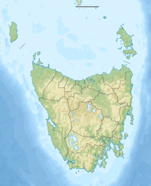
 Location of the Mackintosh River mouth in Tasmania | |
| Location | |
| Country | Australia |
| State | Tasmania |
| Region | West Coast |
| Physical characteristics | |
| Source | West Coast Range |
| Source confluence | Mackintosh Creek and Fury River |
| • location | below Mount Remus |
| • coordinates | 41°37′47″S 145°46′10″E |
| • elevation | 236 m (774 ft) |
| Mouth | Pieman River |
• location | below Tullah |
• coordinates | 41°44′00″S 145°36′38″E |
• elevation | 161 m (528 ft) |
| Length | 20 km (12 mi) |
| Basin features | |
| River system | Pieman River catchment |
| Tributaries | |
| • left | Sophia River |
| • right | Southwell River |
| Reservoir | Lake Mackintosh |
| [1] | |
Course and features
Formed by the confluence of the Fury River and Mackintosh Creek, the Mackintosh River rises below Mount Remus, part of the northern section of the West Coast Range. The river flows a short distance, through what is now known as Lake Mackintosh, joined by four tributaries including the Sophia River and Southwell River, emptying into the Pieman River. The Mackintosh River is impounded by the Mackintosh Dam, the site of the adjacent hydroelectric power station that forms part of the Hydro Tasmania-operated Pieman River Power Development.[3][4] The river descends 75 metres (246 ft) over its 20-kilometre (12 mi) course.[1]
Hydrological measurements on this river by Hydro Tasmania began in 1955.
The easternmost point of the river catchment is defined by Barn Bluff where it also borders with the Murchison River river catchment.[5] The southern portion of the catchment has a very narrow separation from the adjacent Murchison River, where the Sophia River is the main river. The northern side of Sophia river catchment, a creek known as White Hawk, drains ground with features known as Granite Tor, and High Tor, which lie due east of Tullah. The northern Mackintosh catchment has a number of named tributaries. From the orientation of Mount Romulus, Fury River which originates near Barn Bluff, is the main eastern tributary. Mount Remus is drained to the south by Schist Creek which flows into the Fury River, and to the west, Devils Ravine. In the north east of the catchment area, Mayday Mountain is drained by Belvoir River. The north west area the Southwell River drains the eastern slopes of Mount Charles, which is north east of Mount Black.
The river name is used in cartography of the area, with the river name being allocated to current maps,[6][7][8] as well as significantly early maps of the region.[9]
References
- "Map of Mackintosh River, TAS". Bonzle Digital Atlas of Australia. 2015. Retrieved 30 June 2015.
- Peter McGillivray (article) Mackintosh in Tasmania (Journal of the Clan Chattan Association, Vol. VIII - No. 3, 1985), page 162
- Mather, R. P. (1958), Pieman River development: the Mackintosh and Murchison dam sites, n.p, retrieved 14 July 2015
- Kinstler, F. L. (1982), "Mackintosh and Murchison Dams River Diversions", Engineering Conference 1982: Changing Society, a Challenge for Engineering; Technical Papers, The, Institution of Engineers, Australia: 146–151, ISBN 978-0-85825-163-2
- Waterman, Peter; South West Tasmania Resources Survey (1979). "Landforms" (Map). Mackintosh-Murchison catchment. Steering Committee, South West Tasmania Resources Survey. p. 42. ISBN 978-0-7246-0261-2.
- Tasmania. Dept. of Mines; Geological Survey of Tasmania (1974), Geological survey explanatory report : geological atlas 1 mile series, Govt. Printer, retrieved 14 July 2015
- Geological Survey of Tasmania; Collins, P. L. F. (1966), Geological Survey explanatory report, geological atlas 1 mile series, zone 7, sheet 44 (8014 N) Mackintosh (1st ed.), The Department, ISBN 978-0-7246-0492-0
- Forestry Commission of Tasmania (1970), Mackintosh, D (Provisional ed.), Forestry Commission of Tasmania], retrieved 14 July 2015
- [Map of South West Tasmania from the Mackintosh River to the Gordon River and between Macquarie Harbour and Lake St. Clair], 1860, retrieved 14 July 2015
External links
- "The Pieman Catchment". Hydro Tasmania. Archived from the original on 4 December 2004. Retrieved 14 November 2006.